Property Record
7350 N 8730 W, Saratoga Springs, UT 84043


NEARBY LISTINGS FOR SALE OR LEASE
Property Detail
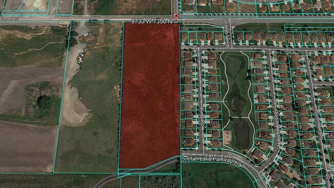
7350 N 8730 W
Provo-Orem, UT
COM N 23.73 FT & W 1.93 FT FR SW COR. SEC. 20, T5S, R1E, SLB&M.; N 0 DEG 30 49 W 949.84 FT; S 89 DEG 11 26 E 367.15 FT; S 4 DEG 54 23 W 46 FT; S 1 DEG 14 24 E 61.06 FT; S 1 DEG 10 46 W 270.02 FT; S 0 DEG 0 14 E 100.51 FT; S 1 DEG 31 30 W 258.64 FT; S
13-032-0083
Utah
Vacantlandnec
Utah
2024
7.50 AC
2025
Utah County
000102
Salt Lake City
DEMOGRAPHICS near 7350 N 8730 W
1 Mile
3 Mile
5 Mile
2024 Total Population
6,153
48,793
164,216
2029 Population
7,148
57,090
193,342
Pop Growth 2024-2029
+ 16.17%
+ 17.00%
+ 17.74%
Average Age
28
30
30
2024 Total Households
1,519
13,129
44,710
HH Growth 2024-2029
+ 16.59%
+ 17.40%
+ 18.16%
Median Household Inc
$120,555
$104,231
$108,962
Avg Household Size
4.00
3.70
3.60
2024 Avg HH Vehicles
2.00
2.00
2.00
Median Home Value
$495,682
$488,693
$487,175
Median Year Built
2007
2004
2008
Nearby Places
Map Layers
Map Styles
 Street
 Aerial
- Restaurants
- Banks
- Shops
- Fitness
- Groceries
PUBLIC TRANSPORTATION
COMMUTER RAIL
American Fork Station (FrontRunner - Utah Transit Authority (UTA))
DRIVE
WALK
Distance
American Fork Station (FrontRunner - Utah Transit Authority (UTA))
9 min
3.7 mi
Lehi Station (FrontRunner - Utah Transit Authority (UTA))
DRIVE
WALK
Distance
Lehi Station (FrontRunner - Utah Transit Authority (UTA))
14 min
5.6 mi
AIRPORT
Provo Municipal
DRIVE
WALK
Distance
Provo Municipal
28 min
19.3 mi
Salt Lake City International
DRIVE
WALK
Distance
Salt Lake City International
45 min
35.0 mi
Freight Ports
Port of Stockton
DRIVE
WALK
Distance
Port of Stockton
746 min
725.4 mi
SALE & LEASE HISTORY
LISTING DATE
SALE/LEASE

Aug 19, 2020
For Sale
Nearby Properties
Address
Land Use
TOTAL SIZE
Lot Size
Zoning
Address
Land Use
TOTAL SIZE
Lot Size
Zoning
359,445 SF
6.46 AC
Address
Land Use
TOTAL SIZE
Lot Size
Zoning
305,553 SF
13.08 AC
Address
Land Use
TOTAL SIZE
Lot Size
Zoning
293,170 SF
9.60 AC
Address
Land Use
TOTAL SIZE
Lot Size
Zoning
266,041 SF
11.28 AC
Address
Land Use
TOTAL SIZE
Lot Size
Zoning
227,030 SF
21.91 AC
Address
Land Use
TOTAL SIZE
Lot Size
Zoning
201,838 SF
8.83 AC
Address
Land Use
TOTAL SIZE
Lot Size
Zoning
123,381 SF
12.30 AC
Address
Land Use
TOTAL SIZE
Lot Size
Zoning
134,637 SF
16.98 AC
Address
Land Use
TOTAL SIZE
Lot Size
Zoning
99,862 SF
10.92 AC
Address
Land Use
TOTAL SIZE
Lot Size
Zoning
149,937 SF
13.49 AC
Address
Land Use
TOTAL SIZE
Lot Size
Zoning
102,380 SF
9.10 AC
Address
Land Use
TOTAL SIZE
Lot Size
Zoning
100,814 SF
8.22 AC
Address
Land Use
TOTAL SIZE
Lot Size
Zoning
62,104 SF
8.97 AC
Address
Land Use
TOTAL SIZE
Lot Size
Zoning
64,605 SF
8.11 AC
Address
Land Use
TOTAL SIZE
Lot Size
Zoning
110,561 SF
6.47 AC
Address
Land Use
TOTAL SIZE
Lot Size
Zoning
1,121 SF
4.07 AC
Address
Land Use
TOTAL SIZE
Lot Size
Zoning
137,193 SF
12.45 AC
Address
Land Use
TOTAL SIZE
Lot Size
Zoning
90,049 SF
5.99 AC
Address
Land Use
TOTAL SIZE
Lot Size
Zoning
111,292 SF
5.36 AC
Address
Land Use
TOTAL SIZE
Lot Size
Zoning
100,973 SF
5.71 AC
Address
Land Use
TOTAL SIZE
Lot Size
Zoning
120,431 SF
7.92 AC
Address
Land Use
TOTAL SIZE
Lot Size
Zoning
76,420 SF
3.94 AC
Address
Land Use
TOTAL SIZE
Lot Size
Zoning
124,836 SF
8.74 AC
Address
Land Use
TOTAL SIZE
Lot Size
Zoning
65,449 SF
2.27 AC
Address
Land Use
TOTAL SIZE
Lot Size
Zoning
59,672 SF
3.24 AC
Address
Land Use
TOTAL SIZE
Lot Size
Zoning
96,361 SF
7.86 AC
Address
Land Use
TOTAL SIZE
Lot Size
Zoning
107,722 SF
5.65 AC
Address
Land Use
TOTAL SIZE
Lot Size
Zoning
105,188 SF
10.64 AC
Address
Land Use
TOTAL SIZE
Lot Size
Zoning
97,088 SF
3.88 AC
Address
Land Use
TOTAL SIZE
Lot Size
Zoning
95,683 SF
9.32 AC
The World's #1 Commercial Real Estate Marketplace
Connect with us
© 2026 CoStar Group
The information above has been obtained from sources believed reliable. While we do not doubt its accuracy we have not verified it and make no guarantee, warranty or representation about it. It is your responsibility to independently confirm its accuracy and completeness. Any projections, opinions, assumptions, or estimates used are for example only and do not represent the current or future performance of the property. The value of this transaction to you depends on tax and other factors which should be evaluated by your tax, financial, and legal advisors. You and your advisors should conduct a careful, independent investigation of the property to determine to your satisfaction the suitability of the property for your needs.