Property Record
1968 Ormond Blvd, Destrehan, LA 70047
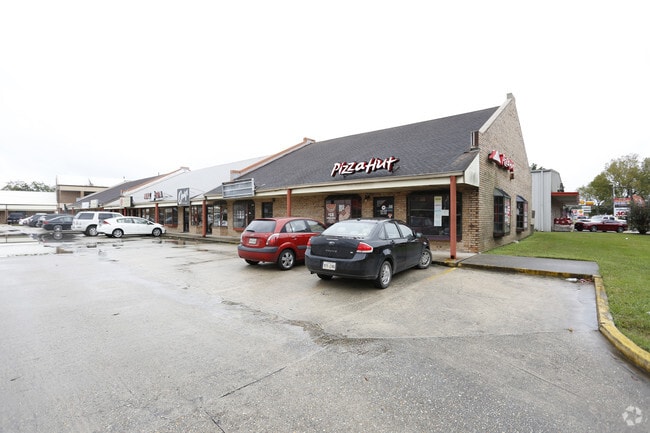

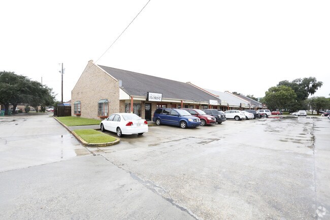
Property Detail
1968 Ormond Blvd
New Orleans-Metairie, LA
LOTS F-5, BEING A RESUBD. OF LOT F-2-A-3-A1-A & F-2-A-3-A1-B, ORMOND COUNTRY CLUB ESTATES
352200000F-5
Saint Charles
Storebuilding
Louisiana
2025
f-5
2025
0.40 AC
062301
St Charles Parish
8,036 SF
New Orleans/Metairie/Kenner
NEARBY LISTINGS FOR SALE OR LEASE
DEMOGRAPHICS near 1968 Ormond Blvd
1 mile
3 mile
5 mile
2025 Total Population
9,148
16,919
35,714
2030 Population
8,813
16,335
34,381
Pop Growth 2025-2030
(3.66%)
(3.45%)
(3.73%)
Average Age
40
40
40
2025 Total Households
3,373
6,301
13,307
HH Growth 2025-2030
(3.62%)
(3.43%)
(3.73%)
Median Household Inc
$91,317
$83,185
$74,289
Avg Household Size
2.70
2.70
2.70
2025 Avg HH Vehicles
2.00
2.00
2.00
Median Home Value
$301,136
$287,736
$268,771
Median Year Built
1985
1985
1983
Nearby Places
Map Layers
Map Styles
 Street
 Aerial
Transit
 Traffic
 Biking
Places
Listings with unknown addresses are not visible on the map
- Restaurants
- Banks
- Shops
- Fitness
- Groceries
PUBLIC TRANSPORTATION
AIRPORT
Louis Armstrong New Orleans International
Drive
Walk
Distance
Louis Armstrong New Orleans International
19 min
10.0 mi
Freight Ports
Port of New Orleans
Drive
Walk
Distance
Port of New Orleans
40 min
24.6 mi
Nearby Properties
Address
Land Use
TOTAL SIZE
Lot Size
Zoning
Address
Land Use
TOTAL SIZE
Lot Size
Zoning
Address
Land Use
TOTAL SIZE
Lot Size
Zoning
Address
Land Use
TOTAL SIZE
Lot Size
Zoning
Address
Land Use
TOTAL SIZE
Lot Size
Zoning
Address
Land Use
TOTAL SIZE
Lot Size
Zoning
34.08 AC
Address
Land Use
TOTAL SIZE
Lot Size
Zoning
4.24 AC
Address
Land Use
TOTAL SIZE
Lot Size
Zoning
Address
Land Use
TOTAL SIZE
Lot Size
Zoning
10.03 AC
Address
Land Use
TOTAL SIZE
Lot Size
Zoning
20.49 AC
Address
Land Use
TOTAL SIZE
Lot Size
Zoning
71,024 SF
28.36 AC
Address
Land Use
TOTAL SIZE
Lot Size
Zoning
57,894 SF
4.43 AC
Address
Land Use
TOTAL SIZE
Lot Size
Zoning
57,894 SF
4.43 AC
Address
Land Use
TOTAL SIZE
Lot Size
Zoning
4.60 AC
Address
Land Use
TOTAL SIZE
Lot Size
Zoning
15.06 AC
Address
Land Use
TOTAL SIZE
Lot Size
Zoning
28,711 SF
24.90 AC
Address
Land Use
TOTAL SIZE
Lot Size
Zoning
2.12 AC
Address
Land Use
TOTAL SIZE
Lot Size
Zoning
9.45 AC
Address
Land Use
TOTAL SIZE
Lot Size
Zoning
Address
Land Use
TOTAL SIZE
Lot Size
Zoning
Address
Land Use
TOTAL SIZE
Lot Size
Zoning
5.97 AC
Address
Land Use
TOTAL SIZE
Lot Size
Zoning
336.78 AC
Address
Land Use
TOTAL SIZE
Lot Size
Zoning
11.70 AC
Address
Land Use
TOTAL SIZE
Lot Size
Zoning
55,814 SF
6.76 AC
Address
Land Use
TOTAL SIZE
Lot Size
Zoning
Address
Land Use
TOTAL SIZE
Lot Size
Zoning
11.70 AC
Address
Land Use
TOTAL SIZE
Lot Size
Zoning
4.66 AC
Address
Land Use
TOTAL SIZE
Lot Size
Zoning
Address
Land Use
TOTAL SIZE
Lot Size
Zoning
3.43 AC
Address
Land Use
TOTAL SIZE
Lot Size
Zoning
80,050 SF
5.29 AC
Address
Land Use
TOTAL SIZE
Lot Size
Zoning
The World's #1 Commercial Real Estate Marketplace
Connect with us
© 2026 CoStar Group
The information above has been obtained from sources believed reliable. While we do not doubt its accuracy we have not verified it and make no guarantee, warranty or representation about it. It is your responsibility to independently confirm its accuracy and completeness. Any projections, opinions, assumptions, or estimates used are for example only and do not represent the current or future performance of the property. The value of this transaction to you depends on tax and other factors which should be evaluated by your tax, financial, and legal advisors. You and your advisors should conduct a careful, independent investigation of the property to determine to your satisfaction the suitability of the property for your needs.