Property Record
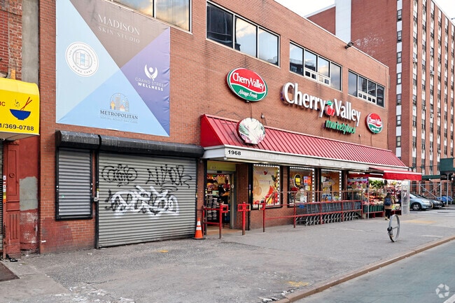
1968 2Nd Ave, New York, NY 10029


Property Detail
1968 2Nd Ave
1673-0001
New York
Storebuilding
New York
R8A
1
B and X Area of moderate flood hazard, usually the area between the limits of the 100-year and 500-year floods.
0.25 AC
2025
Upper East Side
2026
New York City
016400
New York-Jersey City-White Plains, NY-NJ
21,520 SF
NEARBY LISTINGS FOR SALE OR LEASE
DEMOGRAPHICS near 1968 2Nd Ave
1 mile
3 mile
5 mile
2025 Total Population
192,206
1,274,640
2,981,928
2030 Population
199,229
1,320,029
3,054,956
Pop Growth 2025-2030
+ 3.65%
+ 3.56%
+ 2.45%
Average Age
41
41
40
2025 Total Households
88,141
585,891
1,264,063
HH Growth 2025-2030
+ 4.12%
+ 3.96%
+ 2.98%
Median Household Inc
$86,353
$94,314
$84,130
Avg Household Size
2.00
2.00
2.20
2025 Avg HH Vehicles
.00
.00
.00
Median Home Value
$1,011,521
$999,536
$852,869
Median Year Built
1961
1957
1955
Nearby Places
Map Layers
Map Styles
 Street
 Aerial
Layers
 Traffic
 Biking
Places
Listings with unknown addresses are not visible on the map
- Restaurants
- Banks
- Shops
- Fitness
- Groceries
PUBLIC TRANSPORTATION
TRANSIT/SUBWAY
96 St (Broadway Express - MTA New York City Transit, Broadway Local - MTA New York City Transit)
Drive
Walk
Distance
96 St (Broadway Express - MTA New York City Transit, Broadway Local - MTA New York City Transit)
1 min
5 min
0.3 mi
103 Street (4,6 Line) (4 - New York MTA Subway (The Subway), 6 - New York MTA Subway (The Subway))
Drive
Walk
Distance
103 Street (4,6 Line) (4 - New York MTA Subway (The Subway), 6 - New York MTA Subway (The Subway))
2 min
6 min
0.3 mi
96 Street (4,6 Line) (4 - New York MTA Subway (The Subway), 6 - New York MTA Subway (The Subway))
Drive
Walk
Distance
96 Street (4,6 Line) (4 - New York MTA Subway (The Subway), 6 - New York MTA Subway (The Subway))
1 min
9 min
0.5 mi
110 Street (4,6 Line) (4 - New York MTA Subway (The Subway), 6 - New York MTA Subway (The Subway))
Drive
Walk
Distance
110 Street (4,6 Line) (4 - New York MTA Subway (The Subway), 6 - New York MTA Subway (The Subway))
3 min
12 min
0.7 mi
86 St (Broadway Express - MTA New York City Transit, Broadway Local - MTA New York City Transit)
Drive
Walk
Distance
86 St (Broadway Express - MTA New York City Transit, Broadway Local - MTA New York City Transit)
3 min
15 min
0.8 mi
COMMUTER RAIL
Harlem-125Th Street Station (Harlem Line - Metro-North Commuter Railroad Company (Metro-North), Hudson Line - Metro-North Commuter Railroad Company (Metro-North), New Haven Line - Metro-North Commuter Railroad Company (Metro-North))
Drive
Walk
Distance
Harlem-125Th Street Station (Harlem Line - Metro-North Commuter Railroad Company (Metro-North), Hudson Line - Metro-North Commuter Railroad Company (Metro-North), New Haven Line - Metro-North Commuter Railroad Company (Metro-North))
4 min
1.8 mi
Yankees-E 153Rd Street Station (Hudson Line - Metro-North Commuter Railroad Company (Metro-North))
Drive
Walk
Distance
Yankees-E 153Rd Street Station (Hudson Line - Metro-North Commuter Railroad Company (Metro-North))
8 min
3.8 mi
AIRPORT
LaGuardia
Drive
Walk
Distance
LaGuardia
16 min
7.3 mi
Newark Liberty International
Drive
Walk
Distance
Newark Liberty International
29 min
18.4 mi
John F Kennedy International
Drive
Walk
Distance
John F Kennedy International
29 min
18.5 mi
Freight Ports
NY - Red Hook Container Terminal
Drive
Walk
Distance
NY - Red Hook Container Terminal
23 min
10.4 mi
SALE & LEASE HISTORY
LISTING DATE
SALE/LEASE

Oct 26, 2021
For Lease
Jun 24, 2019
For Lease
Jul 24, 2023
For Sale
Aug 15, 2017
For Lease
Nearby Properties
Address
Land Use
TOTAL SIZE
Lot Size
Zoning
Address
Land Use
TOTAL SIZE
Lot Size
Zoning
1,783,434 SF
1.94 AC
C5-3
Address
Land Use
TOTAL SIZE
Lot Size
Zoning
2,050,615 SF
1.84 AC
C5-3
Address
Land Use
TOTAL SIZE
Lot Size
Zoning
2,636,182 SF
2.35 AC
C65.5
Address
Land Use
TOTAL SIZE
Lot Size
Zoning
1,678,135 SF
1.01 AC
C5-3
Address
Land Use
TOTAL SIZE
Lot Size
Zoning
1,233,684 SF
16.94 AC
PARK
Address
Land Use
TOTAL SIZE
Lot Size
Zoning
2,734,038 SF
4.24 AC
C52.5
Address
Land Use
TOTAL SIZE
Lot Size
Zoning
1,897,491 SF
2.06 AC
C52.5
Address
Land Use
TOTAL SIZE
Lot Size
Zoning
1,638,259 SF
1.43 AC
C52.5
Address
Land Use
TOTAL SIZE
Lot Size
Zoning
2,360,627 SF
2.08 AC
C6-7
Address
Land Use
TOTAL SIZE
Lot Size
Zoning
1,984,228 SF
1.95 AC
C65.5
Address
Land Use
TOTAL SIZE
Lot Size
Zoning
1,962,900 SF
1.89 AC
C66.5
Address
Land Use
TOTAL SIZE
Lot Size
Zoning
1,586,876 SF
1.87 AC
C5-3
Address
Land Use
TOTAL SIZE
Lot Size
Zoning
1,842,991 SF
2.08 AC
C66.5
Address
Land Use
TOTAL SIZE
Lot Size
Zoning
400,160 SF
10.96 AC
R7-2
Address
Land Use
TOTAL SIZE
Lot Size
Zoning
1,613,847 SF
1.84 AC
C66.5
Address
Land Use
TOTAL SIZE
Lot Size
Zoning
2,215,000 SF
6.43 AC
R9
Address
Land Use
TOTAL SIZE
Lot Size
Zoning
1,596,521 SF
1.34 AC
C6-4
Address
Land Use
TOTAL SIZE
Lot Size
Zoning
264,420 SF
7.26 AC
C4-7
Address
Land Use
TOTAL SIZE
Lot Size
Zoning
2,400,000 SF
15.14 AC
C5-2
Address
Land Use
TOTAL SIZE
Lot Size
Zoning
1,606,528 SF
1.84 AC
C6-6
Address
Land Use
TOTAL SIZE
Lot Size
Zoning
1,169,666 SF
1.42 AC
C52.5
Address
Land Use
TOTAL SIZE
Lot Size
Zoning
1,482,208 SF
1.71 AC
C5-3
Address
Land Use
TOTAL SIZE
Lot Size
Zoning
1,160,500 SF
1.62 AC
C6-6
Address
Land Use
TOTAL SIZE
Lot Size
Zoning
637,863 SF
C6-6
Address
Land Use
TOTAL SIZE
Lot Size
Zoning
431,963 SF
C67T
Address
Land Use
TOTAL SIZE
Lot Size
Zoning
1,642,441 SF
3.26 AC
C52.5
Address
Land Use
TOTAL SIZE
Lot Size
Zoning
2,230,742 SF
6.33 AC
R9
Address
Land Use
TOTAL SIZE
Lot Size
Zoning
1,015,287 SF
1 AC
C5-3
Address
Land Use
TOTAL SIZE
Lot Size
Zoning
539,643 SF
C5-2
Address
Land Use
TOTAL SIZE
Lot Size
Zoning
822,014 SF
1.38 AC
C52.5
The World's #1 Commercial Real Estate Marketplace
Connect with us
© 2026 CoStar Group
The information above has been obtained from sources believed reliable. While we do not doubt its accuracy we have not verified it and make no guarantee, warranty or representation about it. It is your responsibility to independently confirm its accuracy and completeness. Any projections, opinions, assumptions, or estimates used are for example only and do not represent the current or future performance of the property. The value of this transaction to you depends on tax and other factors which should be evaluated by your tax, financial, and legal advisors. You and your advisors should conduct a careful, independent investigation of the property to determine to your satisfaction the suitability of the property for your needs.