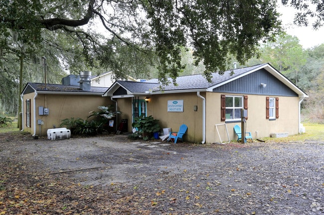
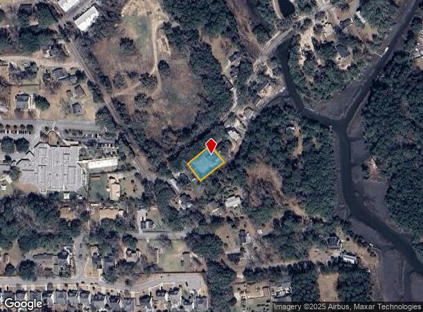
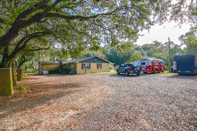
Property Record
1969 Central Park Rd, Charleston, SC 29412

NEARBY LISTINGS FOR SALE OR LEASE
Property Detail
1969 Central Park Rd
Charleston-North Charleston, SC
Oak View Park
340-00-00-044
SUBDIVISION NAME -OAK VIEW PARK DESCRIPTION -LT 8 9 10 & PT LT 7 SITE NAME -S SIDE APPROX 160FT E RIVERLAND DR JCT
Commercialnec
Charleston
AE
South Carolina
45019C0676K
7-10
2025
0.32 AC
2024
James Island/Folly Beach
001901
Charleston/N Charleston
1,630 SF
DEMOGRAPHICS near 1969 Central Park Rd
1 Mile
3 Mile
5 Mile
2024 Total Population
5,377
35,309
115,522
2029 Population
5,791
37,655
124,135
Pop Growth 2024-2029
+ 7.70%
+ 6.64%
+ 7.46%
Average Age
41
41
39
2024 Total Households
2,612
16,104
51,675
HH Growth 2024-2029
+ 7.62%
+ 6.52%
+ 7.44%
Median Household Inc
$78,691
$86,886
$76,704
Avg Household Size
2.00
2.20
2.10
2024 Avg HH Vehicles
2.00
2.00
2.00
Median Home Value
$340,330
$394,628
$419,572
Median Year Built
1988
1984
1976
Nearby Places
Map Layers
Map Styles
 Street
 Aerial
- Restaurants
- Banks
- Shops
- Fitness
- Groceries
PUBLIC TRANSPORTATION
AIRPORT
Charleston AFB/International
DRIVE
WALK
Distance
Charleston AFB/International
28 min
16.3 mi
Freight Ports
Columbus Street Terminal
DRIVE
WALK
Distance
Columbus Street Terminal
11 min
5.9 mi
SALE & LEASE HISTORY
LISTING DATE
SALE/LEASE

Mar 04, 2020
For Sale
Mar 04, 2020
For Sale
Dec 17, 2018
For Sale
Nearby Properties
Address
Land Use
TOTAL SIZE
Lot Size
Zoning
Address
Land Use
TOTAL SIZE
Lot Size
Zoning
80,044 SF
2.48 AC
Address
Land Use
TOTAL SIZE
Lot Size
Zoning
66,136 SF
1.88 AC
Address
Land Use
TOTAL SIZE
Lot Size
Zoning
3,780 SF
14.35 AC
Address
Land Use
TOTAL SIZE
Lot Size
Zoning
8,714 SF
1.60 AC
Address
Land Use
TOTAL SIZE
Lot Size
Zoning
Address
Land Use
TOTAL SIZE
Lot Size
Zoning
Address
Land Use
TOTAL SIZE
Lot Size
Zoning
22,825 SF
4.36 AC
Address
Land Use
TOTAL SIZE
Lot Size
Zoning
257,500 SF
4.72 AC
Address
Land Use
TOTAL SIZE
Lot Size
Zoning
12,766 SF
1.72 AC
Address
Land Use
TOTAL SIZE
Lot Size
Zoning
Address
Land Use
TOTAL SIZE
Lot Size
Zoning
Address
Land Use
TOTAL SIZE
Lot Size
Zoning
7.09 AC
Address
Land Use
TOTAL SIZE
Lot Size
Zoning
119.64 AC
Address
Land Use
TOTAL SIZE
Lot Size
Zoning
Address
Land Use
TOTAL SIZE
Lot Size
Zoning
16,775 SF
5.93 AC
Address
Land Use
TOTAL SIZE
Lot Size
Zoning
Address
Land Use
TOTAL SIZE
Lot Size
Zoning
105,816 SF
16.34 AC
Address
Land Use
TOTAL SIZE
Lot Size
Zoning
7,722 SF
20.48 AC
Address
Land Use
TOTAL SIZE
Lot Size
Zoning
1.11 AC
Address
Land Use
TOTAL SIZE
Lot Size
Zoning
3.11 AC
Address
Land Use
TOTAL SIZE
Lot Size
Zoning
Address
Land Use
TOTAL SIZE
Lot Size
Zoning
1.11 AC
Address
Land Use
TOTAL SIZE
Lot Size
Zoning
2,896 SF
18.13 AC
Address
Land Use
TOTAL SIZE
Lot Size
Zoning
65,397 SF
2.46 AC
Address
Land Use
TOTAL SIZE
Lot Size
Zoning
5,228 SF
2.33 AC
Address
Land Use
TOTAL SIZE
Lot Size
Zoning
Address
Land Use
TOTAL SIZE
Lot Size
Zoning
4,692 SF
12.47 AC
Address
Land Use
TOTAL SIZE
Lot Size
Zoning
11.80 AC
Address
Land Use
TOTAL SIZE
Lot Size
Zoning
5,988 SF
10 AC
Address
Land Use
TOTAL SIZE
Lot Size
Zoning
7.46 AC
The World's #1 Commercial Real Estate Marketplace
Connect with us
© 2025 CoStar Group
The information above has been obtained from sources believed reliable. While we do not doubt its accuracy we have not verified it and make no guarantee, warranty or representation about it. It is your responsibility to independently confirm its accuracy and completeness. Any projections, opinions, assumptions, or estimates used are for example only and do not represent the current or future performance of the property. The value of this transaction to you depends on tax and other factors which should be evaluated by your tax, financial, and legal advisors. You and your advisors should conduct a careful, independent investigation of the property to determine to your satisfaction the suitability of the property for your needs.