Property Record
1969 Highway 4 Rd, Vallecito, CA 95251
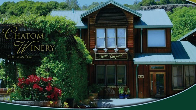


Property Detail
1969 Highway 4 Rd
066-024-006-000
POR SW4 OF 17 T3R14
Winery
CALAVERAS
A1
California
A Areas with a 1% annual chance of flooding and a 26% chance of flooding over the life of a 30-year mortgage.
17
2025
12.44 AC
2026
Merced/Central
000122
Other Market Areas
NEARBY LISTINGS FOR SALE OR LEASE
DEMOGRAPHICS near 1969 Highway 4 Rd
1 mile
3 mile
5 mile
2025 Total Population
303
3,158
5,012
2030 Population
286
3,108
4,892
Pop Growth 2025-2030
(5.61%)
(1.58%)
(2.39%)
Average Age
47
50
50
2025 Total Households
117
1,430
2,238
HH Growth 2025-2030
(5.98%)
(1.19%)
(2.23%)
Median Household Inc
$78,906
$72,285
$73,867
Avg Household Size
2.40
2.10
2.20
2025 Avg HH Vehicles
3.00
2.00
2.00
Median Home Value
$552,631
$569,838
$566,158
Median Year Built
1986
1986
1986
Nearby Places
Map Layers
Map Styles
 Street
 Aerial
Layers
 Traffic
 Biking
Places
Listings with unknown addresses are not visible on the map
- Restaurants
- Banks
- Shops
- Fitness
- Groceries
Nearby Properties
Address
Land Use
TOTAL SIZE
Lot Size
Zoning
Address
Land Use
TOTAL SIZE
Lot Size
Zoning
267 AC
A120
Address
Land Use
TOTAL SIZE
Lot Size
Zoning
44,898 SF
2.04 AC
C2PX
Address
Land Use
TOTAL SIZE
Lot Size
Zoning
1,792 SF
5.92 AC
UHS
Address
Land Use
TOTAL SIZE
Lot Size
Zoning
8,448 SF
1.21 AC
C1
Address
Land Use
TOTAL SIZE
Lot Size
Zoning
116 AC
AP
Address
Land Use
TOTAL SIZE
Lot Size
Zoning
0.70 AC
C1
Address
Land Use
TOTAL SIZE
Lot Size
Zoning
5,398 SF
33.37 AC
A1X
Address
Land Use
TOTAL SIZE
Lot Size
Zoning
0.14 AC
C1
Address
Land Use
TOTAL SIZE
Lot Size
Zoning
155.78 AC
A1
Address
Land Use
TOTAL SIZE
Lot Size
Zoning
6,039 SF
38.09 AC
U
Address
Land Use
TOTAL SIZE
Lot Size
Zoning
4,618 SF
40.55 AC
A120
Address
Land Use
TOTAL SIZE
Lot Size
Zoning
1.35 AC
C2
Address
Land Use
TOTAL SIZE
Lot Size
Zoning
3,991 SF
153.15 AC
RA20
Address
Land Use
TOTAL SIZE
Lot Size
Zoning
4,491 SF
73.55 AC
RR5
Address
Land Use
TOTAL SIZE
Lot Size
Zoning
2,772 SF
0.42 AC
C1
Address
Land Use
TOTAL SIZE
Lot Size
Zoning
4,000 SF
0.70 AC
C24800
Address
Land Use
TOTAL SIZE
Lot Size
Zoning
0.90 AC
Address
Land Use
TOTAL SIZE
Lot Size
Zoning
2,768 SF
18.76 AC
RR5
Address
Land Use
TOTAL SIZE
Lot Size
Zoning
5,789 SF
5.04 AC
RA5
Address
Land Use
TOTAL SIZE
Lot Size
Zoning
7.52 AC
Address
Land Use
TOTAL SIZE
Lot Size
Zoning
2,522 SF
7.51 AC
RRX
Address
Land Use
TOTAL SIZE
Lot Size
Zoning
5 AC
RA5
Address
Land Use
TOTAL SIZE
Lot Size
Zoning
0.44 AC
CP
Address
Land Use
TOTAL SIZE
Lot Size
Zoning
8,066 SF
5.36 AC
CP
Address
Land Use
TOTAL SIZE
Lot Size
Zoning
35.05 AC
Address
Land Use
TOTAL SIZE
Lot Size
Zoning
3,478 SF
67.25 AC
RR
Address
Land Use
TOTAL SIZE
Lot Size
Zoning
3,888 SF
5.04 AC
RR5
Address
Land Use
TOTAL SIZE
Lot Size
Zoning
3,687 SF
40.40 AC
Address
Land Use
TOTAL SIZE
Lot Size
Zoning
4,016 SF
10.05 AC
RRX
The World's #1 Commercial Real Estate Marketplace
Connect with us
© 2026 CoStar Group
The information above has been obtained from sources believed reliable. While we do not doubt its accuracy we have not verified it and make no guarantee, warranty or representation about it. It is your responsibility to independently confirm its accuracy and completeness. Any projections, opinions, assumptions, or estimates used are for example only and do not represent the current or future performance of the property. The value of this transaction to you depends on tax and other factors which should be evaluated by your tax, financial, and legal advisors. You and your advisors should conduct a careful, independent investigation of the property to determine to your satisfaction the suitability of the property for your needs.