Property Record
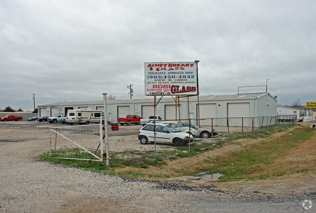
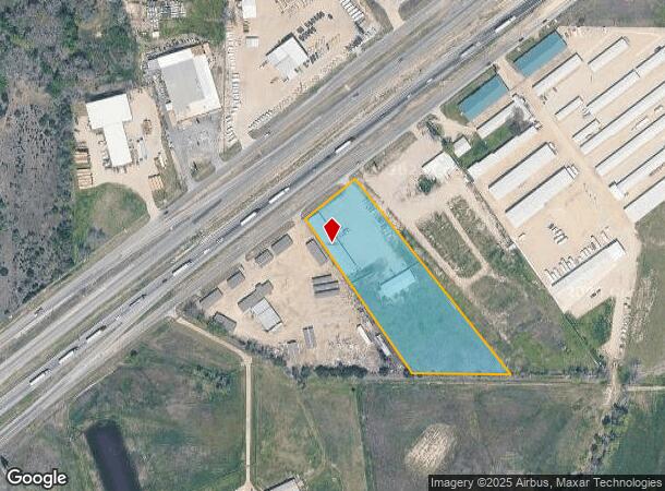
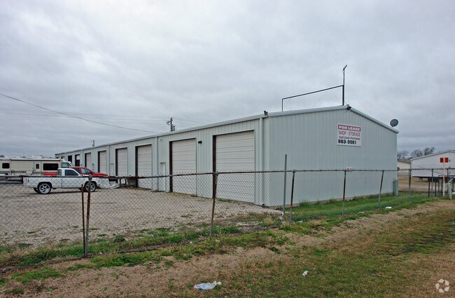
1969 Interstate Highway 30 W, Greenville, TX 75402
NEARBY LISTINGS FOR SALE OR LEASE
Property Detail
1969 Interstate Highway 30 W
Dallas-Fort Worth-Arlington, TX
Morris Mary
29549
A0649 MORRIS MARY,TRACT M62-1, ACRES 3.243
Commercialnec
Hunt
X
Texas
48231C0375G
m62-1
2024
3.24 AC
2025
Hunt County
961102
Dallas/Ft Worth
12,000 SF
DEMOGRAPHICS near 1969 Interstate Highway 30 W
1 Mile
3 Mile
5 Mile
2024 Total Population
137
2,467
19,831
2029 Population
160
2,865
23,235
Pop Growth 2024-2029
+ 16.79%
+ 16.13%
+ 17.17%
Average Age
38
39
39
2024 Total Households
51
877
7,633
HH Growth 2024-2029
+ 17.65%
+ 16.76%
+ 17.78%
Median Household Inc
$61,500
$67,112
$66,127
Avg Household Size
2.70
2.80
2.60
2024 Avg HH Vehicles
2.00
3.00
2.00
Median Home Value
$271,428
$235,496
$208,097
Median Year Built
1987
1989
1987
Nearby Places
Map Layers
Map Styles
 Street
 Aerial
- Restaurants
- Banks
- Shops
- Fitness
- Groceries
Nearby Properties
Address
Land Use
TOTAL SIZE
Lot Size
Zoning
Address
Land Use
TOTAL SIZE
Lot Size
Zoning
179,910 SF
53.91 AC
Address
Land Use
TOTAL SIZE
Lot Size
Zoning
343,740 SF
19.81 AC
Address
Land Use
TOTAL SIZE
Lot Size
Zoning
44,000 SF
5.28 AC
Address
Land Use
TOTAL SIZE
Lot Size
Zoning
125,680 SF
10.83 AC
Address
Land Use
TOTAL SIZE
Lot Size
Zoning
21,580 SF
7.13 AC
Address
Land Use
TOTAL SIZE
Lot Size
Zoning
101,142 SF
29.37 AC
Address
Land Use
TOTAL SIZE
Lot Size
Zoning
100,950 SF
4.03 AC
Address
Land Use
TOTAL SIZE
Lot Size
Zoning
50,000 SF
5 AC
Address
Land Use
TOTAL SIZE
Lot Size
Zoning
110.22 AC
Address
Land Use
TOTAL SIZE
Lot Size
Zoning
4,320 SF
58.51 AC
Address
Land Use
TOTAL SIZE
Lot Size
Zoning
12,524 SF
4 AC
Address
Land Use
TOTAL SIZE
Lot Size
Zoning
37,200 SF
10.67 AC
Address
Land Use
TOTAL SIZE
Lot Size
Zoning
69,400 SF
11.32 AC
Address
Land Use
TOTAL SIZE
Lot Size
Zoning
8,821 SF
9.69 AC
Address
Land Use
TOTAL SIZE
Lot Size
Zoning
9,600 SF
7 AC
Address
Land Use
TOTAL SIZE
Lot Size
Zoning
29,200 SF
3.16 AC
Address
Land Use
TOTAL SIZE
Lot Size
Zoning
1,800 SF
9.99 AC
Address
Land Use
TOTAL SIZE
Lot Size
Zoning
147.29 AC
Address
Land Use
TOTAL SIZE
Lot Size
Zoning
98.88 AC
Address
Land Use
TOTAL SIZE
Lot Size
Zoning
14,180 SF
5.70 AC
Address
Land Use
TOTAL SIZE
Lot Size
Zoning
6,888 SF
7.06 AC
Address
Land Use
TOTAL SIZE
Lot Size
Zoning
35.46 AC
Address
Land Use
TOTAL SIZE
Lot Size
Zoning
153.69 AC
Address
Land Use
TOTAL SIZE
Lot Size
Zoning
8,750 SF
5.89 AC
Address
Land Use
TOTAL SIZE
Lot Size
Zoning
12,584 SF
9.78 AC
C1
Address
Land Use
TOTAL SIZE
Lot Size
Zoning
19,125 SF
4.51 AC
Address
Land Use
TOTAL SIZE
Lot Size
Zoning
6,060 SF
11.35 AC
Address
Land Use
TOTAL SIZE
Lot Size
Zoning
17,500 SF
5.07 AC
Address
Land Use
TOTAL SIZE
Lot Size
Zoning
7,647 SF
8.13 AC
Address
Land Use
TOTAL SIZE
Lot Size
Zoning
7,800 SF
18.18 AC
The World's #1 Commercial Real Estate Marketplace
Connect with us
© 2025 CoStar Group
The information above has been obtained from sources believed reliable. While we do not doubt its accuracy we have not verified it and make no guarantee, warranty or representation about it. It is your responsibility to independently confirm its accuracy and completeness. Any projections, opinions, assumptions, or estimates used are for example only and do not represent the current or future performance of the property. The value of this transaction to you depends on tax and other factors which should be evaluated by your tax, financial, and legal advisors. You and your advisors should conduct a careful, independent investigation of the property to determine to your satisfaction the suitability of the property for your needs.