Property Record
1969 W 9Th St, Riviera Beach, FL 33404


This Property Is For Sale
Current Lease Availabilities
NEARBY LISTINGS FOR SALE OR LEASE
Property Detail
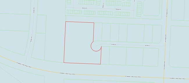
1969 W 9Th St
West Palm Beach-Boca Raton-Delray Beach, FL
Velda Farms
56-43-42-31-13-000-0020
VELDA FARMS DEPOT LT 2
Warehouse
Palm Beach
X
Florida
12099C0389F
2
2024
4.15 AC
2025
Central Palm Bch Area
001404
South Florida
14,901 SF
DEMOGRAPHICS near 1969 W 9Th St
1 Mile
3 Mile
5 Mile
2024 Total Population
10,382
102,609
228,541
2029 Population
11,304
107,478
240,172
Pop Growth 2024-2029
+ 8.88%
+ 4.75%
+ 5.09%
Average Age
35
38
43
2024 Total Households
3,382
37,432
97,621
HH Growth 2024-2029
+ 8.49%
+ 4.16%
+ 4.90%
Median Household Inc
$48,785
$54,993
$58,172
Avg Household Size
2.90
2.60
2.20
2024 Avg HH Vehicles
2.00
2.00
1.00
Median Home Value
$181,698
$249,274
$303,034
Median Year Built
2000
1984
1984
Nearby Places
Map Layers
Map Styles
 Street
 Aerial
- Restaurants
- Banks
- Shops
- Fitness
- Groceries
PUBLIC TRANSPORTATION
COMMUTER RAIL
Mangonia Park (Tri-County Commuter - South Florida Regional Transportation Authority (Tri-Rail))
DRIVE
WALK
Distance
Mangonia Park (Tri-County Commuter - South Florida Regional Transportation Authority (Tri-Rail))
6 min
2.3 mi
West Palm Beach (Tri-County Commuter - South Florida Regional Transportation Authority (Tri-Rail))
DRIVE
WALK
Distance
West Palm Beach (Tri-County Commuter - South Florida Regional Transportation Authority (Tri-Rail))
11 min
5.3 mi
AIRPORT
Palm Beach International
DRIVE
WALK
Distance
Palm Beach International
17 min
9.5 mi
Nearby Properties
Address
Land Use
TOTAL SIZE
Lot Size
Zoning
Address
Land Use
TOTAL SIZE
Lot Size
Zoning
1,778,741 SF
69.19 AC
CF
Address
Land Use
TOTAL SIZE
Lot Size
Zoning
746,972 SF
5.09 AC
CMPD
Address
Land Use
TOTAL SIZE
Lot Size
Zoning
586,386 SF
19.67 AC
RPD
Address
Land Use
TOTAL SIZE
Lot Size
Zoning
739,813 SF
81.18 AC
CSPD
Address
Land Use
TOTAL SIZE
Lot Size
Zoning
546,847 SF
19.50 AC
RPD
Address
Land Use
TOTAL SIZE
Lot Size
Zoning
411,080 SF
7.59 AC
CPD
Address
Land Use
TOTAL SIZE
Lot Size
Zoning
292,706 SF
30.75 AC
RPD
Address
Land Use
TOTAL SIZE
Lot Size
Zoning
416,171 SF
19.24 AC
R-PUD
Address
Land Use
TOTAL SIZE
Lot Size
Zoning
368,320 SF
23.07 AC
CLIC
Address
Land Use
TOTAL SIZE
Lot Size
Zoning
224,212 SF
141.33 AC
CSPD
Address
Land Use
TOTAL SIZE
Lot Size
Zoning
433,243 SF
40.26 AC
RM-15
Address
Land Use
TOTAL SIZE
Lot Size
Zoning
366,446 SF
67.91 AC
CPD
Address
Land Use
TOTAL SIZE
Lot Size
Zoning
307,554 SF
6.10 AC
CSPD
Address
Land Use
TOTAL SIZE
Lot Size
Zoning
247,028 SF
14.30 AC
RS
Address
Land Use
TOTAL SIZE
Lot Size
Zoning
177,585 SF
9.90 AC
CPD
Address
Land Use
TOTAL SIZE
Lot Size
Zoning
219,117 SF
4.15 AC
CPD
Address
Land Use
TOTAL SIZE
Lot Size
Zoning
5.81 AC
CMPD
Address
Land Use
TOTAL SIZE
Lot Size
Zoning
314,993 SF
38.46 AC
CF
Address
Land Use
TOTAL SIZE
Lot Size
Zoning
416,165 SF
42.48 AC
CSPD
Address
Land Use
TOTAL SIZE
Lot Size
Zoning
108,077 SF
9.72 AC
IG
Address
Land Use
TOTAL SIZE
Lot Size
Zoning
248,196 SF
8.74 AC
RPD
Address
Land Use
TOTAL SIZE
Lot Size
Zoning
185,929 SF
7.56 AC
POR/PD
Address
Land Use
TOTAL SIZE
Lot Size
Zoning
270,686 SF
56.14 AC
IG
Address
Land Use
TOTAL SIZE
Lot Size
Zoning
185,238 SF
16.63 AC
CLIC
Address
Land Use
TOTAL SIZE
Lot Size
Zoning
299,161 SF
16.85 AC
CSPD
Address
Land Use
TOTAL SIZE
Lot Size
Zoning
323,628 SF
48.15 AC
IG
Address
Land Use
TOTAL SIZE
Lot Size
Zoning
236,554 SF
14.37 AC
IG
Address
Land Use
TOTAL SIZE
Lot Size
Zoning
216,255 SF
25.37 AC
CSPD
Address
Land Use
TOTAL SIZE
Lot Size
Zoning
178,043 SF
11.60 AC
RPD
Address
Land Use
TOTAL SIZE
Lot Size
Zoning
290,846 SF
20.50 AC
IG
The World's #1 Commercial Real Estate Marketplace
Connect with us
© 2026 CoStar Group
The information above has been obtained from sources believed reliable. While we do not doubt its accuracy we have not verified it and make no guarantee, warranty or representation about it. It is your responsibility to independently confirm its accuracy and completeness. Any projections, opinions, assumptions, or estimates used are for example only and do not represent the current or future performance of the property. The value of this transaction to you depends on tax and other factors which should be evaluated by your tax, financial, and legal advisors. You and your advisors should conduct a careful, independent investigation of the property to determine to your satisfaction the suitability of the property for your needs.