Property Record
197 Beech Ave, Danville, VA 24541


Property Detail
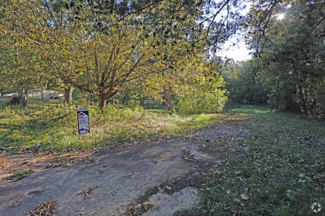
197 Beech Ave
77834
2.524 AC NO 2A BEECH AVE
Mobilehomepark
DANVILLE CITY
MULTI-FAMI
Virginia
B and X Area of moderate flood hazard, usually the area between the limits of the 100-year and 500-year floods.
2.52 AC
2025
Virginia South Central
2025
Other Market Areas
000800
Danville, VA
NEARBY LISTINGS FOR SALE OR LEASE
DEMOGRAPHICS near 197 Beech Ave
1 mile
3 mile
5 mile
2025 Total Population
1,526
9,902
36,493
2030 Population
1,505
9,761
36,209
Pop Growth 2025-2030
(1.38%)
(1.42%)
(0.78%)
Average Age
48
45
43
2025 Total Households
711
4,359
16,099
HH Growth 2025-2030
(1.27%)
(1.42%)
(0.77%)
Median Household Inc
$65,445
$57,598
$48,454
Avg Household Size
2.10
2.20
2.20
2025 Avg HH Vehicles
2.00
2.00
2.00
Median Home Value
$211,481
$196,607
$155,702
Median Year Built
1966
1971
1965
Nearby Places
Map Layers
Map Styles
 Street
 Aerial
Transit
 Traffic
 Biking
Places
Listings with unknown addresses are not visible on the map
- Restaurants
- Banks
- Shops
- Fitness
- Groceries
PUBLIC TRANSPORTATION
COMMUTER RAIL
Drive
Walk
Distance
12 min
7.0 mi
Nearby Properties
Address
Land Use
TOTAL SIZE
Lot Size
Zoning
Address
Land Use
TOTAL SIZE
Lot Size
Zoning
225,611 SF
19.53 AC
PLANNED SH
Address
Land Use
TOTAL SIZE
Lot Size
Zoning
81,251 SF
70.22 AC
TRANSITION
Address
Land Use
TOTAL SIZE
Lot Size
Zoning
53,871 SF
6.89 AC
HIGHWAY RE
Address
Land Use
TOTAL SIZE
Lot Size
Zoning
136,211 SF
15.10 AC
PLANNED SH
Address
Land Use
TOTAL SIZE
Lot Size
Zoning
79,580 SF
15.78 AC
TRANSITION
Address
Land Use
TOTAL SIZE
Lot Size
Zoning
42,882 SF
6.17 AC
HIGHWAY RE
Address
Land Use
TOTAL SIZE
Lot Size
Zoning
168,934 SF
15.14 AC
PLANNED SH
Address
Land Use
TOTAL SIZE
Lot Size
Zoning
41,058 SF
6.80 AC
HIGHWAY RE
Address
Land Use
TOTAL SIZE
Lot Size
Zoning
19.98 AC
B-2
Address
Land Use
TOTAL SIZE
Lot Size
Zoning
97,974 SF
12.22 AC
PLANNED SH
Address
Land Use
TOTAL SIZE
Lot Size
Zoning
76,622 SF
10.21 AC
PLANNED SH
Address
Land Use
TOTAL SIZE
Lot Size
Zoning
35,212 SF
5.38 AC
HIGHWAY RE
Address
Land Use
TOTAL SIZE
Lot Size
Zoning
55,996 SF
7.09 AC
TRANSITION
Address
Land Use
TOTAL SIZE
Lot Size
Zoning
37,761 SF
9.79 AC
TRANSITION
Address
Land Use
TOTAL SIZE
Lot Size
Zoning
112,294 SF
9.71 AC
PLANNED SH
Address
Land Use
TOTAL SIZE
Lot Size
Zoning
33,798 SF
5.18 AC
TRANSITION
Address
Land Use
TOTAL SIZE
Lot Size
Zoning
25,461 SF
5.75 AC
PLANNED SH
Address
Land Use
TOTAL SIZE
Lot Size
Zoning
36,132 SF
3.80 AC
PLANNED SH
Address
Land Use
TOTAL SIZE
Lot Size
Zoning
27,518 SF
3.85 AC
HIGHWAY RE
Address
Land Use
TOTAL SIZE
Lot Size
Zoning
9,793 SF
0.04 AC
TRANSITION
Address
Land Use
TOTAL SIZE
Lot Size
Zoning
13,878 SF
2.23 AC
HIGHWAY RE
Address
Land Use
TOTAL SIZE
Lot Size
Zoning
40,219 SF
3.54 AC
HIGHWAY RE
Address
Land Use
TOTAL SIZE
Lot Size
Zoning
41,911 SF
14.71 AC
SUBURBAN R
Address
Land Use
TOTAL SIZE
Lot Size
Zoning
65,120 SF
6.25 AC
HIGHWAY RE
Address
Land Use
TOTAL SIZE
Lot Size
Zoning
30,204 SF
15.09 AC
SUBURBAN R
Address
Land Use
TOTAL SIZE
Lot Size
Zoning
62,783 SF
7.65 AC
HIGHWAY RE
Address
Land Use
TOTAL SIZE
Lot Size
Zoning
8,764 SF
2.08 AC
PLANNED SH
Address
Land Use
TOTAL SIZE
Lot Size
Zoning
17,265 SF
2.15 AC
HIGHWAY RE
Address
Land Use
TOTAL SIZE
Lot Size
Zoning
8,062 SF
0.04 AC
TRANSITION
Address
Land Use
TOTAL SIZE
Lot Size
Zoning
12,986 SF
3.08 AC
HIGHWAY RE
The World's #1 Commercial Real Estate Marketplace
Connect with us
© 2026 CoStar Group
The information above has been obtained from sources believed reliable. While we do not doubt its accuracy we have not verified it and make no guarantee, warranty or representation about it. It is your responsibility to independently confirm its accuracy and completeness. Any projections, opinions, assumptions, or estimates used are for example only and do not represent the current or future performance of the property. The value of this transaction to you depends on tax and other factors which should be evaluated by your tax, financial, and legal advisors. You and your advisors should conduct a careful, independent investigation of the property to determine to your satisfaction the suitability of the property for your needs.