Property Record
1970 Bush Rd, Grand Island, NY 14072
NEARBY LISTINGS FOR SALE OR LEASE
-
-
View all Grand Island listings for sale on LoopNet.com
Property Detail
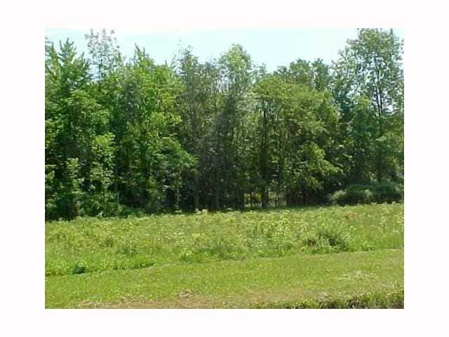
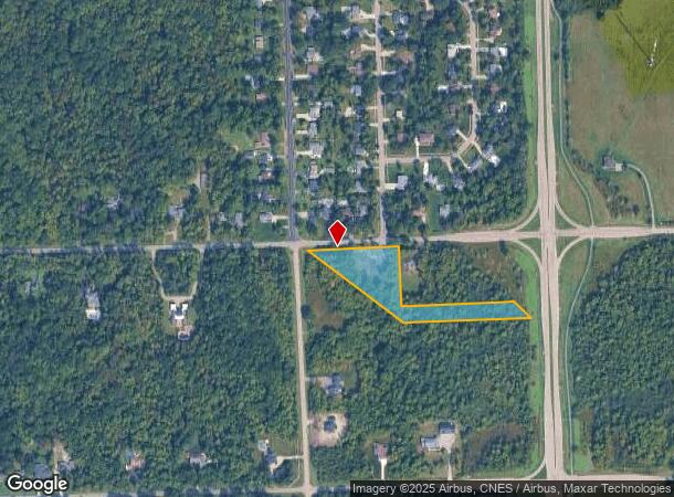
1970 Bush Rd
144600-064-000-0001-021-000
Erie
Residentialacreage
New York
X
21.000
36029C0177J
3.37 AC
2025
North
2024
Buffalo/Niagara Falls
007304
Buffalo-Cheektowaga-Niagara Falls, NY
DEMOGRAPHICS near 1970 Bush Rd
1 Mile
3 Mile
5 Mile
2024 Total Population
2,991
9,902
80,257
2029 Population
2,988
9,853
78,864
Pop Growth 2024-2029
(0.10%)
(0.49%)
(1.74%)
Average Age
44
43
40
2024 Total Households
1,176
4,084
33,902
HH Growth 2024-2029
(0.34%)
(0.64%)
(1.76%)
Median Household Inc
$116,631
$86,566
$54,907
Avg Household Size
2.50
2.40
2.30
2024 Avg HH Vehicles
2.00
2.00
1.00
Median Home Value
$267,018
$234,464
$169,689
Median Year Built
1972
1963
1950
Nearby Places
- Restaurants
- Banks
- Shops
- Fitness
- Groceries
PUBLIC TRANSPORTATION
AIRPORT
Niagara Falls International
DRIVE
WALK
Distance
Niagara Falls International
20 min
12.7 mi
Buffalo Niagara International
DRIVE
WALK
Distance
Buffalo Niagara International
27 min
16.7 mi
Freight Ports
Port of Toledo
DRIVE
WALK
Distance
Port of Toledo
377 min
316.2 mi
SALE & LEASE HISTORY
LISTING DATE
SALE/LEASE

Sep 24, 2016
For Sale
Nearby Properties
Address
Land Use
TOTAL SIZE
Lot Size
Zoning
Address
Land Use
TOTAL SIZE
Lot Size
Zoning
80,927 SF
28.20 AC
WID
Address
Land Use
TOTAL SIZE
Lot Size
Zoning
9,626 SF
31.67 AC
Address
Land Use
TOTAL SIZE
Lot Size
Zoning
59,670 SF
911.28 AC
OS
Address
Land Use
TOTAL SIZE
Lot Size
Zoning
650,000 SF
42.15 AC
G-1
Address
Land Use
TOTAL SIZE
Lot Size
Zoning
67,666 SF
17.43 AC
G-1
Address
Land Use
TOTAL SIZE
Lot Size
Zoning
3.20 AC
G-1
Address
Land Use
TOTAL SIZE
Lot Size
Zoning
16 AC
G-1
Address
Land Use
TOTAL SIZE
Lot Size
Zoning
11,442 SF
23.87 AC
Address
Land Use
TOTAL SIZE
Lot Size
Zoning
1,459,536 SF
51.28 AC
G-1
Address
Land Use
TOTAL SIZE
Lot Size
Zoning
15.19 AC
Address
Land Use
TOTAL SIZE
Lot Size
Zoning
227,073 SF
17.25 AC
WID
Address
Land Use
TOTAL SIZE
Lot Size
Zoning
69,348 SF
28.23 AC
R1E
Address
Land Use
TOTAL SIZE
Lot Size
Zoning
67,245 SF
5.34 AC
Address
Land Use
TOTAL SIZE
Lot Size
Zoning
23,800 SF
4.86 AC
G-1
Address
Land Use
TOTAL SIZE
Lot Size
Zoning
35,202 SF
9.09 AC
B1
Address
Land Use
TOTAL SIZE
Lot Size
Zoning
270,926 SF
19.02 AC
G-1
Address
Land Use
TOTAL SIZE
Lot Size
Zoning
30,700 SF
14.56 AC
B1
Address
Land Use
TOTAL SIZE
Lot Size
Zoning
55.20 AC
M1
Address
Land Use
TOTAL SIZE
Lot Size
Zoning
31,238 SF
109.35 AC
G-1
Address
Land Use
TOTAL SIZE
Lot Size
Zoning
5,514 SF
6.90 AC
CBD
Address
Land Use
TOTAL SIZE
Lot Size
Zoning
28,122 SF
130.70 AC
G-1
Address
Land Use
TOTAL SIZE
Lot Size
Zoning
25,290 SF
11.70 AC
B1
Address
Land Use
TOTAL SIZE
Lot Size
Zoning
16,964 SF
13.60 AC
B2
Address
Land Use
TOTAL SIZE
Lot Size
Zoning
768,000 SF
98.41 AC
G-1
Address
Land Use
TOTAL SIZE
Lot Size
Zoning
14,552 SF
2.67 AC
CBD
Address
Land Use
TOTAL SIZE
Lot Size
Zoning
102.32 AC
G-1
Address
Land Use
TOTAL SIZE
Lot Size
Zoning
12,510 SF
38.46 AC
G-1
Address
Land Use
TOTAL SIZE
Lot Size
Zoning
9,600 SF
7.60 AC
B1
Address
Land Use
TOTAL SIZE
Lot Size
Zoning
35,153 SF
1 AC
CBD
Address
Land Use
TOTAL SIZE
Lot Size
Zoning
17,531 SF
11.92 AC
B2
The World's #1 Commercial Real Estate Marketplace
Connect with us
© 2025 CoStar Group
The information above has been obtained from sources believed reliable. While we do not doubt its accuracy we have not verified it and make no guarantee, warranty or representation about it. It is your responsibility to independently confirm its accuracy and completeness. Any projections, opinions, assumptions, or estimates used are for example only and do not represent the current or future performance of the property. The value of this transaction to you depends on tax and other factors which should be evaluated by your tax, financial, and legal advisors. You and your advisors should conduct a careful, independent investigation of the property to determine to your satisfaction the suitability of the property for your needs.