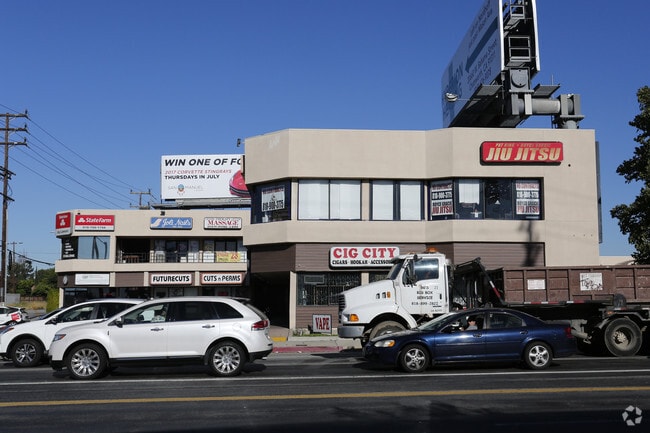
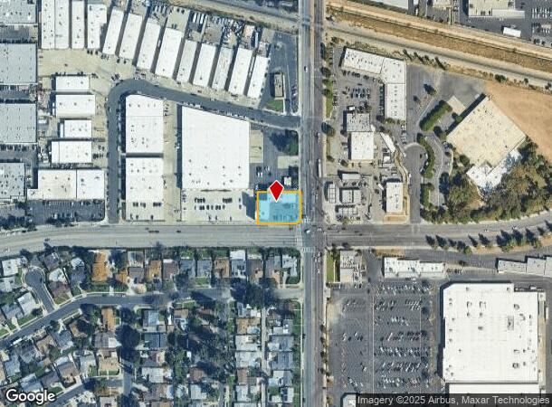
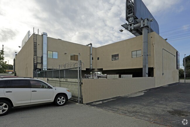
Property Record
19703 Nordhoff St, Northridge, CA 91324

Current Lease Availabilities
NEARBY LISTINGS FOR SALE OR LEASE
Property Detail
19703 Nordhoff St
Los Angeles-Long Beach-Glendale, CA
29373
2782-038-004
TRACT NO 29373 LOT 4
Storesoffices
Los Angeles
X
California
06037C1280F
4
2024
0.40 AC
2025
Western SFV
113424
Los Angeles
13,566 SF
DEMOGRAPHICS near 19703 Nordhoff St
1 Mile
3 Mile
5 Mile
2024 Total Population
20,461
236,379
503,369
2029 Population
20,039
230,206
490,890
Pop Growth 2024-2029
(2.06%)
(2.61%)
(2.48%)
Average Age
41
40
41
2024 Total Households
6,741
75,755
173,512
HH Growth 2024-2029
(2.23%)
(2.83%)
(2.61%)
Median Household Inc
$80,889
$77,895
$87,297
Avg Household Size
2.90
3.00
2.80
2024 Avg HH Vehicles
2.00
2.00
2.00
Median Home Value
$727,479
$734,157
$761,077
Median Year Built
1969
1970
1971
Nearby Places
- Restaurants
- Banks
- Shops
- Fitness
- Groceries
PUBLIC TRANSPORTATION
COMMUTER RAIL
Northridge (Ventura County Line - Southern California Regional Rail Authority (Metrolink))
DRIVE
WALK
Distance
Northridge (Ventura County Line - Southern California Regional Rail Authority (Metrolink))
4 min
1.4 mi
DRIVE
WALK
Distance
5 min
1.5 mi
AIRPORT
Bob Hope
DRIVE
WALK
Distance
Bob Hope
27 min
17.3 mi
Los Angeles International
DRIVE
WALK
Distance
Los Angeles International
41 min
27.3 mi
Long Beach (Daugherty Field)
DRIVE
WALK
Distance
Long Beach (Daugherty Field)
59 min
44.8 mi
Freight Ports
The Port of Hueneme
DRIVE
WALK
Distance
The Port of Hueneme
64 min
45.6 mi
Nearby Properties
Address
Land Use
TOTAL SIZE
Lot Size
Zoning
Address
Land Use
TOTAL SIZE
Lot Size
Zoning
300,266 SF
7.29 AC
LAR4
Address
Land Use
TOTAL SIZE
Lot Size
Zoning
273,849 SF
22.90 AC
LAC4
Address
Land Use
TOTAL SIZE
Lot Size
Zoning
546,652 SF
4.27 AC
LAC2
Address
Land Use
TOTAL SIZE
Lot Size
Zoning
143,806 SF
23.03 AC
LACM
Address
Land Use
TOTAL SIZE
Lot Size
Zoning
354,762 SF
5.05 AC
LAC2
Address
Land Use
TOTAL SIZE
Lot Size
Zoning
805,833 SF
9.02 AC
LAC4
Address
Land Use
TOTAL SIZE
Lot Size
Zoning
539,022 SF
35.67 AC
LAMR2
Address
Land Use
TOTAL SIZE
Lot Size
Zoning
219,083 SF
23.03 AC
LACM
Address
Land Use
TOTAL SIZE
Lot Size
Zoning
298,782 SF
8.63 AC
LAR3
Address
Land Use
TOTAL SIZE
Lot Size
Zoning
260,991 SF
3.32 AC
LAC2
Address
Land Use
TOTAL SIZE
Lot Size
Zoning
511,930 SF
Address
Land Use
TOTAL SIZE
Lot Size
Zoning
237,082 SF
2.17 AC
LARA
Address
Land Use
TOTAL SIZE
Lot Size
Zoning
304,209 SF
11.31 AC
LAMR2
Address
Land Use
TOTAL SIZE
Lot Size
Zoning
219,126 SF
6.06 AC
LAR1
Address
Land Use
TOTAL SIZE
Lot Size
Zoning
216,121 SF
6.10 AC
LAC4
Address
Land Use
TOTAL SIZE
Lot Size
Zoning
175,056 SF
5.98 AC
LAR3
Address
Land Use
TOTAL SIZE
Lot Size
Zoning
334,428 SF
9.25 AC
LAC4
Address
Land Use
TOTAL SIZE
Lot Size
Zoning
281,941 SF
9.10 AC
LAC4
Address
Land Use
TOTAL SIZE
Lot Size
Zoning
158,163 SF
3.65 AC
LAR3
Address
Land Use
TOTAL SIZE
Lot Size
Zoning
355,475 SF
6.46 AC
LARA
Address
Land Use
TOTAL SIZE
Lot Size
Zoning
274,013 SF
15.24 AC
LAA1
Address
Land Use
TOTAL SIZE
Lot Size
Zoning
657,547 SF
6.85 AC
LAC4
Address
Land Use
TOTAL SIZE
Lot Size
Zoning
353,563 SF
9.37 AC
LAC2
Address
Land Use
TOTAL SIZE
Lot Size
Zoning
323,511 SF
7.58 AC
LAC1
Address
Land Use
TOTAL SIZE
Lot Size
Zoning
93,466 SF
11.07 AC
LAC2
Address
Land Use
TOTAL SIZE
Lot Size
Zoning
272,065 SF
7.83 AC
LAMR2
Address
Land Use
TOTAL SIZE
Lot Size
Zoning
210,386 SF
8.33 AC
LAMR2
Address
Land Use
TOTAL SIZE
Lot Size
Zoning
87,708 SF
2.23 AC
LAR3
The World's #1 Commercial Real Estate Marketplace
Connect with us
© 2025 CoStar Group
The information above has been obtained from sources believed reliable. While we do not doubt its accuracy we have not verified it and make no guarantee, warranty or representation about it. It is your responsibility to independently confirm its accuracy and completeness. Any projections, opinions, assumptions, or estimates used are for example only and do not represent the current or future performance of the property. The value of this transaction to you depends on tax and other factors which should be evaluated by your tax, financial, and legal advisors. You and your advisors should conduct a careful, independent investigation of the property to determine to your satisfaction the suitability of the property for your needs.