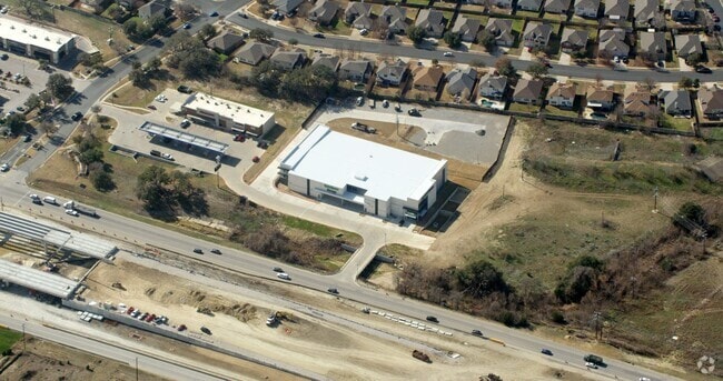
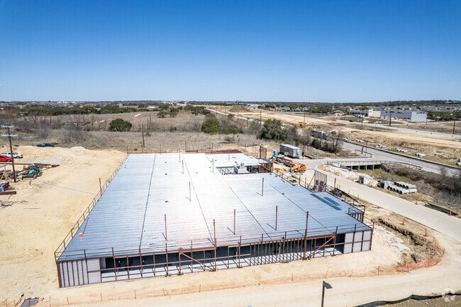
Property Record
1972 Highway 183, Leander, TX 78641

Property Detail
1972 Highway 183
Austin-Round Rock-San Marcos, TX
S11961 - WHITEWING SUB, BLOCK 1, LOT 2A, ACRES 3.6
R582490
Williamson
Commercialnec
Texas
B and X Area of moderate flood hazard, usually the area between the limits of the 100-year and 500-year floods.
2a
2024
3.60 AC
2025
Georgetown
020329
Austin
101,012 SF
NEARBY LISTINGS FOR SALE OR LEASE
-
-
View all Leander listings for sale on LoopNet.com
DEMOGRAPHICS near 1972 Highway 183
1 mile
3 mile
5 mile
2025 Total Population
7,504
38,863
91,796
2030 Population
8,875
46,533
109,074
Pop Growth 2025-2030
+ 18.27%
+ 19.74%
+ 18.82%
Average Age
33
35
36
2025 Total Households
2,505
13,152
31,651
HH Growth 2025-2030
+ 18.72%
+ 20.14%
+ 19.24%
Median Household Inc
$108,624
$128,270
$130,187
Avg Household Size
3.00
2.90
2.90
2025 Avg HH Vehicles
2.00
2.00
2.00
Median Home Value
$427,435
$463,050
$482,503
Median Year Built
2011
2011
2011
Nearby Places
Map Layers
Map Styles
 Street
 Aerial
Layers
 Traffic
 Biking
Places
Listings with unknown addresses are not visible on the map
- Restaurants
- Banks
- Shops
- Fitness
- Groceries
PUBLIC TRANSPORTATION
AIRPORT
Robert Gray AAF
Drive
Walk
Distance
Robert Gray AAF
50 min
36.8 mi
Austin-Bergstrom International
Drive
Walk
Distance
Austin-Bergstrom International
51 min
39.9 mi
Killeen Municipal
Drive
Walk
Distance
Killeen Municipal
55 min
45.5 mi
Nearby Properties
Address
Land Use
TOTAL SIZE
Lot Size
Zoning
Address
Land Use
TOTAL SIZE
Lot Size
Zoning
454,000 SF
58.85 AC
Address
Land Use
TOTAL SIZE
Lot Size
Zoning
435,000 SF
88.70 AC
Address
Land Use
TOTAL SIZE
Lot Size
Zoning
106,000 SF
72.51 AC
Address
Land Use
TOTAL SIZE
Lot Size
Zoning
341,700 SF
17.71 AC
Address
Land Use
TOTAL SIZE
Lot Size
Zoning
287,118 SF
9.26 AC
Address
Land Use
TOTAL SIZE
Lot Size
Zoning
327,784 SF
22.95 AC
Address
Land Use
TOTAL SIZE
Lot Size
Zoning
325,045 SF
11.40 AC
Address
Land Use
TOTAL SIZE
Lot Size
Zoning
31.42 AC
Address
Land Use
TOTAL SIZE
Lot Size
Zoning
285,365 SF
12.24 AC
Address
Land Use
TOTAL SIZE
Lot Size
Zoning
312,374 SF
15.77 AC
Address
Land Use
TOTAL SIZE
Lot Size
Zoning
232,172 SF
10.43 AC
Address
Land Use
TOTAL SIZE
Lot Size
Zoning
341,700 SF
9.90 AC
Address
Land Use
TOTAL SIZE
Lot Size
Zoning
286,888 SF
20.68 AC
Address
Land Use
TOTAL SIZE
Lot Size
Zoning
193,600 SF
70.78 AC
Address
Land Use
TOTAL SIZE
Lot Size
Zoning
247,584 SF
18.45 AC
Address
Land Use
TOTAL SIZE
Lot Size
Zoning
1,971 SF
52.04 AC
Address
Land Use
TOTAL SIZE
Lot Size
Zoning
109,663 SF
19.54 AC
Address
Land Use
TOTAL SIZE
Lot Size
Zoning
194,695 SF
5.09 AC
Address
Land Use
TOTAL SIZE
Lot Size
Zoning
256,008 SF
15.88 AC
Address
Land Use
TOTAL SIZE
Lot Size
Zoning
35,223 SF
9.75 AC
Address
Land Use
TOTAL SIZE
Lot Size
Zoning
37,809 SF
6.26 AC
Address
Land Use
TOTAL SIZE
Lot Size
Zoning
127,329 SF
32.79 AC
Address
Land Use
TOTAL SIZE
Lot Size
Zoning
39,180 SF
9.28 AC
Address
Land Use
TOTAL SIZE
Lot Size
Zoning
60,305 SF
0.87 AC
Address
Land Use
TOTAL SIZE
Lot Size
Zoning
1,412 SF
20.17 AC
Address
Land Use
TOTAL SIZE
Lot Size
Zoning
46,979 SF
5.56 AC
Address
Land Use
TOTAL SIZE
Lot Size
Zoning
40.21 AC
Address
Land Use
TOTAL SIZE
Lot Size
Zoning
308,888 SF
34.18 AC
Address
Land Use
TOTAL SIZE
Lot Size
Zoning
67,651 SF
2.68 AC
Address
Land Use
TOTAL SIZE
Lot Size
Zoning
111,000 SF
15.27 AC
The World's #1 Commercial Real Estate Marketplace
Connect with us
© 2026 CoStar Group
The information above has been obtained from sources believed reliable. While we do not doubt its accuracy we have not verified it and make no guarantee, warranty or representation about it. It is your responsibility to independently confirm its accuracy and completeness. Any projections, opinions, assumptions, or estimates used are for example only and do not represent the current or future performance of the property. The value of this transaction to you depends on tax and other factors which should be evaluated by your tax, financial, and legal advisors. You and your advisors should conduct a careful, independent investigation of the property to determine to your satisfaction the suitability of the property for your needs.