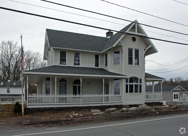
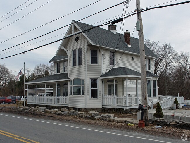
Property Record
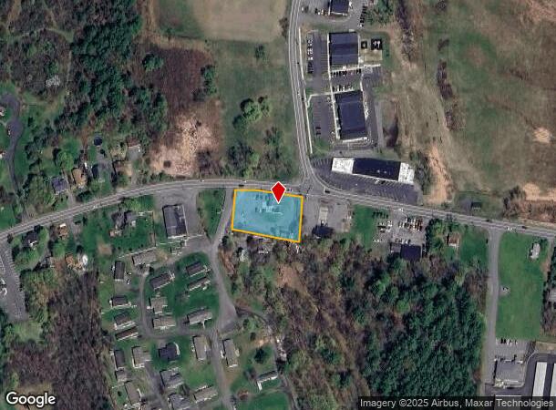
1972 New Scotland Rd, Slingerlands, NY 12159
NEARBY LISTINGS FOR SALE OR LEASE
Property Detail
1972 New Scotland Rd
013489-084-000-0002-026-000-0000
1.-201-6 KIRK KISSELBURG RESIDENCE
Commercialofficeresidentialmixeduse
Albany
X
New York
36001C0169D
26.000
2025
0.69 AC
2024
W Outer Albany County
014502
Albany/Schenectady/Troy
2,592 SF
Albany-Schenectady-Troy, NY
DEMOGRAPHICS near 1972 New Scotland Rd
1 Mile
3 Mile
5 Mile
2024 Total Population
821
13,756
57,532
2029 Population
830
13,697
57,380
Pop Growth 2024-2029
+ 1.10%
(0.43%)
(0.26%)
Average Age
44
43
43
2024 Total Households
339
5,539
24,564
HH Growth 2024-2029
+ 1.18%
(0.36%)
(0.21%)
Median Household Inc
$127,083
$113,121
$94,932
Avg Household Size
2.40
2.40
2.20
2024 Avg HH Vehicles
2.00
2.00
2.00
Median Home Value
$429,245
$341,781
$298,248
Median Year Built
1989
1976
1973
Nearby Places
- Restaurants
- Banks
- Shops
- Fitness
- Groceries
PUBLIC TRANSPORTATION
COMMUTER RAIL
DRIVE
WALK
Distance
21 min
9.6 mi
AIRPORT
Albany International
DRIVE
WALK
Distance
Albany International
27 min
16.1 mi
Freight Ports
Albany, NY Port
DRIVE
WALK
Distance
Albany, NY Port
18 min
9.5 mi
Nearby Properties
Address
Land Use
TOTAL SIZE
Lot Size
Zoning
Address
Land Use
TOTAL SIZE
Lot Size
Zoning
349,516 SF
22.61 AC
MED
Address
Land Use
TOTAL SIZE
Lot Size
Zoning
79.50 AC
IND
Address
Land Use
TOTAL SIZE
Lot Size
Zoning
315,680 SF
73.80 AC
RA
Address
Land Use
TOTAL SIZE
Lot Size
Zoning
18,390 SF
15.52 AC
PDD
Address
Land Use
TOTAL SIZE
Lot Size
Zoning
497.90 AC
RA
Address
Land Use
TOTAL SIZE
Lot Size
Zoning
140,609 SF
14.50 AC
CR
Address
Land Use
TOTAL SIZE
Lot Size
Zoning
69,106 SF
7.80 AC
MED
Address
Land Use
TOTAL SIZE
Lot Size
Zoning
72,741 SF
12.92 AC
CH
Address
Land Use
TOTAL SIZE
Lot Size
Zoning
43,196 SF
12.40 AC
CH
Address
Land Use
TOTAL SIZE
Lot Size
Zoning
17,388 SF
8.10 AC
PDD
Address
Land Use
TOTAL SIZE
Lot Size
Zoning
69,574 SF
21.69 AC
RA
Address
Land Use
TOTAL SIZE
Lot Size
Zoning
87,773 SF
29.40 AC
RH
Address
Land Use
TOTAL SIZE
Lot Size
Zoning
63,740 SF
3 AC
V1
Address
Land Use
TOTAL SIZE
Lot Size
Zoning
13,380 SF
9.20 AC
H
Address
Land Use
TOTAL SIZE
Lot Size
Zoning
47,499 SF
4.90 AC
CH
Address
Land Use
TOTAL SIZE
Lot Size
Zoning
14,028 SF
5.80 AC
PDD
Address
Land Use
TOTAL SIZE
Lot Size
Zoning
10,882 SF
6.09 AC
H
Address
Land Use
TOTAL SIZE
Lot Size
Zoning
2,592 SF
244.23 AC
RA
Address
Land Use
TOTAL SIZE
Lot Size
Zoning
78,295 SF
44.50 AC
V7
Address
Land Use
TOTAL SIZE
Lot Size
Zoning
9,175 SF
0.01 AC
PDD
Address
Land Use
TOTAL SIZE
Lot Size
Zoning
12,718 SF
1.40 AC
H
Address
Land Use
TOTAL SIZE
Lot Size
Zoning
15,268 SF
2.37 AC
MED
Address
Land Use
TOTAL SIZE
Lot Size
Zoning
21,400 SF
2.80 AC
CR
Address
Land Use
TOTAL SIZE
Lot Size
Zoning
14,028 SF
2 AC
PDD
Address
Land Use
TOTAL SIZE
Lot Size
Zoning
24,629 SF
2.50 AC
CH
Address
Land Use
TOTAL SIZE
Lot Size
Zoning
26,142 SF
198.70 AC
RA
Address
Land Use
TOTAL SIZE
Lot Size
Zoning
3,600 SF
10.16 AC
HD-E
Address
Land Use
TOTAL SIZE
Lot Size
Zoning
8,885 SF
2.33 AC
MED
Address
Land Use
TOTAL SIZE
Lot Size
Zoning
1.02 AC
V2
Address
Land Use
TOTAL SIZE
Lot Size
Zoning
1,680 SF
1.60 AC
H
The World's #1 Commercial Real Estate Marketplace
Connect with us
© 2025 CoStar Group
The information above has been obtained from sources believed reliable. While we do not doubt its accuracy we have not verified it and make no guarantee, warranty or representation about it. It is your responsibility to independently confirm its accuracy and completeness. Any projections, opinions, assumptions, or estimates used are for example only and do not represent the current or future performance of the property. The value of this transaction to you depends on tax and other factors which should be evaluated by your tax, financial, and legal advisors. You and your advisors should conduct a careful, independent investigation of the property to determine to your satisfaction the suitability of the property for your needs.