Property Record
1972 Pipestone Rd, Benton Harbor, MI 49022
NEARBY LISTINGS FOR SALE OR LEASE
Property Detail
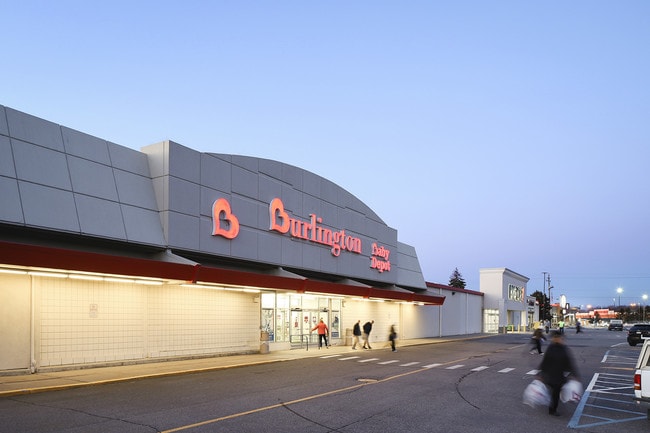
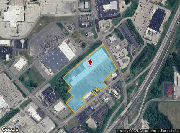
1972 Pipestone Rd
Wholesaleoutletdiscountstore
FROM N1/4 PST SEC 32 T4S R18W MEAS S89DEG21'45''E 1900.4' TH S9DEG20' 30''E 1293' TH S29DEG15'44''E 231.94' TH S44DEG11'W 34.43' TO POB TH S44DEG11'W 27.63' TH S50DEG 29'30''W 977.03' TH S39DEG30'28''E 291.2' TH S50DEG29'04''W 123.69' TH S39DEG29'E 1
X
Berrien
26021C0108C
Michigan
2024
15.15 AC
2025
Other Market Areas
002100
Niles-Benton Harbor, MI
171,165 SF
11-03-0032-0009-86-2
DEMOGRAPHICS near 1972 Pipestone Rd
1 Mile
3 Mile
5 Mile
2024 Total Population
1,215
24,808
48,155
2029 Population
1,178
24,541
47,383
Pop Growth 2024-2029
(3.05%)
(1.08%)
(1.60%)
Average Age
46
38
40
2024 Total Households
606
9,765
19,870
HH Growth 2024-2029
(3.30%)
(1.43%)
(1.90%)
Median Household Inc
$28,579
$33,216
$50,870
Avg Household Size
2.00
2.40
2.30
2024 Avg HH Vehicles
1.00
1.00
2.00
Median Home Value
$78,408
$140,268
$200,947
Median Year Built
1956
1962
1963
Nearby Places
Map Layers
Map Styles
 Street
 Aerial
- Restaurants
- Banks
- Shops
- Fitness
- Groceries
PUBLIC TRANSPORTATION
COMMUTER RAIL
St. Joseph-Benton Harbor Amtrak Station (Pere Marquette - Amtrak)
DRIVE
WALK
Distance
St. Joseph-Benton Harbor Amtrak Station (Pere Marquette - Amtrak)
11 min
5.0 mi
AIRPORT
South Bend International
DRIVE
WALK
Distance
South Bend International
47 min
32.2 mi
Freight Ports
Port Milwaukee
DRIVE
WALK
Distance
Port Milwaukee
217 min
181.6 mi
SALE & LEASE HISTORY
LISTING DATE
SALE/LEASE

Sep 26, 2016
For Lease
Sep 25, 2016
For Lease
Mar 22, 2019
For Sale
Aug 06, 2019
For Lease
Apr 21, 2017
For Lease
Apr 21, 2017
For Lease
Nearby Properties
Address
Land Use
TOTAL SIZE
Lot Size
Zoning
Address
Land Use
TOTAL SIZE
Lot Size
Zoning
200,321 SF
15.47 AC
D1 COMM
Address
Land Use
TOTAL SIZE
Lot Size
Zoning
218,334 SF
25.05 AC
Address
Land Use
TOTAL SIZE
Lot Size
Zoning
69,180 SF
3.58 AC
D1 COMM
Address
Land Use
TOTAL SIZE
Lot Size
Zoning
73,505 SF
4.02 AC
D1 COMM
Address
Land Use
TOTAL SIZE
Lot Size
Zoning
66,680 SF
3.42 AC
Address
Land Use
TOTAL SIZE
Lot Size
Zoning
296,788 SF
34 AC
D1 COMM
Address
Land Use
TOTAL SIZE
Lot Size
Zoning
258,549 SF
17.20 AC
C MULTI
Address
Land Use
TOTAL SIZE
Lot Size
Zoning
62,800 SF
3.06 AC
Address
Land Use
TOTAL SIZE
Lot Size
Zoning
61,732 SF
3.51 AC
D1 COMM
Address
Land Use
TOTAL SIZE
Lot Size
Zoning
42,610 SF
5.30 AC
C4 HEAVY
Address
Land Use
TOTAL SIZE
Lot Size
Zoning
112,503 SF
4.30 AC
C MULTI FA
Address
Land Use
TOTAL SIZE
Lot Size
Zoning
75,050 SF
5.33 AC
NONE
Address
Land Use
TOTAL SIZE
Lot Size
Zoning
126,127 SF
11.84 AC
D1 COMM
Address
Land Use
TOTAL SIZE
Lot Size
Zoning
204,000 SF
34.08 AC
F HEAVY
Address
Land Use
TOTAL SIZE
Lot Size
Zoning
391,928 SF
40.84 AC
F HEAVY
Address
Land Use
TOTAL SIZE
Lot Size
Zoning
84,732 SF
4.19 AC
C MULTI FA
Address
Land Use
TOTAL SIZE
Lot Size
Zoning
77,703 SF
28.05 AC
F HEAVY
Address
Land Use
TOTAL SIZE
Lot Size
Zoning
88,572 SF
15.70 AC
D1 COMM
Address
Land Use
TOTAL SIZE
Lot Size
Zoning
254,984 SF
25.04 AC
R-A RE
Address
Land Use
TOTAL SIZE
Lot Size
Zoning
49,527 SF
4.47 AC
PUD
Address
Land Use
TOTAL SIZE
Lot Size
Zoning
70,617 SF
12 AC
E RESTRICT
Address
Land Use
TOTAL SIZE
Lot Size
Zoning
103,591 SF
8.77 AC
D1 COMM
Address
Land Use
TOTAL SIZE
Lot Size
Zoning
69,484 SF
8.08 AC
C MULTI
Address
Land Use
TOTAL SIZE
Lot Size
Zoning
18.05 AC
D1 COMM
Address
Land Use
TOTAL SIZE
Lot Size
Zoning
60,188 SF
3.59 AC
D1 COMM
Address
Land Use
TOTAL SIZE
Lot Size
Zoning
55,753 SF
6 AC
DISTRICT D
Address
Land Use
TOTAL SIZE
Lot Size
Zoning
172,489 SF
12.66 AC
E RESTRICT
Address
Land Use
TOTAL SIZE
Lot Size
Zoning
23,923 SF
2.40 AC
D1 COMM
Address
Land Use
TOTAL SIZE
Lot Size
Zoning
1,590 SF
33.32 AC
C MULTI
The World's #1 Commercial Real Estate Marketplace
Connect with us
© 2025 CoStar Group
The information above has been obtained from sources believed reliable. While we do not doubt its accuracy we have not verified it and make no guarantee, warranty or representation about it. It is your responsibility to independently confirm its accuracy and completeness. Any projections, opinions, assumptions, or estimates used are for example only and do not represent the current or future performance of the property. The value of this transaction to you depends on tax and other factors which should be evaluated by your tax, financial, and legal advisors. You and your advisors should conduct a careful, independent investigation of the property to determine to your satisfaction the suitability of the property for your needs.