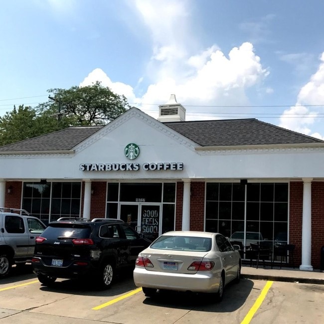
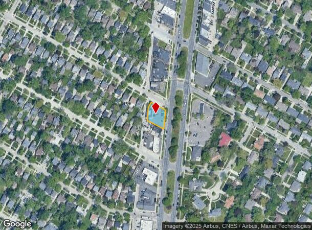
Property Record
19727 Mack Ave, Grosse Pointe Woods, MI 48236

NEARBY LISTINGS FOR SALE OR LEASE
Property Detail
19727 Mack Ave
Detroit-Warren-Dearborn, MI
Grosse Pointe Country Club Woods No 1
40-011-04-0784-000
WDGG784 TO 788 LOTS 784 TO 788 INCL GROSSE POINTE COUNTRY CLUB WOODS NO 1 PC619 L60 P16 WCR K 108.43
Restaurantdrivein
Wayne
X
Michigan
26163C0141F
784-788
2024
0.26 AC
2025
The Pointes/Harper Woods
551200
Detroit
1,384 SF
DEMOGRAPHICS near 19727 Mack Ave
1 Mile
3 Mile
5 Mile
2024 Total Population
13,717
125,740
269,119
2029 Population
13,152
123,048
267,166
Pop Growth 2024-2029
(4.12%)
(2.14%)
(0.73%)
Average Age
42
39
39
2024 Total Households
5,536
48,241
103,843
HH Growth 2024-2029
(4.17%)
(2.27%)
(0.87%)
Median Household Inc
$90,405
$61,402
$53,381
Avg Household Size
2.40
2.50
2.50
2024 Avg HH Vehicles
2.00
2.00
2.00
Median Home Value
$239,459
$173,928
$140,074
Median Year Built
1952
1951
1953
Nearby Places
Map Layers
Map Styles
 Street
 Aerial
- Restaurants
- Banks
- Shops
- Fitness
- Groceries
PUBLIC TRANSPORTATION
AIRPORT
Windsor International
DRIVE
WALK
Distance
Windsor International
42 min
21.8 mi
Detroit Metro Wayne County
DRIVE
WALK
Distance
Detroit Metro Wayne County
46 min
31.3 mi
Freight Ports
Port of Toledo
DRIVE
WALK
Distance
Port of Toledo
92 min
72.1 mi
SALE & LEASE HISTORY
LISTING DATE
SALE/LEASE

Sep 25, 2017
For Sale
Sep 13, 2022
For Sale
Jul 01, 2021
For Lease
Nearby Properties
Address
Land Use
TOTAL SIZE
Lot Size
Zoning
Address
Land Use
TOTAL SIZE
Lot Size
Zoning
1,034,990 SF
28.60 AC
Address
Land Use
TOTAL SIZE
Lot Size
Zoning
9,937 SF
35.42 AC
CLD
Address
Land Use
TOTAL SIZE
Lot Size
Zoning
211,065 SF
8.84 AC
C.F
Address
Land Use
TOTAL SIZE
Lot Size
Zoning
575,081 SF
8.53 AC
R6
Address
Land Use
TOTAL SIZE
Lot Size
Zoning
89,970 SF
2.86 AC
RM-1
Address
Land Use
TOTAL SIZE
Lot Size
Zoning
101,733 SF
1.10 AC
C-2
Address
Land Use
TOTAL SIZE
Lot Size
Zoning
49,437 SF
0.47 AC
Address
Land Use
TOTAL SIZE
Lot Size
Zoning
103,069 SF
11.41 AC
B-3
Address
Land Use
TOTAL SIZE
Lot Size
Zoning
93,296 SF
1.05 AC
C-2
Address
Land Use
TOTAL SIZE
Lot Size
Zoning
62,195 SF
1.50 AC
Address
Land Use
TOTAL SIZE
Lot Size
Zoning
115,307 SF
7.01 AC
RM-1
Address
Land Use
TOTAL SIZE
Lot Size
Zoning
75,284 SF
0.87 AC
C
Address
Land Use
TOTAL SIZE
Lot Size
Zoning
17,558 SF
3.15 AC
Address
Land Use
TOTAL SIZE
Lot Size
Zoning
5,511 SF
1.52 AC
Address
Land Use
TOTAL SIZE
Lot Size
Zoning
41,235 SF
8.81 AC
Address
Land Use
TOTAL SIZE
Lot Size
Zoning
136,270 SF
3.42 AC
LI
Address
Land Use
TOTAL SIZE
Lot Size
Zoning
11,315 SF
41.52 AC
RA
Address
Land Use
TOTAL SIZE
Lot Size
Zoning
46,246 SF
3.19 AC
B-3
Address
Land Use
TOTAL SIZE
Lot Size
Zoning
30,919 SF
0.86 AC
C
Address
Land Use
TOTAL SIZE
Lot Size
Zoning
28,055 SF
0.44 AC
Address
Land Use
TOTAL SIZE
Lot Size
Zoning
92,903 SF
1.70 AC
LI
Address
Land Use
TOTAL SIZE
Lot Size
Zoning
80,320 SF
4.73 AC
RM-1
Address
Land Use
TOTAL SIZE
Lot Size
Zoning
42,113 SF
0.54 AC
Address
Land Use
TOTAL SIZE
Lot Size
Zoning
102,205 SF
214.30 AC
Address
Land Use
TOTAL SIZE
Lot Size
Zoning
20,625 SF
0.48 AC
C-2
Address
Land Use
TOTAL SIZE
Lot Size
Zoning
36,191 SF
3.87 AC
B-2
Address
Land Use
TOTAL SIZE
Lot Size
Zoning
60,694 SF
3.05 AC
B-2
Address
Land Use
TOTAL SIZE
Lot Size
Zoning
3,312 SF
8.81 AC
R-1A
Address
Land Use
TOTAL SIZE
Lot Size
Zoning
27,860 SF
3.79 AC
LI
Address
Land Use
TOTAL SIZE
Lot Size
Zoning
10,704 SF
1.84 AC
The World's #1 Commercial Real Estate Marketplace
Connect with us
© 2025 CoStar Group
The information above has been obtained from sources believed reliable. While we do not doubt its accuracy we have not verified it and make no guarantee, warranty or representation about it. It is your responsibility to independently confirm its accuracy and completeness. Any projections, opinions, assumptions, or estimates used are for example only and do not represent the current or future performance of the property. The value of this transaction to you depends on tax and other factors which should be evaluated by your tax, financial, and legal advisors. You and your advisors should conduct a careful, independent investigation of the property to determine to your satisfaction the suitability of the property for your needs.