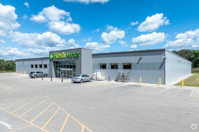
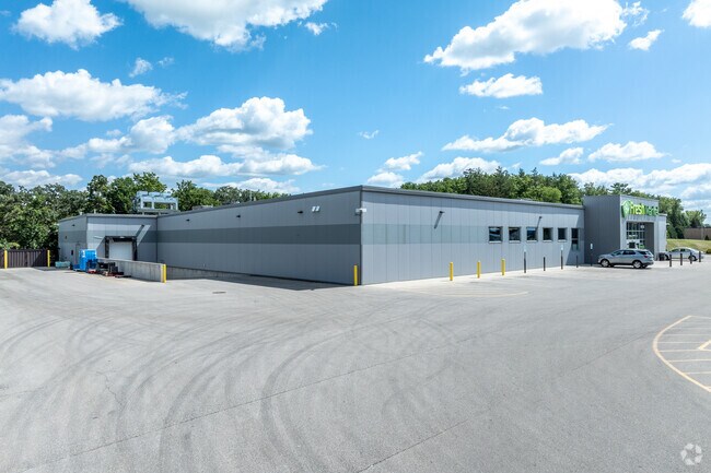
Property Record
1975 Three Elms Park Rd, Independence, IA 50644

Property Detail
1975 Three Elms Park Rd
10.10.101.002
NW4 S10 T88N R9W
Commercialnec
BUCHANAN
AE The base floodplain where base flood elevations are provided. AE Zones are now used on new format FIRMs instead of A1-A30 Zones.
Iowa
2024
5.77 AC
2025
Iowa City/Waterloo
950500
Other Market Areas
27,038 SF
NEARBY LISTINGS FOR SALE OR LEASE
-
-
View all Independence listings for sale on LoopNet.com
DEMOGRAPHICS near 1975 Three Elms Park Rd
1 mile
3 mile
5 mile
2025 Total Population
3,355
7,309
8,057
2030 Population
3,418
7,403
8,143
Pop Growth 2025-2030
+ 1.88%
+ 1.29%
+ 1.07%
Average Age
42
42
42
2025 Total Households
1,417
3,130
3,424
HH Growth 2025-2030
+ 1.98%
+ 1.41%
+ 1.20%
Median Household Inc
$83,877
$76,718
$76,774
Avg Household Size
2.30
2.30
2.30
2025 Avg HH Vehicles
2.00
2.00
2.00
Median Home Value
$179,593
$176,120
$178,892
Median Year Built
1974
1972
1972
Nearby Places
Map Layers
Map Styles
 Street
 Aerial
Layers
 Traffic
 Biking
Places
Listings with unknown addresses are not visible on the map
- Restaurants
- Banks
- Shops
- Fitness
- Groceries
SALE & LEASE HISTORY
LISTING DATE
SALE/LEASE

Aug 22, 2024
For Sale
Nearby Properties
Address
Land Use
TOTAL SIZE
Lot Size
Zoning
Address
Land Use
TOTAL SIZE
Lot Size
Zoning
100,046 SF
13.91 AC
Address
Land Use
TOTAL SIZE
Lot Size
Zoning
9,012 SF
12.04 AC
Address
Land Use
TOTAL SIZE
Lot Size
Zoning
65,500 SF
1.35 AC
Address
Land Use
TOTAL SIZE
Lot Size
Zoning
12,548 SF
6.73 AC
Address
Land Use
TOTAL SIZE
Lot Size
Zoning
60,010 SF
1.75 AC
Address
Land Use
TOTAL SIZE
Lot Size
Zoning
49,521 SF
1.73 AC
Address
Land Use
TOTAL SIZE
Lot Size
Zoning
14,442 SF
1 AC
Address
Land Use
TOTAL SIZE
Lot Size
Zoning
14,442 SF
0.93 AC
Address
Land Use
TOTAL SIZE
Lot Size
Zoning
30,614 SF
3.42 AC
Address
Land Use
TOTAL SIZE
Lot Size
Zoning
6,480 SF
2.89 AC
Address
Land Use
TOTAL SIZE
Lot Size
Zoning
35,907 SF
1 AC
Address
Land Use
TOTAL SIZE
Lot Size
Zoning
1.85 AC
Address
Land Use
TOTAL SIZE
Lot Size
Zoning
9,278 SF
0.37 AC
Address
Land Use
TOTAL SIZE
Lot Size
Zoning
22,626 SF
1 AC
Address
Land Use
TOTAL SIZE
Lot Size
Zoning
9,045 SF
0.46 AC
Address
Land Use
TOTAL SIZE
Lot Size
Zoning
3.77 AC
Address
Land Use
TOTAL SIZE
Lot Size
Zoning
86,828 SF
1.40 AC
Address
Land Use
TOTAL SIZE
Lot Size
Zoning
28,468 SF
1 AC
Address
Land Use
TOTAL SIZE
Lot Size
Zoning
27,094 SF
1.49 AC
Address
Land Use
TOTAL SIZE
Lot Size
Zoning
3,216 SF
6.69 AC
Address
Land Use
TOTAL SIZE
Lot Size
Zoning
12,500 SF
1 AC
Address
Land Use
TOTAL SIZE
Lot Size
Zoning
10,864 SF
0.24 AC
Address
Land Use
TOTAL SIZE
Lot Size
Zoning
Address
Land Use
TOTAL SIZE
Lot Size
Zoning
31,000 SF
1 AC
Address
Land Use
TOTAL SIZE
Lot Size
Zoning
120,004 SF
3.94 AC
Address
Land Use
TOTAL SIZE
Lot Size
Zoning
29,725 SF
1 AC
Address
Land Use
TOTAL SIZE
Lot Size
Zoning
8,016 SF
4.71 AC
Address
Land Use
TOTAL SIZE
Lot Size
Zoning
17,193 SF
1 AC
Address
Land Use
TOTAL SIZE
Lot Size
Zoning
4,462 SF
0.85 AC
The World's #1 Commercial Real Estate Marketplace
Connect with us
© 2026 CoStar Group
The information above has been obtained from sources believed reliable. While we do not doubt its accuracy we have not verified it and make no guarantee, warranty or representation about it. It is your responsibility to independently confirm its accuracy and completeness. Any projections, opinions, assumptions, or estimates used are for example only and do not represent the current or future performance of the property. The value of this transaction to you depends on tax and other factors which should be evaluated by your tax, financial, and legal advisors. You and your advisors should conduct a careful, independent investigation of the property to determine to your satisfaction the suitability of the property for your needs.