Property Record
1975 W Blairtown Rd, Rock Springs, WY 82901
NEARBY LISTINGS FOR SALE OR LEASE
Property Detail
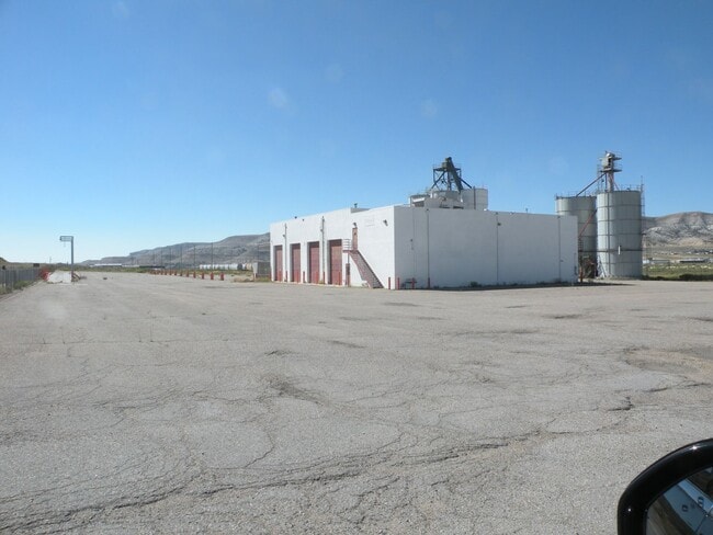
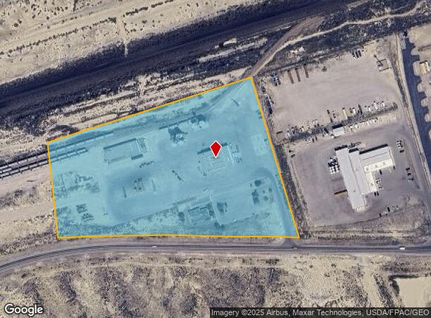
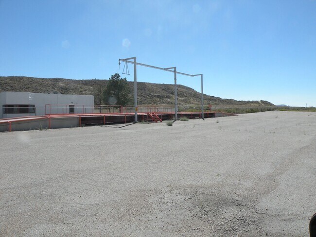
1975 W Blairtown Rd
Rock Springs, WY
T18N R105W SEC 4 N2S2 TR COMMERCIAL
04-1805-04-3-00-023.00
Sweetwater
Officebuilding
Wyoming
2024
11.22 AC
2025
I-80 Corridor/Cheyenne
970903
Other Market Areas
19,998 SF
DEMOGRAPHICS near 1975 W Blairtown Rd
1 Mile
3 Mile
5 Mile
2024 Total Population
838
18,419
25,396
2029 Population
859
18,136
24,963
Pop Growth 2024-2029
+ 2.51%
(1.54%)
(1.70%)
Average Age
33
37
37
2024 Total Households
307
7,323
10,048
HH Growth 2024-2029
+ 3.26%
(1.39%)
(1.56%)
Median Household Inc
$43,928
$78,532
$74,246
Avg Household Size
2.30
2.40
2.40
2024 Avg HH Vehicles
2.00
2.00
2.00
Median Home Value
$120,000
$233,375
$228,345
Median Year Built
1984
1983
1980
Nearby Places
- Restaurants
- Banks
- Shops
- Fitness
- Groceries
SALE & LEASE HISTORY
LISTING DATE
SALE/LEASE

Sep 01, 2022
For Lease
Nearby Properties
Address
Land Use
TOTAL SIZE
Lot Size
Zoning
Address
Land Use
TOTAL SIZE
Lot Size
Zoning
253,525 SF
10.84 AC
Address
Land Use
TOTAL SIZE
Lot Size
Zoning
569,982 SF
29.86 AC
Address
Land Use
TOTAL SIZE
Lot Size
Zoning
191,048 SF
10.51 AC
Address
Land Use
TOTAL SIZE
Lot Size
Zoning
52,373 SF
10 AC
Address
Land Use
TOTAL SIZE
Lot Size
Zoning
152,739 SF
11.46 AC
Address
Land Use
TOTAL SIZE
Lot Size
Zoning
117,792 SF
6.37 AC
Address
Land Use
TOTAL SIZE
Lot Size
Zoning
105,904 SF
5.33 AC
Address
Land Use
TOTAL SIZE
Lot Size
Zoning
265,909 SF
19.60 AC
Address
Land Use
TOTAL SIZE
Lot Size
Zoning
77,388 SF
2.56 AC
Address
Land Use
TOTAL SIZE
Lot Size
Zoning
31,887 SF
0.92 AC
Address
Land Use
TOTAL SIZE
Lot Size
Zoning
106,224 SF
11.55 AC
Address
Land Use
TOTAL SIZE
Lot Size
Zoning
42,808 SF
4.51 AC
Address
Land Use
TOTAL SIZE
Lot Size
Zoning
57,799 SF
2.71 AC
Address
Land Use
TOTAL SIZE
Lot Size
Zoning
41,836 SF
2.02 AC
Address
Land Use
TOTAL SIZE
Lot Size
Zoning
192,458 SF
Address
Land Use
TOTAL SIZE
Lot Size
Zoning
86,700 SF
5.12 AC
Address
Land Use
TOTAL SIZE
Lot Size
Zoning
104,998 SF
7.72 AC
Address
Land Use
TOTAL SIZE
Lot Size
Zoning
58,316 SF
5.34 AC
Address
Land Use
TOTAL SIZE
Lot Size
Zoning
29,900 SF
7.19 AC
Address
Land Use
TOTAL SIZE
Lot Size
Zoning
37,040 SF
2.48 AC
Address
Land Use
TOTAL SIZE
Lot Size
Zoning
40,405 SF
4.22 AC
Address
Land Use
TOTAL SIZE
Lot Size
Zoning
1 SF
20.34 AC
Address
Land Use
TOTAL SIZE
Lot Size
Zoning
40,788 SF
12.15 AC
Address
Land Use
TOTAL SIZE
Lot Size
Zoning
41,055 SF
1.90 AC
Address
Land Use
TOTAL SIZE
Lot Size
Zoning
33,508 SF
1 AC
Address
Land Use
TOTAL SIZE
Lot Size
Zoning
57,612 SF
3.93 AC
Address
Land Use
TOTAL SIZE
Lot Size
Zoning
18,547 SF
3.32 AC
Address
Land Use
TOTAL SIZE
Lot Size
Zoning
40,983 SF
3.92 AC
Address
Land Use
TOTAL SIZE
Lot Size
Zoning
26,832 SF
16.50 AC
Address
Land Use
TOTAL SIZE
Lot Size
Zoning
12,500 SF
1.63 AC
The World's #1 Commercial Real Estate Marketplace
Connect with us
© 2025 CoStar Group
The information above has been obtained from sources believed reliable. While we do not doubt its accuracy we have not verified it and make no guarantee, warranty or representation about it. It is your responsibility to independently confirm its accuracy and completeness. Any projections, opinions, assumptions, or estimates used are for example only and do not represent the current or future performance of the property. The value of this transaction to you depends on tax and other factors which should be evaluated by your tax, financial, and legal advisors. You and your advisors should conduct a careful, independent investigation of the property to determine to your satisfaction the suitability of the property for your needs.