Property Record
19765 Gregory Creek Rd, Lakehead, CA 96051

NEARBY LISTINGS FOR SALE OR LEASE
-
-
View all Lakehead listings for sale on LoopNet.com
Property Detail
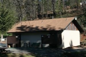
19765 Gregory Creek Rd
Recreationalentertainmentgeneral
Shasta
D
California
06089C0925G
9.09 AC
2024
Other Market Areas
2025
Redding, CA
012500
084-040-007-000
DEMOGRAPHICS near 19765 Gregory Creek Rd
1 Mile
3 Mile
5 Mile
2024 Total Population
54
684
829
2029 Population
51
659
796
Pop Growth 2024-2029
(5.56%)
(3.65%)
(3.98%)
Average Age
50
54
53
2024 Total Households
27
342
414
HH Growth 2024-2029
(7.41%)
(3.51%)
(4.11%)
Median Household Inc
$53,333
$46,764
$48,499
Avg Household Size
2.00
1.90
1.90
2024 Avg HH Vehicles
2.00
2.00
2.00
Median Home Value
$407,143
$299,450
$316,129
Median Year Built
1973
1972
1972
Nearby Places
Map Layers
Map Styles
 Street
 Aerial
- Restaurants
- Banks
- Shops
- Fitness
- Groceries
PUBLIC TRANSPORTATION
AIRPORT
Redding Regional
DRIVE
WALK
Distance
Redding Regional
35 min
28.5 mi
Freight Ports
Port of Coos Bay, OR
DRIVE
WALK
Distance
Port of Coos Bay, OR
365 min
292.6 mi
Nearby Properties
Address
Land Use
TOTAL SIZE
Lot Size
Zoning
Address
Land Use
TOTAL SIZE
Lot Size
Zoning
3,698 SF
20 AC
C-R-NRA-S
Address
Land Use
TOTAL SIZE
Lot Size
Zoning
2,500 SF
0.50 AC
MU-NRA-S
Address
Land Use
TOTAL SIZE
Lot Size
Zoning
3,797 SF
0.17 AC
R-R-NRA-S
Address
Land Use
TOTAL SIZE
Lot Size
Zoning
1,440 SF
6.54 AC
MU-NRA-S
Address
Land Use
TOTAL SIZE
Lot Size
Zoning
3,883 SF
0.18 AC
R-R-NRA-S
Address
Land Use
TOTAL SIZE
Lot Size
Zoning
4,421 SF
0.30 AC
R-R-NRA-S
Address
Land Use
TOTAL SIZE
Lot Size
Zoning
2,904 SF
0.29 AC
R-R-NRA-S
Address
Land Use
TOTAL SIZE
Lot Size
Zoning
3,104 SF
0.29 AC
R-R-NRA-S
Address
Land Use
TOTAL SIZE
Lot Size
Zoning
4,027 SF
1.25 AC
C-R-NRA-S
Address
Land Use
TOTAL SIZE
Lot Size
Zoning
2,558 SF
9.09 AC
MU-NRA-S
Address
Land Use
TOTAL SIZE
Lot Size
Zoning
7,005 SF
1.87 AC
MU-NRA-S
Address
Land Use
TOTAL SIZE
Lot Size
Zoning
2,660 SF
0.41 AC
R-R-NRA-S
Address
Land Use
TOTAL SIZE
Lot Size
Zoning
1.02 AC
MU-NRA-S
Address
Land Use
TOTAL SIZE
Lot Size
Zoning
500 SF
33.67 AC
C-R-NRA-S
Address
Land Use
TOTAL SIZE
Lot Size
Zoning
1 AC
C-R-NRA-S
Address
Land Use
TOTAL SIZE
Lot Size
Zoning
2,686 SF
2.20 AC
R-R-NRA-S
Address
Land Use
TOTAL SIZE
Lot Size
Zoning
2,262 SF
0.20 AC
R-R-NRA-S
Address
Land Use
TOTAL SIZE
Lot Size
Zoning
2,045 SF
0.16 AC
R-R-NRA-S
Address
Land Use
TOTAL SIZE
Lot Size
Zoning
2,022 SF
0.44 AC
R-R-NRA-S
Address
Land Use
TOTAL SIZE
Lot Size
Zoning
2,088 SF
0.85 AC
MU-NRA-S
Address
Land Use
TOTAL SIZE
Lot Size
Zoning
1,316 SF
2.50 AC
R-R-NRA-S
Address
Land Use
TOTAL SIZE
Lot Size
Zoning
1,584 SF
5 AC
R-R-BA-2.5
Address
Land Use
TOTAL SIZE
Lot Size
Zoning
2,904 SF
2 AC
MU-NRA-S
Address
Land Use
TOTAL SIZE
Lot Size
Zoning
1,945 SF
0.93 AC
NRA-S-T-BS
Address
Land Use
TOTAL SIZE
Lot Size
Zoning
1,305 SF
1.10 AC
R-R-NRA-S
Address
Land Use
TOTAL SIZE
Lot Size
Zoning
1,640 SF
0.22 AC
R-R-NRA-S
Address
Land Use
TOTAL SIZE
Lot Size
Zoning
10,612 SF
1.13 AC
MU-NRA-S
Address
Land Use
TOTAL SIZE
Lot Size
Zoning
640 SF
6.11 AC
C-R-NRA-S
Address
Land Use
TOTAL SIZE
Lot Size
Zoning
2,496 SF
1.35 AC
R-R-NRA-S
Address
Land Use
TOTAL SIZE
Lot Size
Zoning
2,024 SF
0.22 AC
R-R-T-NRA-
The World's #1 Commercial Real Estate Marketplace
Connect with us
© 2025 CoStar Group
The information above has been obtained from sources believed reliable. While we do not doubt its accuracy we have not verified it and make no guarantee, warranty or representation about it. It is your responsibility to independently confirm its accuracy and completeness. Any projections, opinions, assumptions, or estimates used are for example only and do not represent the current or future performance of the property. The value of this transaction to you depends on tax and other factors which should be evaluated by your tax, financial, and legal advisors. You and your advisors should conduct a careful, independent investigation of the property to determine to your satisfaction the suitability of the property for your needs.