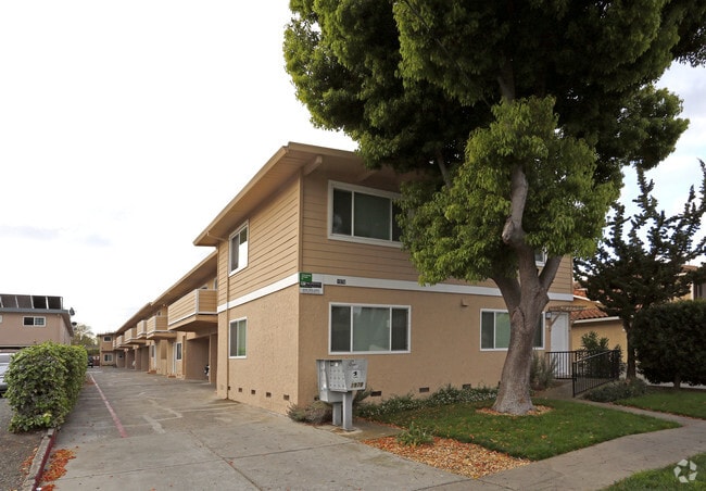
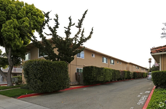
Property Record
1978 Bellomy St, Santa Clara, CA 95050


Property Detail
1978 Bellomy St
269-39-096
CALIFORNIA GARDEN MAP D5 833
Multifamilydwelling
Santa Clara
R325
California
C and X Area of minimal flood hazard, usually depicted on FIRMs as above the 500-year flood level.
0.38 AC
2024
Outer Santa Clara
2025
South Bay/San Jose
505902
San Jose-Sunnyvale-Santa Clara, CA
10,316 SF
NEARBY LISTINGS FOR SALE OR LEASE
DEMOGRAPHICS near 1978 Bellomy St
1 mile
3 mile
5 mile
2025 Total Population
29,634
232,697
644,166
2030 Population
30,415
239,047
661,064
Pop Growth 2025-2030
+ 2.64%
+ 2.73%
+ 2.62%
Average Age
39
39
39
2025 Total Households
11,272
86,848
239,208
HH Growth 2025-2030
+ 2.63%
+ 2.77%
+ 2.72%
Median Household Inc
$139,879
$145,409
$154,432
Avg Household Size
2.50
2.60
2.60
2025 Avg HH Vehicles
2.00
2.00
2.00
Median Home Value
$1,131,380
$1,112,827
$1,111,317
Median Year Built
1960
1970
1973
Nearby Places
Map Layers
Map Styles
 Street
 Aerial
Layers
 Traffic
 Biking
Places
Listings with unknown addresses are not visible on the map
- Restaurants
- Banks
- Shops
- Fitness
- Groceries
PUBLIC TRANSPORTATION
COMMUTER RAIL
Drive
Walk
Distance
4 min
1.7 mi
Drive
Walk
Distance
4 min
1.7 mi
AIRPORT
Norman Y Mineta San Jose International
Drive
Walk
Distance
Norman Y Mineta San Jose International
6 min
2.4 mi
San Francisco International
Drive
Walk
Distance
San Francisco International
46 min
34.4 mi
Metro Oakland International
Drive
Walk
Distance
Metro Oakland International
48 min
38.0 mi
Freight Ports
Port of Redwood City
Drive
Walk
Distance
Port of Redwood City
31 min
21.3 mi
Nearby Properties
Address
Land Use
TOTAL SIZE
Lot Size
Zoning
Address
Land Use
TOTAL SIZE
Lot Size
Zoning
2,819,800 SF
91.85 AC
CU
Address
Land Use
TOTAL SIZE
Lot Size
Zoning
0.06 AC
PD
Address
Land Use
TOTAL SIZE
Lot Size
Zoning
238,239 SF
24.67 AC
PD
Address
Land Use
TOTAL SIZE
Lot Size
Zoning
576,892 SF
8.28 AC
APD
Address
Land Use
TOTAL SIZE
Lot Size
Zoning
111,585 SF
6.69 AC
ML
Address
Land Use
TOTAL SIZE
Lot Size
Zoning
360,000 SF
18.81 AC
MH
Address
Land Use
TOTAL SIZE
Lot Size
Zoning
9.11 AC
ML
Address
Land Use
TOTAL SIZE
Lot Size
Zoning
194,790 SF
5.30 AC
APDCI
Address
Land Use
TOTAL SIZE
Lot Size
Zoning
1,121,228 SF
7.68 AC
RM(PD
Address
Land Use
TOTAL SIZE
Lot Size
Zoning
2.99 AC
MH
Address
Land Use
TOTAL SIZE
Lot Size
Zoning
180,846 SF
12.19 AC
ML
Address
Land Use
TOTAL SIZE
Lot Size
Zoning
833,956 SF
55.15 AC
PD
Address
Land Use
TOTAL SIZE
Lot Size
Zoning
304,000 SF
6.79 AC
PM0
Address
Land Use
TOTAL SIZE
Lot Size
Zoning
146,390 SF
9.04 AC
MP
Address
Land Use
TOTAL SIZE
Lot Size
Zoning
8.22 AC
PD
Address
Land Use
TOTAL SIZE
Lot Size
Zoning
50,774 SF
3.84 AC
MP
Address
Land Use
TOTAL SIZE
Lot Size
Zoning
320,000 SF
15.18 AC
APD
Address
Land Use
TOTAL SIZE
Lot Size
Zoning
897,944 SF
7.40 AC
PD
Address
Land Use
TOTAL SIZE
Lot Size
Zoning
500,000 SF
41.05 AC
MH
Address
Land Use
TOTAL SIZE
Lot Size
Zoning
1,016,763 SF
7.63 AC
CC
Address
Land Use
TOTAL SIZE
Lot Size
Zoning
2.99 AC
MH
Address
Land Use
TOTAL SIZE
Lot Size
Zoning
457,162 SF
3.97 AC
A(PD)
Address
Land Use
TOTAL SIZE
Lot Size
Zoning
473,849 SF
6 AC
ML
Address
Land Use
TOTAL SIZE
Lot Size
Zoning
27,000 SF
2 AC
MH
Address
Land Use
TOTAL SIZE
Lot Size
Zoning
57,536 SF
9.79 AC
MXD1
Address
Land Use
TOTAL SIZE
Lot Size
Zoning
446,996 SF
5.24 AC
ML
Address
Land Use
TOTAL SIZE
Lot Size
Zoning
486,104 SF
5.43 AC
ML
Address
Land Use
TOTAL SIZE
Lot Size
Zoning
617,814 SF
21.96 AC
CG
Address
Land Use
TOTAL SIZE
Lot Size
Zoning
60,133 SF
10.06 AC
C
Address
Land Use
TOTAL SIZE
Lot Size
Zoning
194,530 SF
12.26 AC
APD
The World's #1 Commercial Real Estate Marketplace
Connect with us
© 2026 CoStar Group
The information above has been obtained from sources believed reliable. While we do not doubt its accuracy we have not verified it and make no guarantee, warranty or representation about it. It is your responsibility to independently confirm its accuracy and completeness. Any projections, opinions, assumptions, or estimates used are for example only and do not represent the current or future performance of the property. The value of this transaction to you depends on tax and other factors which should be evaluated by your tax, financial, and legal advisors. You and your advisors should conduct a careful, independent investigation of the property to determine to your satisfaction the suitability of the property for your needs.