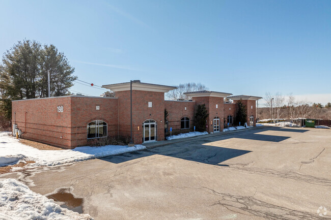
Property Record
198 Groton Rd, Ayer, MA 01432


NEARBY LISTINGS FOR SALE OR LEASE
Property Detail
198 Groton Rd
AYER-000004-000000-000002A
Middlesex
Medicalbuilding
Massachusetts
X
2a
25017C0204F
0.93 AC
2025
Groton/Townsend
2025
Boston
325102
Boston-Cambridge-Newton, MA-NH
9,316 SF
DEMOGRAPHICS near 198 Groton Rd
1 Mile
3 Mile
5 Mile
2024 Total Population
2,011
15,200
36,450
2029 Population
2,000
15,154
36,239
Pop Growth 2024-2029
(0.55%)
(0.30%)
(0.58%)
Average Age
44
42
42
2024 Total Households
810
5,806
13,202
HH Growth 2024-2029
(0.62%)
(0.36%)
(0.59%)
Median Household Inc
$108,695
$124,262
$131,076
Avg Household Size
2.30
2.40
2.50
2024 Avg HH Vehicles
2.00
2.00
2.00
Median Home Value
$392,499
$451,548
$494,317
Median Year Built
1978
1981
1979
Nearby Places
Map Layers
Map Styles
 Street
 Aerial
- Restaurants
- Banks
- Shops
- Fitness
- Groceries
PUBLIC TRANSPORTATION
COMMUTER RAIL
Ayer (Fitchburg/South Acton Line - Massachusetts Bay Transportation Authority Commuter Rail (Purple Line))
DRIVE
WALK
Distance
Ayer (Fitchburg/South Acton Line - Massachusetts Bay Transportation Authority Commuter Rail (Purple Line))
6 min
2.2 mi
Shirley (Fitchburg/South Acton Line - Massachusetts Bay Transportation Authority Commuter Rail (Purple Line))
DRIVE
WALK
Distance
Shirley (Fitchburg/South Acton Line - Massachusetts Bay Transportation Authority Commuter Rail (Purple Line))
12 min
5.1 mi
AIRPORT
Manchester Boston Regional
DRIVE
WALK
Distance
Manchester Boston Regional
56 min
30.9 mi
Worcester Regional
DRIVE
WALK
Distance
Worcester Regional
56 min
37.4 mi
General Edward Lawrence Logan International
DRIVE
WALK
Distance
General Edward Lawrence Logan International
63 min
38.6 mi
SALE & LEASE HISTORY
LISTING DATE
SALE/LEASE

Nov 12, 2024
For Lease
May 05, 2025
For Sale
Nearby Properties
Address
Land Use
TOTAL SIZE
Lot Size
Zoning
Address
Land Use
TOTAL SIZE
Lot Size
Zoning
329,818 SF
55 AC
A1
Address
Land Use
TOTAL SIZE
Lot Size
Zoning
35.63 AC
O
Address
Land Use
TOTAL SIZE
Lot Size
Zoning
337,563 SF
21.31 AC
17
Address
Land Use
TOTAL SIZE
Lot Size
Zoning
832,622 SF
43.78 AC
I
Address
Land Use
TOTAL SIZE
Lot Size
Zoning
51,888 SF
57.38 AC
LI
Address
Land Use
TOTAL SIZE
Lot Size
Zoning
28 AC
RA
Address
Land Use
TOTAL SIZE
Lot Size
Zoning
398,800 SF
21.92 AC
I
Address
Land Use
TOTAL SIZE
Lot Size
Zoning
342,309 SF
21.60 AC
I
Address
Land Use
TOTAL SIZE
Lot Size
Zoning
15.98 AC
O
Address
Land Use
TOTAL SIZE
Lot Size
Zoning
213,950 SF
22.71 AC
I
Address
Land Use
TOTAL SIZE
Lot Size
Zoning
293,250 SF
60.10 AC
LI
Address
Land Use
TOTAL SIZE
Lot Size
Zoning
343,400 SF
20 AC
LI
Address
Land Use
TOTAL SIZE
Lot Size
Zoning
105,559 SF
35.45 AC
A1
Address
Land Use
TOTAL SIZE
Lot Size
Zoning
216,289 SF
17.54 AC
I
Address
Land Use
TOTAL SIZE
Lot Size
Zoning
162,000 SF
19.40 AC
I
Address
Land Use
TOTAL SIZE
Lot Size
Zoning
186,000 SF
16.02 AC
C
Address
Land Use
TOTAL SIZE
Lot Size
Zoning
134,920 SF
26.90 AC
I
Address
Land Use
TOTAL SIZE
Lot Size
Zoning
234,465 SF
16.13 AC
I
Address
Land Use
TOTAL SIZE
Lot Size
Zoning
8.44 AC
B1
Address
Land Use
TOTAL SIZE
Lot Size
Zoning
14.90 AC
RA
Address
Land Use
TOTAL SIZE
Lot Size
Zoning
6.50 AC
RA
Address
Land Use
TOTAL SIZE
Lot Size
Zoning
84.10 AC
15
Address
Land Use
TOTAL SIZE
Lot Size
Zoning
94,159 SF
13.31 AC
I
Address
Land Use
TOTAL SIZE
Lot Size
Zoning
57,152 SF
20.30 AC
A2
Address
Land Use
TOTAL SIZE
Lot Size
Zoning
78,808 SF
6.38 AC
I
Address
Land Use
TOTAL SIZE
Lot Size
Zoning
58,738 SF
183.84 AC
RA
Address
Land Use
TOTAL SIZE
Lot Size
Zoning
130 AC
RA
Address
Land Use
TOTAL SIZE
Lot Size
Zoning
140,318 SF
12.75 AC
I
Address
Land Use
TOTAL SIZE
Lot Size
Zoning
49,689 SF
3.67 AC
GB
Address
Land Use
TOTAL SIZE
Lot Size
Zoning
160,860 SF
5.81 AC
I
The World's #1 Commercial Real Estate Marketplace
Connect with us
© 2026 CoStar Group
The information above has been obtained from sources believed reliable. While we do not doubt its accuracy we have not verified it and make no guarantee, warranty or representation about it. It is your responsibility to independently confirm its accuracy and completeness. Any projections, opinions, assumptions, or estimates used are for example only and do not represent the current or future performance of the property. The value of this transaction to you depends on tax and other factors which should be evaluated by your tax, financial, and legal advisors. You and your advisors should conduct a careful, independent investigation of the property to determine to your satisfaction the suitability of the property for your needs.