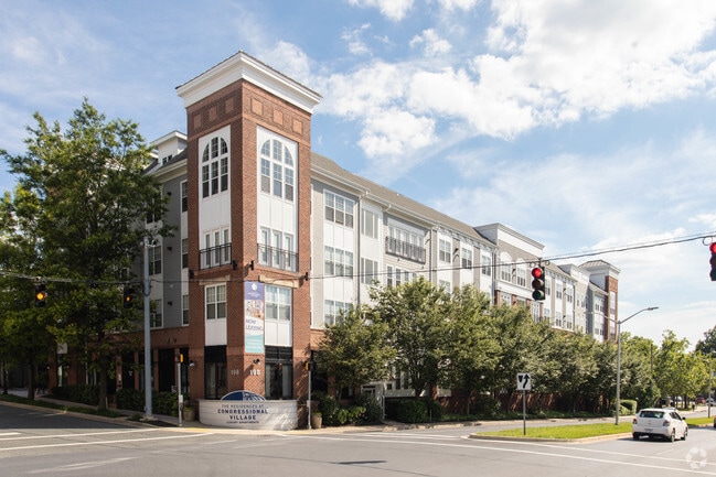
Property Record
198 Halpine Rd, Rockville, MD 20852


Property Detail
198 Halpine Rd
04-03395616
MONTROSE OWNERSHIP PLAT
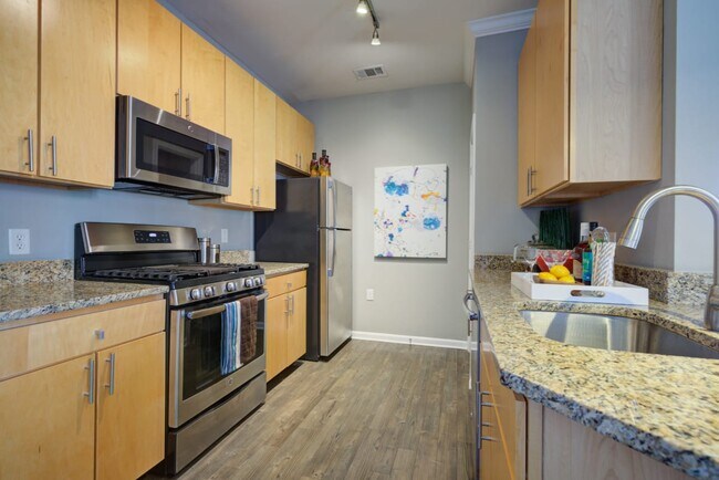
Apartment
Montgomery
MXCD
Maryland
B and X Area of moderate flood hazard, usually the area between the limits of the 100-year and 500-year floods.
4c
2024
7.28 AC
2025
Central Rockville
700904
Washington, DC
414,000 SF
Washington-Arlington-Alexandria, DC-VA-MD-WV
NEARBY LISTINGS FOR SALE OR LEASE
DEMOGRAPHICS near 198 Halpine Rd
1 mile
3 mile
5 mile
2025 Total Population
23,792
152,966
360,611
2030 Population
24,680
157,494
371,576
Pop Growth 2025-2030
+ 3.73%
+ 2.96%
+ 3.04%
Average Age
39
41
42
2025 Total Households
10,570
58,437
135,096
HH Growth 2025-2030
+ 3.78%
+ 3.04%
+ 3.12%
Median Household Inc
$94,872
$123,972
$128,102
Avg Household Size
2.20
2.50
2.60
2025 Avg HH Vehicles
1.00
2.00
2.00
Median Home Value
$587,296
$660,075
$701,593
Median Year Built
1986
1971
1974
Nearby Places
Map Layers
Map Styles
 Street
 Aerial
Layers
 Traffic
 Biking
Places
Listings with unknown addresses are not visible on the map
- Restaurants
- Banks
- Shops
- Fitness
- Groceries
PUBLIC TRANSPORTATION
TRANSIT/SUBWAY
Twinbrook (Red Line - Washington Metropolitan Area Transit Authority Metrorail (Metrorail))
Drive
Walk
Distance
Twinbrook (Red Line - Washington Metropolitan Area Transit Authority Metrorail (Metrorail))
2 min
9 min
0.5 mi
COMMUTER RAIL
Rockville (BRUNSWICK - WASHINGTON - Maryland Area Regional Commuter Trains (The MARC), Brunswick Line - Maryland Area Regional Commuter Trains (The MARC))
Drive
Walk
Distance
Rockville (BRUNSWICK - WASHINGTON - Maryland Area Regional Commuter Trains (The MARC), Brunswick Line - Maryland Area Regional Commuter Trains (The MARC))
6 min
2.4 mi
Garrett Park Marc Eb (BRUNSWICK - WASHINGTON - Maryland Transit Administration)
Drive
Walk
Distance
Garrett Park Marc Eb (BRUNSWICK - WASHINGTON - Maryland Transit Administration)
8 min
3.2 mi
AIRPORT
Ronald Reagan Washington Ntl
Drive
Walk
Distance
Ronald Reagan Washington Ntl
35 min
17.6 mi
Washington Dulles International
Drive
Walk
Distance
Washington Dulles International
44 min
27.4 mi
Baltimore/Washington International Thurgood Marshall
Drive
Walk
Distance
Baltimore/Washington International Thurgood Marshall
49 min
34.6 mi
Freight Ports
Port of Baltimore
Drive
Walk
Distance
Port of Baltimore
53 min
37.5 mi
SALE & LEASE HISTORY
LISTING DATE
SALE/LEASE

Apr 01, 2021
For Sale
Nearby Properties
Address
Land Use
TOTAL SIZE
Lot Size
Zoning
Address
Land Use
TOTAL SIZE
Lot Size
Zoning
987,382 SF
5 AC
MXTD
Address
Land Use
TOTAL SIZE
Lot Size
Zoning
769,580 SF
21.77 AC
GR1.5
Address
Land Use
TOTAL SIZE
Lot Size
Zoning
1,332,482 SF
3.79 AC
CR2.0
Address
Land Use
TOTAL SIZE
Lot Size
Zoning
1,119,608 SF
90.30 AC
R90
Address
Land Use
TOTAL SIZE
Lot Size
Zoning
178,124 SF
11 AC
R60
Address
Land Use
TOTAL SIZE
Lot Size
Zoning
515,000 SF
5.23 AC
CR1.5
Address
Land Use
TOTAL SIZE
Lot Size
Zoning
432,000 SF
1.77 AC
CR4.0
Address
Land Use
TOTAL SIZE
Lot Size
Zoning
379,100 SF
11.80 AC
CR4.0
Address
Land Use
TOTAL SIZE
Lot Size
Zoning
626,132 SF
7.28 AC
CR0.5
Address
Land Use
TOTAL SIZE
Lot Size
Zoning
380,452 SF
2.38 AC
CR3.0
Address
Land Use
TOTAL SIZE
Lot Size
Zoning
393,977 SF
17.88 AC
MXCD
Address
Land Use
TOTAL SIZE
Lot Size
Zoning
412,122 SF
10.44 AC
CR1.5
Address
Land Use
TOTAL SIZE
Lot Size
Zoning
379,878 SF
2.13 AC
CR
Address
Land Use
TOTAL SIZE
Lot Size
Zoning
815,414 SF
3.27 AC
CR4.0
Address
Land Use
TOTAL SIZE
Lot Size
Zoning
674,400 SF
3.21 AC
CR3.0
Address
Land Use
TOTAL SIZE
Lot Size
Zoning
223,520 SF
2.77 AC
CR2.0
Address
Land Use
TOTAL SIZE
Lot Size
Zoning
559,515 SF
26.51 AC
EOF12
Address
Land Use
TOTAL SIZE
Lot Size
Zoning
362,353 SF
27.72 AC
R90
Address
Land Use
TOTAL SIZE
Lot Size
Zoning
291,194 SF
0.72 AC
CR4.0
Address
Land Use
TOTAL SIZE
Lot Size
Zoning
80,359 SF
11.61 AC
CRT1.
Address
Land Use
TOTAL SIZE
Lot Size
Zoning
330,650 SF
2.89 AC
MXTD
Address
Land Use
TOTAL SIZE
Lot Size
Zoning
454,275 SF
1.12 AC
CR7.2
Address
Land Use
TOTAL SIZE
Lot Size
Zoning
465,983 SF
1.38 AC
CR3.0
Address
Land Use
TOTAL SIZE
Lot Size
Zoning
149,170 SF
13.13 AC
CRT0.
Address
Land Use
TOTAL SIZE
Lot Size
Zoning
429,137 SF
1.80 AC
CR4.0
Address
Land Use
TOTAL SIZE
Lot Size
Zoning
243,000 SF
2.10 AC
PD-KS
Address
Land Use
TOTAL SIZE
Lot Size
Zoning
322,078 SF
30.28 AC
R90
Address
Land Use
TOTAL SIZE
Lot Size
Zoning
1,433,751 SF
32 AC
CR1.5
Address
Land Use
TOTAL SIZE
Lot Size
Zoning
311,500 SF
29.05 AC
R60
The World's #1 Commercial Real Estate Marketplace
Connect with us
© 2026 CoStar Group
The information above has been obtained from sources believed reliable. While we do not doubt its accuracy we have not verified it and make no guarantee, warranty or representation about it. It is your responsibility to independently confirm its accuracy and completeness. Any projections, opinions, assumptions, or estimates used are for example only and do not represent the current or future performance of the property. The value of this transaction to you depends on tax and other factors which should be evaluated by your tax, financial, and legal advisors. You and your advisors should conduct a careful, independent investigation of the property to determine to your satisfaction the suitability of the property for your needs.