Property Record
198 N Springfield Ave, Rockford, IL 61101

Property Detail
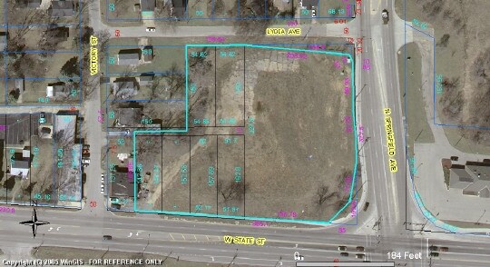
198 N Springfield Ave
11-20-132-002
PURI WEST STATE PLAT PT NW1/4 SEC 20-44-1 LT 1
Officebuilding
WINNEBAGO
C2
Illinois
B and X Area of moderate flood hazard, usually the area between the limits of the 100-year and 500-year floods.
1
2024
1.18 AC
2024
I-39 Corr/Winnebago Cnty
002301
Chicago
6,677 SF
Rockford, IL
NEARBY LISTINGS FOR SALE OR LEASE
DEMOGRAPHICS near 198 N Springfield Ave
1 mile
3 mile
5 mile
2025 Total Population
5,562
36,608
93,428
2030 Population
5,667
37,253
93,922
Pop Growth 2025-2030
+ 1.89%
+ 1.76%
+ 0.53%
Average Age
37
37
38
2025 Total Households
2,093
13,717
37,449
HH Growth 2025-2030
+ 1.82%
+ 1.74%
+ 0.47%
Median Household Inc
$39,374
$39,229
$45,989
Avg Household Size
2.60
2.50
2.40
2025 Avg HH Vehicles
2.00
2.00
2.00
Median Home Value
$76,750
$83,372
$110,842
Median Year Built
1958
1954
1953
Nearby Places
Map Layers
Map Styles
 Street
 Aerial
Layers
 Traffic
 Biking
Places
Listings with unknown addresses are not visible on the map
- Restaurants
- Banks
- Shops
- Fitness
- Groceries
PUBLIC TRANSPORTATION
AIRPORT
Chicago/Rockford International
Drive
Walk
Distance
Chicago/Rockford International
19 min
9.9 mi
Freight Ports
Port Milwaukee
Drive
Walk
Distance
Port Milwaukee
119 min
96.8 mi
Nearby Properties
Address
Land Use
TOTAL SIZE
Lot Size
Zoning
Address
Land Use
TOTAL SIZE
Lot Size
Zoning
1,456,216 SF
103.10 AC
I1
Address
Land Use
TOTAL SIZE
Lot Size
Zoning
216,540 SF
22 AC
C3
Address
Land Use
TOTAL SIZE
Lot Size
Zoning
201,507 SF
C4
Address
Land Use
TOTAL SIZE
Lot Size
Zoning
115,095 SF
0.25 AC
C4
Address
Land Use
TOTAL SIZE
Lot Size
Zoning
111,491 SF
0.32 AC
C4
Address
Land Use
TOTAL SIZE
Lot Size
Zoning
43.23 AC
I1
Address
Land Use
TOTAL SIZE
Lot Size
Zoning
238,884 SF
15.96 AC
R3
Address
Land Use
TOTAL SIZE
Lot Size
Zoning
108,233 SF
0.34 AC
C4
Address
Land Use
TOTAL SIZE
Lot Size
Zoning
153,461 SF
19.35 AC
I2
Address
Land Use
TOTAL SIZE
Lot Size
Zoning
77,936 SF
1.71 AC
C4
Address
Land Use
TOTAL SIZE
Lot Size
Zoning
299,238 SF
18.84 AC
I2
Address
Land Use
TOTAL SIZE
Lot Size
Zoning
137,546 SF
0.71 AC
C4
Address
Land Use
TOTAL SIZE
Lot Size
Zoning
111,696 SF
11.99 AC
CG
Address
Land Use
TOTAL SIZE
Lot Size
Zoning
118,780 SF
30.47 AC
I2
Address
Land Use
TOTAL SIZE
Lot Size
Zoning
133,645 SF
5.51 AC
R4
Address
Land Use
TOTAL SIZE
Lot Size
Zoning
24.05 AC
IH
Address
Land Use
TOTAL SIZE
Lot Size
Zoning
40,812 SF
0.24 AC
C4
Address
Land Use
TOTAL SIZE
Lot Size
Zoning
46,872 SF
2.13 AC
R1
Address
Land Use
TOTAL SIZE
Lot Size
Zoning
210,980 SF
12.56 AC
I1
Address
Land Use
TOTAL SIZE
Lot Size
Zoning
47,940 SF
0.34 AC
C4
Address
Land Use
TOTAL SIZE
Lot Size
Zoning
195,360 SF
28.13 AC
I1
Address
Land Use
TOTAL SIZE
Lot Size
Zoning
37,525 SF
C4
Address
Land Use
TOTAL SIZE
Lot Size
Zoning
104,956 SF
3.82 AC
R4
Address
Land Use
TOTAL SIZE
Lot Size
Zoning
113,902 SF
16.26 AC
R3
Address
Land Use
TOTAL SIZE
Lot Size
Zoning
34,295 SF
1.92 AC
C4
Address
Land Use
TOTAL SIZE
Lot Size
Zoning
4,972 SF
2 AC
C2
Address
Land Use
TOTAL SIZE
Lot Size
Zoning
34,848 SF
0.71 AC
C4
Address
Land Use
TOTAL SIZE
Lot Size
Zoning
168,222 SF
7.65 AC
I1
Address
Land Use
TOTAL SIZE
Lot Size
Zoning
91,708 SF
21.61 AC
CG
Address
Land Use
TOTAL SIZE
Lot Size
Zoning
17.82 AC
The World's #1 Commercial Real Estate Marketplace
Connect with us
© 2026 CoStar Group
The information above has been obtained from sources believed reliable. While we do not doubt its accuracy we have not verified it and make no guarantee, warranty or representation about it. It is your responsibility to independently confirm its accuracy and completeness. Any projections, opinions, assumptions, or estimates used are for example only and do not represent the current or future performance of the property. The value of this transaction to you depends on tax and other factors which should be evaluated by your tax, financial, and legal advisors. You and your advisors should conduct a careful, independent investigation of the property to determine to your satisfaction the suitability of the property for your needs.