Property Record
198 Thornton Ave, Albion, PA 16401


NEARBY LISTINGS FOR SALE OR LEASE
-
-
View all Albion listings for sale on LoopNet.com
Property Detail
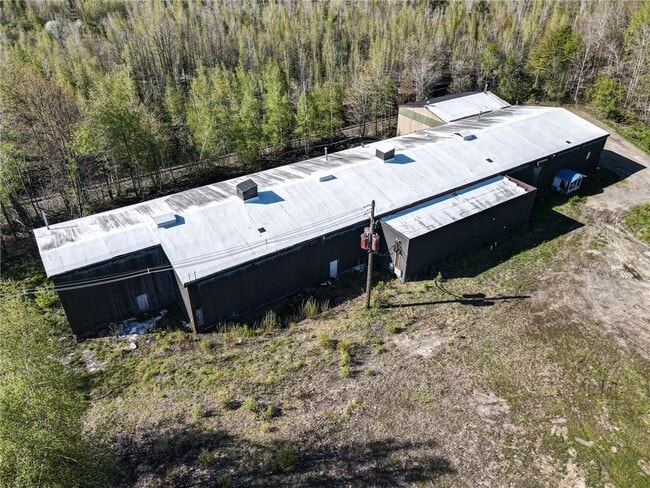
198 Thornton Ave
01-002-009.0-001.00
Rogers Brothers Addition
Warehouse
198 THORNTON AVE 7.6 AC
X
Erie
42049C0338D
Pennsylvania
2025
7.60 AC
2025
Outlying Erie County
010103
Erie
14,122 SF
Erie, PA
DEMOGRAPHICS near 198 Thornton Ave
1 Mile
3 Mile
5 Mile
2024 Total Population
2,511
5,948
8,041
2029 Population
2,467
5,852
7,858
Pop Growth 2024-2029
(1.75%)
(1.61%)
(2.28%)
Average Age
41
43
43
2024 Total Households
1,009
1,478
2,293
HH Growth 2024-2029
(1.88%)
(2.64%)
(3.23%)
Median Household Inc
$60,909
$66,513
$66,758
Avg Household Size
2.50
2.50
2.50
2024 Avg HH Vehicles
2.00
2.00
2.00
Median Home Value
$140,058
$147,206
$154,716
Median Year Built
1956
1957
1962
Nearby Places
Map Layers
Map Styles
 Street
 Aerial
- Restaurants
- Banks
- Shops
- Fitness
- Groceries
PUBLIC TRANSPORTATION
AIRPORT
Erie International/Tom Ridge Field
DRIVE
WALK
Distance
Erie International/Tom Ridge Field
33 min
20.3 mi
Freight Ports
Port of Toledo
DRIVE
WALK
Distance
Port of Toledo
232 min
196.7 mi
SALE & LEASE HISTORY
LISTING DATE
SALE/LEASE

Jun 24, 2022
For Sale
Nearby Properties
Address
Land Use
TOTAL SIZE
Lot Size
Zoning
Address
Land Use
TOTAL SIZE
Lot Size
Zoning
27,648 SF
54.74 AC
Address
Land Use
TOTAL SIZE
Lot Size
Zoning
6.25 AC
R1
Address
Land Use
TOTAL SIZE
Lot Size
Zoning
11,650 SF
25.92 AC
Address
Land Use
TOTAL SIZE
Lot Size
Zoning
3,508 SF
3.07 AC
T
Address
Land Use
TOTAL SIZE
Lot Size
Zoning
9.50 AC
R1
Address
Land Use
TOTAL SIZE
Lot Size
Zoning
79,646 SF
3.78 AC
B2
Address
Land Use
TOTAL SIZE
Lot Size
Zoning
5,420 SF
2.98 AC
R2
Address
Land Use
TOTAL SIZE
Lot Size
Zoning
0.41 AC
R2
Address
Land Use
TOTAL SIZE
Lot Size
Zoning
0.87 AC
R2
Address
Land Use
TOTAL SIZE
Lot Size
Zoning
1.07 AC
Address
Land Use
TOTAL SIZE
Lot Size
Zoning
9,402 SF
0.82 AC
R2
Address
Land Use
TOTAL SIZE
Lot Size
Zoning
0.55 AC
B1
Address
Land Use
TOTAL SIZE
Lot Size
Zoning
30,340 SF
1.82 AC
I1
Address
Land Use
TOTAL SIZE
Lot Size
Zoning
10,768 SF
1.59 AC
Address
Land Use
TOTAL SIZE
Lot Size
Zoning
8,050 SF
0.82 AC
R2
Address
Land Use
TOTAL SIZE
Lot Size
Zoning
2.93 AC
R1
Address
Land Use
TOTAL SIZE
Lot Size
Zoning
21,294 SF
1.89 AC
I1
Address
Land Use
TOTAL SIZE
Lot Size
Zoning
Address
Land Use
TOTAL SIZE
Lot Size
Zoning
11,408 SF
0.72 AC
B2
Address
Land Use
TOTAL SIZE
Lot Size
Zoning
0.65 AC
R2
Address
Land Use
TOTAL SIZE
Lot Size
Zoning
3,489 SF
2.11 AC
Address
Land Use
TOTAL SIZE
Lot Size
Zoning
0.31 AC
R2
Address
Land Use
TOTAL SIZE
Lot Size
Zoning
14,505 SF
2.36 AC
I1
Address
Land Use
TOTAL SIZE
Lot Size
Zoning
3,562 SF
146.39 AC
Address
Land Use
TOTAL SIZE
Lot Size
Zoning
4,802 SF
96.94 AC
Address
Land Use
TOTAL SIZE
Lot Size
Zoning
2,796 SF
0.77 AC
T
Address
Land Use
TOTAL SIZE
Lot Size
Zoning
12,510 SF
0.47 AC
R2
Address
Land Use
TOTAL SIZE
Lot Size
Zoning
1,792 SF
21.04 AC
R1
Address
Land Use
TOTAL SIZE
Lot Size
Zoning
9,700 SF
1.16 AC
I1
Address
Land Use
TOTAL SIZE
Lot Size
Zoning
The World's #1 Commercial Real Estate Marketplace
Connect with us
© 2025 CoStar Group
The information above has been obtained from sources believed reliable. While we do not doubt its accuracy we have not verified it and make no guarantee, warranty or representation about it. It is your responsibility to independently confirm its accuracy and completeness. Any projections, opinions, assumptions, or estimates used are for example only and do not represent the current or future performance of the property. The value of this transaction to you depends on tax and other factors which should be evaluated by your tax, financial, and legal advisors. You and your advisors should conduct a careful, independent investigation of the property to determine to your satisfaction the suitability of the property for your needs.