Property Record
1980 Dee Gabriel Colns Rd, Austin, TX 78744

Property Detail
1980 Dee Gabriel Colns Rd
Austin-Round Rock-San Marcos, TX
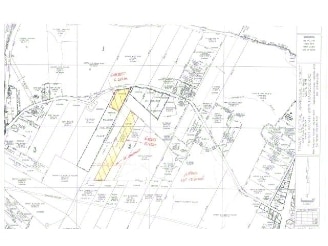
ABS 24 DELVALLE S ACR 18.450
297341
TRAVIS
Farms
Texas
AE The base floodplain where base flood elevations are provided. AE Zones are now used on new format FIRMs instead of A1-A30 Zones.
18.45 AC
2025
Southeast
2025
Austin
002413
NEARBY LISTINGS FOR SALE OR LEASE
DEMOGRAPHICS near 1980 Dee Gabriel Colns Rd
1 mile
3 mile
5 mile
2025 Total Population
2,100
40,341
169,034
2030 Population
2,432
43,022
178,800
Pop Growth 2025-2030
+ 15.81%
+ 6.65%
+ 5.78%
Average Age
36
36
35
2025 Total Households
787
12,880
66,728
HH Growth 2025-2030
+ 16.14%
+ 7.71%
+ 6.47%
Median Household Inc
$147,429
$95,763
$73,822
Avg Household Size
2.70
3.00
2.40
2025 Avg HH Vehicles
2.00
2.00
2.00
Median Home Value
$587,020
$416,675
$417,291
Median Year Built
2011
2008
2003
Nearby Places
Map Layers
Map Styles
 Street
 Aerial
Layers
 Traffic
 Biking
Places
Listings with unknown addresses are not visible on the map
- Restaurants
- Banks
- Shops
- Fitness
- Groceries
PUBLIC TRANSPORTATION
AIRPORT
Austin-Bergstrom International
Drive
Walk
Distance
Austin-Bergstrom International
17 min
6.5 mi
Freight Ports
Calhoun Port
Drive
Walk
Distance
Calhoun Port
179 min
147.3 mi
Nearby Properties
Address
Land Use
TOTAL SIZE
Lot Size
Zoning
Address
Land Use
TOTAL SIZE
Lot Size
Zoning
942.08 AC
Address
Land Use
TOTAL SIZE
Lot Size
Zoning
290,643 SF
13.59 AC
Address
Land Use
TOTAL SIZE
Lot Size
Zoning
255,483 SF
35 AC
Address
Land Use
TOTAL SIZE
Lot Size
Zoning
335,913 SF
13.83 AC
Address
Land Use
TOTAL SIZE
Lot Size
Zoning
390,384 SF
34.08 AC
Address
Land Use
TOTAL SIZE
Lot Size
Zoning
287,925 SF
9.92 AC
Address
Land Use
TOTAL SIZE
Lot Size
Zoning
288,174 SF
18.91 AC
Address
Land Use
TOTAL SIZE
Lot Size
Zoning
323,360 SF
20.93 AC
Address
Land Use
TOTAL SIZE
Lot Size
Zoning
162,000 SF
12.62 AC
Address
Land Use
TOTAL SIZE
Lot Size
Zoning
368,244 SF
93.34 AC
Address
Land Use
TOTAL SIZE
Lot Size
Zoning
353,770 SF
23.97 AC
Address
Land Use
TOTAL SIZE
Lot Size
Zoning
326,400 SF
26.12 AC
Address
Land Use
TOTAL SIZE
Lot Size
Zoning
351,255 SF
12.45 AC
Address
Land Use
TOTAL SIZE
Lot Size
Zoning
257,600 SF
26.83 AC
Address
Land Use
TOTAL SIZE
Lot Size
Zoning
237,600 SF
17.79 AC
Address
Land Use
TOTAL SIZE
Lot Size
Zoning
249,216 SF
20.19 AC
Address
Land Use
TOTAL SIZE
Lot Size
Zoning
166,770 SF
13.51 AC
Address
Land Use
TOTAL SIZE
Lot Size
Zoning
267,300 SF
17.53 AC
Address
Land Use
TOTAL SIZE
Lot Size
Zoning
172,800 SF
22.82 AC
Address
Land Use
TOTAL SIZE
Lot Size
Zoning
264,765 SF
23.37 AC
Address
Land Use
TOTAL SIZE
Lot Size
Zoning
177,375 SF
26.20 AC
Address
Land Use
TOTAL SIZE
Lot Size
Zoning
167,500 SF
14.03 AC
Address
Land Use
TOTAL SIZE
Lot Size
Zoning
204,741 SF
18.90 AC
Address
Land Use
TOTAL SIZE
Lot Size
Zoning
206,299 SF
12.19 AC
Address
Land Use
TOTAL SIZE
Lot Size
Zoning
212,472 SF
20.12 AC
Address
Land Use
TOTAL SIZE
Lot Size
Zoning
214,500 SF
8.78 AC
Address
Land Use
TOTAL SIZE
Lot Size
Zoning
132,050 SF
11.60 AC
Address
Land Use
TOTAL SIZE
Lot Size
Zoning
164,845 SF
33.90 AC
Address
Land Use
TOTAL SIZE
Lot Size
Zoning
181,115 SF
13.81 AC
Address
Land Use
TOTAL SIZE
Lot Size
Zoning
150,000 SF
16.18 AC
The World's #1 Commercial Real Estate Marketplace
Connect with us
© 2026 CoStar Group
The information above has been obtained from sources believed reliable. While we do not doubt its accuracy we have not verified it and make no guarantee, warranty or representation about it. It is your responsibility to independently confirm its accuracy and completeness. Any projections, opinions, assumptions, or estimates used are for example only and do not represent the current or future performance of the property. The value of this transaction to you depends on tax and other factors which should be evaluated by your tax, financial, and legal advisors. You and your advisors should conduct a careful, independent investigation of the property to determine to your satisfaction the suitability of the property for your needs.