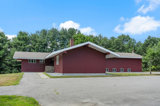
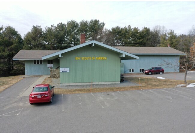
Property Record
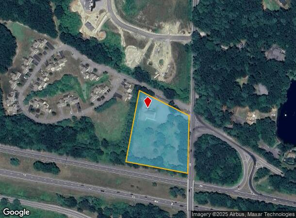
1980 Lunenburg Rd, Lancaster, MA 01523
NEARBY LISTINGS FOR SALE OR LEASE
-
-
View all Lancaster listings for lease on LoopNet.com
Property Detail
1980 Lunenburg Rd
LANC-000040-000000-000010A
Worcester
Officebuilding
Massachusetts
X
10.a
25027C0289F
3 AC
2025
Fitchburg/Leominster
2025
Boston
713100
Worcester, MA-CT
12,708 SF
DEMOGRAPHICS near 1980 Lunenburg Rd
1 Mile
3 Mile
5 Mile
2024 Total Population
1,151
19,642
62,890
2029 Population
1,148
19,512
62,634
Pop Growth 2024-2029
(0.26%)
(0.66%)
(0.41%)
Average Age
43
42
42
2024 Total Households
260
7,132
23,903
HH Growth 2024-2029
+ 0.38%
(0.63%)
(0.40%)
Median Household Inc
$127,885
$76,821
$83,366
Avg Household Size
2.70
2.40
2.40
2024 Avg HH Vehicles
2.00
2.00
2.00
Median Home Value
$476,470
$337,290
$356,621
Median Year Built
1981
1962
1967
Nearby Places
Map Layers
Map Styles
 Street
 Aerial
- Restaurants
- Banks
- Shops
- Fitness
- Groceries
PUBLIC TRANSPORTATION
COMMUTER RAIL
North Leominster (Fitchburg/South Acton Line - Massachusetts Bay Transportation Authority Commuter Rail (Purple Line))
DRIVE
WALK
Distance
North Leominster (Fitchburg/South Acton Line - Massachusetts Bay Transportation Authority Commuter Rail (Purple Line))
6 min
3.6 mi
Shirley (Fitchburg/South Acton Line - Massachusetts Bay Transportation Authority Commuter Rail (Purple Line))
DRIVE
WALK
Distance
Shirley (Fitchburg/South Acton Line - Massachusetts Bay Transportation Authority Commuter Rail (Purple Line))
8 min
4.0 mi
AIRPORT
Worcester Regional
DRIVE
WALK
Distance
Worcester Regional
40 min
27.7 mi
Manchester Boston Regional
DRIVE
WALK
Distance
Manchester Boston Regional
68 min
46.5 mi
Freight Ports
Port of Boston
DRIVE
WALK
Distance
Port of Boston
64 min
41.4 mi
SALE & LEASE HISTORY
LISTING DATE
SALE/LEASE

May 21, 2024
For Lease
Mar 28, 2022
For Lease
Feb 05, 2021
For Lease
Feb 05, 2021
For Sale
Nearby Properties
Address
Land Use
TOTAL SIZE
Lot Size
Zoning
Address
Land Use
TOTAL SIZE
Lot Size
Zoning
663,948 SF
516.30 AC
Address
Land Use
TOTAL SIZE
Lot Size
Zoning
97.47 AC
R1
Address
Land Use
TOTAL SIZE
Lot Size
Zoning
65.15 AC
Address
Land Use
TOTAL SIZE
Lot Size
Zoning
24.35 AC
Address
Land Use
TOTAL SIZE
Lot Size
Zoning
45,066 SF
18.52 AC
Address
Land Use
TOTAL SIZE
Lot Size
Zoning
372,000 SF
30.33 AC
Address
Land Use
TOTAL SIZE
Lot Size
Zoning
552,952 SF
27.44 AC
Address
Land Use
TOTAL SIZE
Lot Size
Zoning
20.30 AC
Address
Land Use
TOTAL SIZE
Lot Size
Zoning
68,822 SF
9.83 AC
Address
Land Use
TOTAL SIZE
Lot Size
Zoning
171,063 SF
14.62 AC
Address
Land Use
TOTAL SIZE
Lot Size
Zoning
56.75 AC
Address
Land Use
TOTAL SIZE
Lot Size
Zoning
Address
Land Use
TOTAL SIZE
Lot Size
Zoning
125,461 SF
11.27 AC
Address
Land Use
TOTAL SIZE
Lot Size
Zoning
66.70 AC
Address
Land Use
TOTAL SIZE
Lot Size
Zoning
274,272 SF
50 AC
Address
Land Use
TOTAL SIZE
Lot Size
Zoning
102,628 SF
10.50 AC
Address
Land Use
TOTAL SIZE
Lot Size
Zoning
Address
Land Use
TOTAL SIZE
Lot Size
Zoning
118,587 SF
22.30 AC
Address
Land Use
TOTAL SIZE
Lot Size
Zoning
81,594 SF
1.59 AC
Address
Land Use
TOTAL SIZE
Lot Size
Zoning
4.71 AC
Address
Land Use
TOTAL SIZE
Lot Size
Zoning
12.51 AC
Address
Land Use
TOTAL SIZE
Lot Size
Zoning
88,566 SF
29.46 AC
Address
Land Use
TOTAL SIZE
Lot Size
Zoning
230,382 SF
10.67 AC
Address
Land Use
TOTAL SIZE
Lot Size
Zoning
72,948 SF
0.72 AC
Address
Land Use
TOTAL SIZE
Lot Size
Zoning
3,712 SF
7.58 AC
Address
Land Use
TOTAL SIZE
Lot Size
Zoning
Address
Land Use
TOTAL SIZE
Lot Size
Zoning
77,064 SF
6.04 AC
Address
Land Use
TOTAL SIZE
Lot Size
Zoning
59,587 SF
1.13 AC
Address
Land Use
TOTAL SIZE
Lot Size
Zoning
97,048 SF
6.85 AC
Address
Land Use
TOTAL SIZE
Lot Size
Zoning
63,415 SF
10.33 AC
R2
The World's #1 Commercial Real Estate Marketplace
Connect with us
© 2025 CoStar Group
The information above has been obtained from sources believed reliable. While we do not doubt its accuracy we have not verified it and make no guarantee, warranty or representation about it. It is your responsibility to independently confirm its accuracy and completeness. Any projections, opinions, assumptions, or estimates used are for example only and do not represent the current or future performance of the property. The value of this transaction to you depends on tax and other factors which should be evaluated by your tax, financial, and legal advisors. You and your advisors should conduct a careful, independent investigation of the property to determine to your satisfaction the suitability of the property for your needs.