Property Record
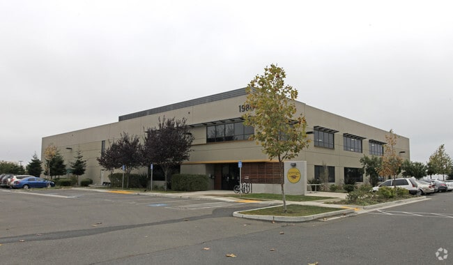
1980 N Loop Rd, Alameda, CA 94502


Property Detail
1980 N Loop Rd
074-1359-023-00
LOT: 00005 BLK: PM: 0296 PAGE: 0055
Lightindustrial
Alameda
B and X Area of moderate flood hazard, usually the area between the limits of the 100-year and 500-year floods.
California
2024
2.15 AC
2025
Alameda
428301
East Bay/Oakland
33,091 SF
Oakland-Fremont-Berkeley, CA
NEARBY LISTINGS FOR SALE OR LEASE
DEMOGRAPHICS near 1980 N Loop Rd
1 mile
3 mile
5 mile
2025 Total Population
9,270
47,806
309,353
2030 Population
9,258
47,726
308,655
Pop Growth 2025-2030
(0.13%)
(0.17%)
(0.23%)
Average Age
44
44
40
2025 Total Households
3,267
18,455
104,229
HH Growth 2025-2030
(0.24%)
(0.29%)
(0.20%)
Median Household Inc
$174,077
$138,358
$87,897
Avg Household Size
2.80
2.50
2.80
2025 Avg HH Vehicles
2.00
2.00
2.00
Median Home Value
$1,045,822
$1,085,832
$837,602
Median Year Built
1980
1964
1956
Nearby Places
Map Layers
Map Styles
 Street
 Aerial
Transit
 Traffic
 Biking
Places
Listings with unknown addresses are not visible on the map
- Restaurants
- Banks
- Shops
- Fitness
- Groceries
PUBLIC TRANSPORTATION
COMMUTER RAIL
Oakland (Capitol Corridor - Amtrak, Coast Starlight - Amtrak, San Joaquins - Amtrak)
Drive
Walk
Distance
Oakland (Capitol Corridor - Amtrak, Coast Starlight - Amtrak, San Joaquins - Amtrak)
15 min
8.0 mi
AIRPORT
Metro Oakland International
Drive
Walk
Distance
Metro Oakland International
4 min
1.9 mi
San Francisco International
Drive
Walk
Distance
San Francisco International
43 min
32.9 mi
Freight Ports
Port of Oakland
Drive
Walk
Distance
Port of Oakland
17 min
8.5 mi
Nearby Properties
Address
Land Use
TOTAL SIZE
Lot Size
Zoning
Address
Land Use
TOTAL SIZE
Lot Size
Zoning
Address
Land Use
TOTAL SIZE
Lot Size
Zoning
219,200 SF
5.49 AC
Address
Land Use
TOTAL SIZE
Lot Size
Zoning
259,247 SF
5.44 AC
R5PD
Address
Land Use
TOTAL SIZE
Lot Size
Zoning
165,923 SF
14.99 AC
Address
Land Use
TOTAL SIZE
Lot Size
Zoning
190,786 SF
3.75 AC
Address
Land Use
TOTAL SIZE
Lot Size
Zoning
128,650 SF
6.38 AC
Address
Land Use
TOTAL SIZE
Lot Size
Zoning
180,959 SF
9.38 AC
Address
Land Use
TOTAL SIZE
Lot Size
Zoning
374,725 SF
18.63 AC
Address
Land Use
TOTAL SIZE
Lot Size
Zoning
200,238 SF
9.28 AC
Address
Land Use
TOTAL SIZE
Lot Size
Zoning
138,196 SF
8.47 AC
Address
Land Use
TOTAL SIZE
Lot Size
Zoning
155,000 SF
8.41 AC
Address
Land Use
TOTAL SIZE
Lot Size
Zoning
93,964 SF
24.21 AC
Address
Land Use
TOTAL SIZE
Lot Size
Zoning
76,114 SF
6 AC
Address
Land Use
TOTAL SIZE
Lot Size
Zoning
213,600 SF
10.60 AC
Address
Land Use
TOTAL SIZE
Lot Size
Zoning
100,909 SF
6.70 AC
Address
Land Use
TOTAL SIZE
Lot Size
Zoning
121,597 SF
5.75 AC
Address
Land Use
TOTAL SIZE
Lot Size
Zoning
204,006 SF
6.39 AC
M40
Address
Land Use
TOTAL SIZE
Lot Size
Zoning
80,810 SF
5.62 AC
Address
Land Use
TOTAL SIZE
Lot Size
Zoning
86,973 SF
2.92 AC
Address
Land Use
TOTAL SIZE
Lot Size
Zoning
93,100 SF
24.21 AC
Address
Land Use
TOTAL SIZE
Lot Size
Zoning
60,846 SF
3.75 AC
Address
Land Use
TOTAL SIZE
Lot Size
Zoning
152,535 SF
1.86 AC
Address
Land Use
TOTAL SIZE
Lot Size
Zoning
95,670 SF
1.95 AC
Address
Land Use
TOTAL SIZE
Lot Size
Zoning
66,157 SF
7.68 AC
Address
Land Use
TOTAL SIZE
Lot Size
Zoning
383,560 SF
18.90 AC
Address
Land Use
TOTAL SIZE
Lot Size
Zoning
114,980 SF
3.55 AC
Address
Land Use
TOTAL SIZE
Lot Size
Zoning
63,544 SF
1.95 AC
Address
Land Use
TOTAL SIZE
Lot Size
Zoning
76,486 SF
4.64 AC
Address
Land Use
TOTAL SIZE
Lot Size
Zoning
273,468 SF
9.49 AC
Address
Land Use
TOTAL SIZE
Lot Size
Zoning
148,060 SF
4.81 AC
The World's #1 Commercial Real Estate Marketplace
Connect with us
© 2026 CoStar Group
The information above has been obtained from sources believed reliable. While we do not doubt its accuracy we have not verified it and make no guarantee, warranty or representation about it. It is your responsibility to independently confirm its accuracy and completeness. Any projections, opinions, assumptions, or estimates used are for example only and do not represent the current or future performance of the property. The value of this transaction to you depends on tax and other factors which should be evaluated by your tax, financial, and legal advisors. You and your advisors should conduct a careful, independent investigation of the property to determine to your satisfaction the suitability of the property for your needs.