Property Record
1981 E Gamebird Rd, Pahrump, NV 89048

Save to a Folder
{{folder.Name}}
{{folder.ListingIds.length}} Properties
{{folder.ListingIds.length}} Property
Create a New Folder
Property Detail
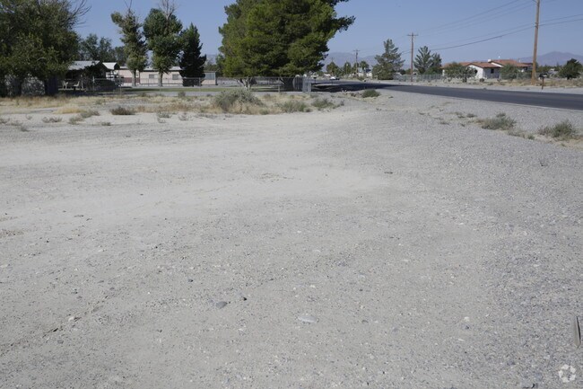
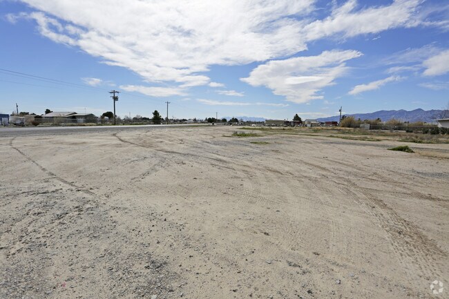
1981 E Gamebird Rd
Pahrump, NV
T21S R53E S2 B.A L.1 GAMEBIRD SUBDIVISION
44-171-15
NYE
Commercialacreage
Nevada
GC
1
AO River or stream flood hazard areas, and areas with a 1% or greater chance of shallow flooding each year. These areas have a 26% chance of flooding over the life of a 30-year mortgage.
1.10 AC
0
Carson City/Nevada Area
2025
Other Market Areas
960405
NEARBY LISTINGS FOR SALE OR LEASE
DEMOGRAPHICS near 1981 E Gamebird Rd
1 mile
3 mile
5 mile
2025 Total Population
1,967
16,270
30,498
2030 Population
2,041
17,165
32,302
Pop Growth 2025-2030
+ 3.76%
+ 5.50%
+ 5.92%
Average Age
49
49
50
2025 Total Households
816
6,912
13,246
HH Growth 2025-2030
+ 3.68%
+ 5.47%
+ 5.91%
Median Household Inc
$53,732
$60,735
$62,372
Avg Household Size
2.40
2.30
2.30
2025 Avg HH Vehicles
2.00
2.00
2.00
Median Home Value
$330,078
$335,500
$331,411
Median Year Built
1999
1999
1999
Nearby Places
Map Layers
Map Styles
 Street
 Aerial
Layers
 Traffic
 Biking
Places
Listings with unknown addresses are not visible on the map
- Restaurants
- Banks
- Shops
- Fitness
- Groceries
Nearby Properties
Address
Land Use
TOTAL SIZE
Lot Size
Zoning
Address
Land Use
TOTAL SIZE
Lot Size
Zoning
133,185 SF
41.60 AC
CF
Address
Land Use
TOTAL SIZE
Lot Size
Zoning
57,213 SF
6.88 AC
GC
Address
Land Use
TOTAL SIZE
Lot Size
Zoning
25,729 SF
32.26 AC
GC
Address
Land Use
TOTAL SIZE
Lot Size
Zoning
77,352 SF
3.17 AC
GC
Address
Land Use
TOTAL SIZE
Lot Size
Zoning
10 SF
2.14 AC
OS
Address
Land Use
TOTAL SIZE
Lot Size
Zoning
0.50 AC
VR-20
Address
Land Use
TOTAL SIZE
Lot Size
Zoning
38,606 SF
10 AC
CF
Address
Land Use
TOTAL SIZE
Lot Size
Zoning
53,707 SF
4.55 AC
Address
Land Use
TOTAL SIZE
Lot Size
Zoning
0.46 AC
VR-8
Address
Land Use
TOTAL SIZE
Lot Size
Zoning
16,466 SF
2.15 AC
GC
Address
Land Use
TOTAL SIZE
Lot Size
Zoning
5,806 SF
15.50 AC
SO
Address
Land Use
TOTAL SIZE
Lot Size
Zoning
33,199 SF
4.40 AC
Address
Land Use
TOTAL SIZE
Lot Size
Zoning
12,806 SF
5.39 AC
SP
Address
Land Use
TOTAL SIZE
Lot Size
Zoning
9,590 SF
4.87 AC
GC
Address
Land Use
TOTAL SIZE
Lot Size
Zoning
10,733 SF
33.04 AC
TC
Address
Land Use
TOTAL SIZE
Lot Size
Zoning
14,770 SF
1.10 AC
MU
Address
Land Use
TOTAL SIZE
Lot Size
Zoning
6,300 SF
10.99 AC
CF
Address
Land Use
TOTAL SIZE
Lot Size
Zoning
25,000 SF
4.23 AC
GC
Address
Land Use
TOTAL SIZE
Lot Size
Zoning
10 SF
1.08 AC
SP
Address
Land Use
TOTAL SIZE
Lot Size
Zoning
12.06 AC
GC
Address
Land Use
TOTAL SIZE
Lot Size
Zoning
31,890 SF
10.58 AC
VR-20
Address
Land Use
TOTAL SIZE
Lot Size
Zoning
31,860 SF
3.32 AC
Address
Land Use
TOTAL SIZE
Lot Size
Zoning
11,953 SF
3.83 AC
CF
Address
Land Use
TOTAL SIZE
Lot Size
Zoning
41,448 SF
4.25 AC
GC
Address
Land Use
TOTAL SIZE
Lot Size
Zoning
18,858 SF
4.72 AC
NC
Address
Land Use
TOTAL SIZE
Lot Size
Zoning
24,856 SF
2.19 AC
GC
Address
Land Use
TOTAL SIZE
Lot Size
Zoning
8,737 SF
1.10 AC
MU
Address
Land Use
TOTAL SIZE
Lot Size
Zoning
6,433 SF
2.66 AC
Address
Land Use
TOTAL SIZE
Lot Size
Zoning
8,737 SF
1.10 AC
MU
Address
Land Use
TOTAL SIZE
Lot Size
Zoning
10,569 SF
0.94 AC
GC
The World's #1 Commercial Real Estate Marketplace
Connect with us
© 2026 CoStar Group
The information above has been obtained from sources believed reliable. While we do not doubt its accuracy we have not verified it and make no guarantee, warranty or representation about it. It is your responsibility to independently confirm its accuracy and completeness. Any projections, opinions, assumptions, or estimates used are for example only and do not represent the current or future performance of the property. The value of this transaction to you depends on tax and other factors which should be evaluated by your tax, financial, and legal advisors. You and your advisors should conduct a careful, independent investigation of the property to determine to your satisfaction the suitability of the property for your needs.