Property Record
1981 N Airport Rd, Jasper, AL 35504
NEARBY LISTINGS FOR SALE OR LEASE
Property Detail
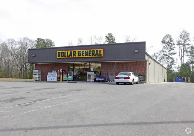
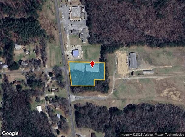
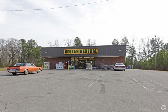
1981 N Airport Rd
10-08-34-0-001-022-0040
City Of Jasper
Commercialofficeresidentialmixeduse
P/O NW/SW 34-13-7 BEG 87.57 W & 214.03 S OF NE COR S 182.09 W 109.92 S 70.66 W 247.06 NW 255.49 E 392.09 TO POB 2AC
X
Walker
01127C0307E
Alabama
2025
2 AC
2024
Walker County
020802
Birmingham
8,125 SF
Birmingham-Hoover, AL
DEMOGRAPHICS near 1981 N Airport Rd
1 Mile
3 Mile
5 Mile
2024 Total Population
1,148
12,944
20,985
2029 Population
1,106
12,614
20,525
Pop Growth 2024-2029
(3.66%)
(2.55%)
(2.19%)
Average Age
44
42
42
2024 Total Households
427
5,023
8,287
HH Growth 2024-2029
(3.75%)
(2.51%)
(2.12%)
Median Household Inc
$54,500
$58,888
$51,118
Avg Household Size
2.40
2.40
2.40
2024 Avg HH Vehicles
2.00
2.00
2.00
Median Home Value
$170,957
$194,965
$175,286
Median Year Built
1979
1979
1980
Nearby Places
Map Layers
Map Styles
 Street
 Aerial
- Restaurants
- Banks
- Shops
- Fitness
- Groceries
Nearby Properties
Address
Land Use
TOTAL SIZE
Lot Size
Zoning
Address
Land Use
TOTAL SIZE
Lot Size
Zoning
86,928 SF
19 AC
OT
Address
Land Use
TOTAL SIZE
Lot Size
Zoning
55,188 SF
4.80 AC
OT
Address
Land Use
TOTAL SIZE
Lot Size
Zoning
8,932 SF
7.50 AC
CO
Address
Land Use
TOTAL SIZE
Lot Size
Zoning
60,200 SF
5.60 AC
OT
Address
Land Use
TOTAL SIZE
Lot Size
Zoning
846 SF
11 AC
SF
Address
Land Use
TOTAL SIZE
Lot Size
Zoning
44,601 SF
3.80 AC
OT
Address
Land Use
TOTAL SIZE
Lot Size
Zoning
38,770 SF
180 AC
CO
Address
Land Use
TOTAL SIZE
Lot Size
Zoning
37,813 SF
2 AC
O
Address
Land Use
TOTAL SIZE
Lot Size
Zoning
4,830 SF
6.10 AC
OT
Address
Land Use
TOTAL SIZE
Lot Size
Zoning
30,981 SF
3.90 AC
S
Address
Land Use
TOTAL SIZE
Lot Size
Zoning
9,735 SF
13 AC
SF
Address
Land Use
TOTAL SIZE
Lot Size
Zoning
100 SF
20 AC
OT
Address
Land Use
TOTAL SIZE
Lot Size
Zoning
19,040 SF
2 AC
OT
Address
Land Use
TOTAL SIZE
Lot Size
Zoning
22,364 SF
4 AC
O
Address
Land Use
TOTAL SIZE
Lot Size
Zoning
54,905 SF
3 AC
C
Address
Land Use
TOTAL SIZE
Lot Size
Zoning
13,578 SF
1.60 AC
O
The World's #1 Commercial Real Estate Marketplace
Connect with us
© 2026 CoStar Group
The information above has been obtained from sources believed reliable. While we do not doubt its accuracy we have not verified it and make no guarantee, warranty or representation about it. It is your responsibility to independently confirm its accuracy and completeness. Any projections, opinions, assumptions, or estimates used are for example only and do not represent the current or future performance of the property. The value of this transaction to you depends on tax and other factors which should be evaluated by your tax, financial, and legal advisors. You and your advisors should conduct a careful, independent investigation of the property to determine to your satisfaction the suitability of the property for your needs.