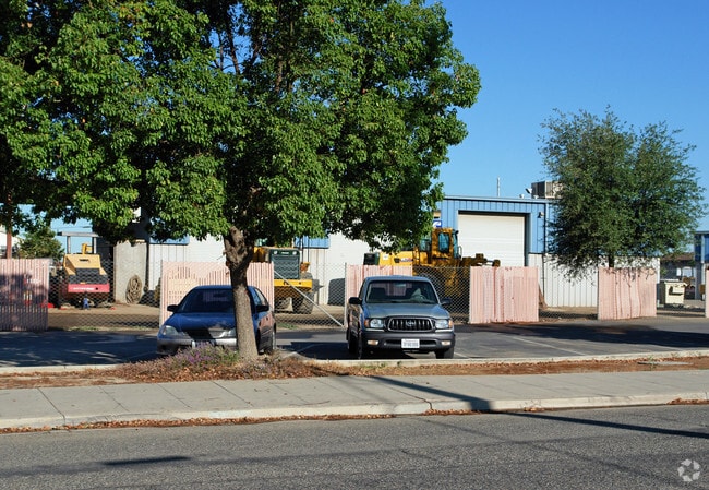
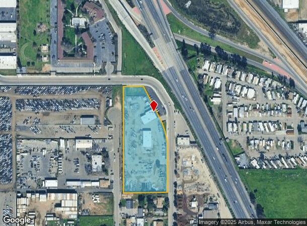
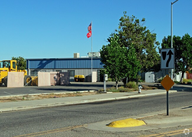
Property Record
1981 N Parkway Dr, Fresno, CA 93705
NEARBY LISTINGS FOR SALE OR LEASE
Property Detail
1981 N Parkway Dr
Fresno, CA
Highway Heights
442-112-04
3.51 AC IN LOTS 26-35 HIGHWAY HTS
Warehouse
Fresno
X
California
06019C1565H
27
2025
3.83 AC
2025
Northwest Fresno
004703
Fresno
10,000 SF
DEMOGRAPHICS near 1981 N Parkway Dr
1 Mile
3 Mile
5 Mile
2024 Total Population
19,155
128,485
318,549
2029 Population
19,520
130,744
324,879
Pop Growth 2024-2029
+ 1.91%
+ 1.76%
+ 1.99%
Average Age
33
35
35
2024 Total Households
5,836
41,831
103,325
HH Growth 2024-2029
+ 1.88%
+ 1.75%
+ 2.00%
Median Household Inc
$41,487
$51,680
$53,512
Avg Household Size
3.20
3.00
2.90
2024 Avg HH Vehicles
2.00
2.00
2.00
Median Home Value
$207,503
$263,096
$283,268
Median Year Built
1967
1967
1971
Nearby Places
Map Layers
Map Styles
 Street
 Aerial
- Restaurants
- Banks
- Shops
- Fitness
- Groceries
PUBLIC TRANSPORTATION
COMMUTER RAIL
DRIVE
WALK
Distance
8 min
4.7 mi
AIRPORT
Fresno Yosemite International
DRIVE
WALK
Distance
Fresno Yosemite International
15 min
7.2 mi
Nearby Properties
Address
Land Use
TOTAL SIZE
Lot Size
Zoning
Address
Land Use
TOTAL SIZE
Lot Size
Zoning
234,370 SF
23 AC
SPLIT
Address
Land Use
TOTAL SIZE
Lot Size
Zoning
232,183 SF
18.32 AC
R2A
Address
Land Use
TOTAL SIZE
Lot Size
Zoning
110,456 SF
6.56 AC
RMX
Address
Land Use
TOTAL SIZE
Lot Size
Zoning
669,447 SF
0.01 AC
C3
Address
Land Use
TOTAL SIZE
Lot Size
Zoning
159,822 SF
9.67 AC
R2
Address
Land Use
TOTAL SIZE
Lot Size
Zoning
51,363 SF
3.14 AC
CG
Address
Land Use
TOTAL SIZE
Lot Size
Zoning
110,341 SF
5.45 AC
R3
Address
Land Use
TOTAL SIZE
Lot Size
Zoning
191,136 SF
12.12 AC
R2
Address
Land Use
TOTAL SIZE
Lot Size
Zoning
92,096 SF
0.01 AC
C3
Address
Land Use
TOTAL SIZE
Lot Size
Zoning
145,783 SF
9.22 AC
R2
Address
Land Use
TOTAL SIZE
Lot Size
Zoning
108,017 SF
2.91 AC
CM
Address
Land Use
TOTAL SIZE
Lot Size
Zoning
45,944 SF
2.30 AC
CP
Address
Land Use
TOTAL SIZE
Lot Size
Zoning
96,077 SF
8.29 AC
C3
Address
Land Use
TOTAL SIZE
Lot Size
Zoning
71,384 SF
6.34 AC
IL
Address
Land Use
TOTAL SIZE
Lot Size
Zoning
83,622 SF
3.98 AC
M1
Address
Land Use
TOTAL SIZE
Lot Size
Zoning
108,795 SF
7.32 AC
R2
Address
Land Use
TOTAL SIZE
Lot Size
Zoning
106,740 SF
63.59 AC
AE20
Address
Land Use
TOTAL SIZE
Lot Size
Zoning
68,222 SF
2.73 AC
R3
Address
Land Use
TOTAL SIZE
Lot Size
Zoning
32,156 SF
2.60 AC
C6
Address
Land Use
TOTAL SIZE
Lot Size
Zoning
103,088 SF
5.41 AC
R3
Address
Land Use
TOTAL SIZE
Lot Size
Zoning
104,819 SF
8.50 AC
C2
Address
Land Use
TOTAL SIZE
Lot Size
Zoning
113,419 SF
1.26 AC
C4
Address
Land Use
TOTAL SIZE
Lot Size
Zoning
84,050 SF
6.84 AC
R3
Address
Land Use
TOTAL SIZE
Lot Size
Zoning
88,718 SF
1.64 AC
C4
Address
Land Use
TOTAL SIZE
Lot Size
Zoning
111,104 SF
7.96 AC
R2A
Address
Land Use
TOTAL SIZE
Lot Size
Zoning
96,760 SF
11.11 AC
SPLIT
Address
Land Use
TOTAL SIZE
Lot Size
Zoning
210,924 SF
13.36 AC
SPLIT
Address
Land Use
TOTAL SIZE
Lot Size
Zoning
46,838 SF
1.47 AC
CP
Address
Land Use
TOTAL SIZE
Lot Size
Zoning
88,345 SF
5.18 AC
R3
Address
Land Use
TOTAL SIZE
Lot Size
Zoning
43,002 SF
1.34 AC
DTN
The World's #1 Commercial Real Estate Marketplace
Connect with us
© 2026 CoStar Group
The information above has been obtained from sources believed reliable. While we do not doubt its accuracy we have not verified it and make no guarantee, warranty or representation about it. It is your responsibility to independently confirm its accuracy and completeness. Any projections, opinions, assumptions, or estimates used are for example only and do not represent the current or future performance of the property. The value of this transaction to you depends on tax and other factors which should be evaluated by your tax, financial, and legal advisors. You and your advisors should conduct a careful, independent investigation of the property to determine to your satisfaction the suitability of the property for your needs.