Property Record
1982 Georgia Pacific Rd, Whiteville, NC 28472

NEARBY LISTINGS FOR SALE OR LEASE
-
-
View all Whiteville listings for sale on LoopNet.com
Property Detail
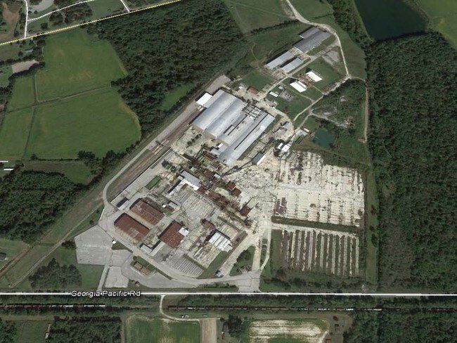
1982 Georgia Pacific Rd
0260.00-79-4948.000
COLUMBUS COUNTY
Officebuilding
Columbus
2025
North Carolina
2025
North Carolina Southeast Area
931000
Other Market Areas
2,850 SF
DEMOGRAPHICS near 1982 Georgia Pacific Rd
1 Mile
3 Mile
5 Mile
2024 Total Population
218
3,642
13,516
2029 Population
216
3,611
13,380
Pop Growth 2024-2029
(0.92%)
(0.85%)
(1.01%)
Average Age
45
43
43
2024 Total Households
95
1,588
5,690
HH Growth 2024-2029
(1.05%)
(0.88%)
(0.93%)
Median Household Inc
$27,608
$32,864
$36,977
Avg Household Size
2.30
2.30
2.30
2024 Avg HH Vehicles
2.00
2.00
2.00
Median Home Value
$156,249
$122,147
$122,023
Median Year Built
1977
1978
1977
Nearby Places
Map Layers
Map Styles
 Street
 Aerial
- Restaurants
- Banks
- Shops
- Fitness
- Groceries
SALE & LEASE HISTORY
LISTING DATE
SALE/LEASE

Sep 24, 2016
For Sale
Nearby Properties
Address
Land Use
TOTAL SIZE
Lot Size
Zoning
Address
Land Use
TOTAL SIZE
Lot Size
Zoning
31,640 SF
75 AC
I
Address
Land Use
TOTAL SIZE
Lot Size
Zoning
39,676 SF
6.50 AC
Address
Land Use
TOTAL SIZE
Lot Size
Zoning
18,688 SF
13.78 AC
Address
Land Use
TOTAL SIZE
Lot Size
Zoning
58,100 SF
Address
Land Use
TOTAL SIZE
Lot Size
Zoning
13,680 SF
3.80 AC
Address
Land Use
TOTAL SIZE
Lot Size
Zoning
44,868 SF
12.03 AC
RA
Address
Land Use
TOTAL SIZE
Lot Size
Zoning
26,175 SF
2 AC
RA
Address
Land Use
TOTAL SIZE
Lot Size
Zoning
129,876 SF
20 AC
RA
Address
Land Use
TOTAL SIZE
Lot Size
Zoning
2,100 SF
43 AC
Address
Land Use
TOTAL SIZE
Lot Size
Zoning
Address
Land Use
TOTAL SIZE
Lot Size
Zoning
51,480 SF
15 AC
RA
Address
Land Use
TOTAL SIZE
Lot Size
Zoning
41,850 SF
5.59 AC
RA
Address
Land Use
TOTAL SIZE
Lot Size
Zoning
816 SF
2.86 AC
Address
Land Use
TOTAL SIZE
Lot Size
Zoning
3,269 SF
1.24 AC
Address
Land Use
TOTAL SIZE
Lot Size
Zoning
17,300 SF
7.66 AC
RA
Address
Land Use
TOTAL SIZE
Lot Size
Zoning
Address
Land Use
TOTAL SIZE
Lot Size
Zoning
3,626 SF
1.47 AC
Address
Land Use
TOTAL SIZE
Lot Size
Zoning
19,350 SF
1.43 AC
Address
Land Use
TOTAL SIZE
Lot Size
Zoning
Address
Land Use
TOTAL SIZE
Lot Size
Zoning
10,200 SF
4 AC
Address
Land Use
TOTAL SIZE
Lot Size
Zoning
7,571 SF
16.23 AC
RA
Address
Land Use
TOTAL SIZE
Lot Size
Zoning
226.38 AC
Address
Land Use
TOTAL SIZE
Lot Size
Zoning
4,484 SF
0.82 AC
Address
Land Use
TOTAL SIZE
Lot Size
Zoning
3,888 SF
1.55 AC
Address
Land Use
TOTAL SIZE
Lot Size
Zoning
6,895 SF
0.62 AC
Address
Land Use
TOTAL SIZE
Lot Size
Zoning
10,700 SF
1.72 AC
Address
Land Use
TOTAL SIZE
Lot Size
Zoning
8,000 SF
1.07 AC
Address
Land Use
TOTAL SIZE
Lot Size
Zoning
6,858 SF
Address
Land Use
TOTAL SIZE
Lot Size
Zoning
442.80 AC
RA
The World's #1 Commercial Real Estate Marketplace
Connect with us
© 2026 CoStar Group
The information above has been obtained from sources believed reliable. While we do not doubt its accuracy we have not verified it and make no guarantee, warranty or representation about it. It is your responsibility to independently confirm its accuracy and completeness. Any projections, opinions, assumptions, or estimates used are for example only and do not represent the current or future performance of the property. The value of this transaction to you depends on tax and other factors which should be evaluated by your tax, financial, and legal advisors. You and your advisors should conduct a careful, independent investigation of the property to determine to your satisfaction the suitability of the property for your needs.