Property Record
1982 W Jefferson Ave, Detroit, MI 48216


NEARBY LISTINGS FOR SALE OR LEASE
Property Detail
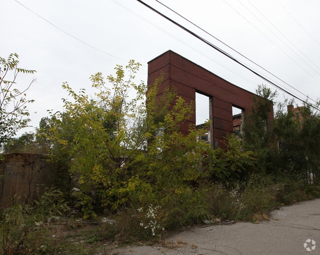
1982 W Jefferson Ave
08-000039
Clement & Oakmans
Industrialgeneral
S FORT 3 & 6 & PRIVATE ALLEY ADJ 5 & 4 & S 10 FT PRIVATE ALLEY ADJ LAFFERTY FARM L148 P389 DEEDS, W C R 8/189 ALSO W 50 FT OF
X
Wayne
26163C0280E
Michigan
2025
1.03 AC
2025
Detroit West
521100
Detroit
33,635 SF
Detroit-Warren-Dearborn, MI
DEMOGRAPHICS near 1982 W Jefferson Ave
1 Mile
3 Mile
5 Mile
2024 Total Population
4,488
75,539
196,733
2029 Population
4,463
74,038
195,750
Pop Growth 2024-2029
(0.56%)
(1.99%)
(0.50%)
Average Age
40
37
38
2024 Total Households
2,471
36,135
84,684
HH Growth 2024-2029
(0.28%)
(1.94%)
(0.40%)
Median Household Inc
$63,665
$39,370
$35,450
Avg Household Size
1.70
1.90
2.20
2024 Avg HH Vehicles
1.00
1.00
1.00
Median Home Value
$288,753
$160,857
$95,060
Median Year Built
1974
1959
1948
Nearby Places
Map Layers
Map Styles
 Street
 Aerial
- Restaurants
- Banks
- Shops
- Fitness
- Groceries
PUBLIC TRANSPORTATION
COMMUTER RAIL
DRIVE
WALK
Distance
9 min
4.3 mi
DRIVE
WALK
Distance
13 min
4.6 mi
AIRPORT
Windsor International
DRIVE
WALK
Distance
Windsor International
27 min
10.7 mi
Detroit Metro Wayne County
DRIVE
WALK
Distance
Detroit Metro Wayne County
35 min
22.6 mi
Freight Ports
DRIVE
WALK
Distance
75 min
59.3 mi
Nearby Properties
Address
Land Use
TOTAL SIZE
Lot Size
Zoning
Address
Land Use
TOTAL SIZE
Lot Size
Zoning
3,032,363 SF
24.24 AC
SD5
Address
Land Use
TOTAL SIZE
Lot Size
Zoning
6,112,830 SF
13.67 AC
PD
Address
Land Use
TOTAL SIZE
Lot Size
Zoning
409,438 SF
0.83 AC
B6
Address
Land Use
TOTAL SIZE
Lot Size
Zoning
1,409,416 SF
13.53 AC
R6
Address
Land Use
TOTAL SIZE
Lot Size
Zoning
1,553,311 SF
3.05 AC
SD5
Address
Land Use
TOTAL SIZE
Lot Size
Zoning
1,994,989 SF
4.97 AC
B5
Address
Land Use
TOTAL SIZE
Lot Size
Zoning
873,048 SF
7.70 AC
R6
Address
Land Use
TOTAL SIZE
Lot Size
Zoning
1,478,866 SF
2.88 AC
PCA
Address
Land Use
TOTAL SIZE
Lot Size
Zoning
1,017,009 SF
1.35 AC
R6
Address
Land Use
TOTAL SIZE
Lot Size
Zoning
848,598 SF
8.78 AC
SD5
Address
Land Use
TOTAL SIZE
Lot Size
Zoning
252,150 SF
2.46 AC
SD5
Address
Land Use
TOTAL SIZE
Lot Size
Zoning
185,300 SF
3.36 AC
SD5
Address
Land Use
TOTAL SIZE
Lot Size
Zoning
1,847,449 SF
13.85 AC
PD
Address
Land Use
TOTAL SIZE
Lot Size
Zoning
6,620 SF
9.43 AC
B6
Address
Land Use
TOTAL SIZE
Lot Size
Zoning
1,004,872 SF
1.05 AC
PCA
Address
Land Use
TOTAL SIZE
Lot Size
Zoning
720,653 SF
1.53 AC
PCA
Address
Land Use
TOTAL SIZE
Lot Size
Zoning
895,279 SF
3.58 AC
PCA
Address
Land Use
TOTAL SIZE
Lot Size
Zoning
1,149,710 SF
1.07 AC
B5
Address
Land Use
TOTAL SIZE
Lot Size
Zoning
503,688 SF
Address
Land Use
TOTAL SIZE
Lot Size
Zoning
919,213 SF
B5
Address
Land Use
TOTAL SIZE
Lot Size
Zoning
568,546 SF
B5
Address
Land Use
TOTAL SIZE
Lot Size
Zoning
874,160 SF
9.91 AC
R6
Address
Land Use
TOTAL SIZE
Lot Size
Zoning
520,897 SF
0.85 AC
Address
Land Use
TOTAL SIZE
Lot Size
Zoning
306,496 SF
1.91 AC
R6
Address
Land Use
TOTAL SIZE
Lot Size
Zoning
430,286 SF
1.14 AC
PCA
Address
Land Use
TOTAL SIZE
Lot Size
Zoning
437,558 SF
0.72 AC
Address
Land Use
TOTAL SIZE
Lot Size
Zoning
187,652 SF
Address
Land Use
TOTAL SIZE
Lot Size
Zoning
268,746 SF
B5
Address
Land Use
TOTAL SIZE
Lot Size
Zoning
576,286 SF
1.66 AC
B4
Address
Land Use
TOTAL SIZE
Lot Size
Zoning
167,719 SF
2.18 AC
SD5
The World's #1 Commercial Real Estate Marketplace
Connect with us
© 2025 CoStar Group
The information above has been obtained from sources believed reliable. While we do not doubt its accuracy we have not verified it and make no guarantee, warranty or representation about it. It is your responsibility to independently confirm its accuracy and completeness. Any projections, opinions, assumptions, or estimates used are for example only and do not represent the current or future performance of the property. The value of this transaction to you depends on tax and other factors which should be evaluated by your tax, financial, and legal advisors. You and your advisors should conduct a careful, independent investigation of the property to determine to your satisfaction the suitability of the property for your needs.