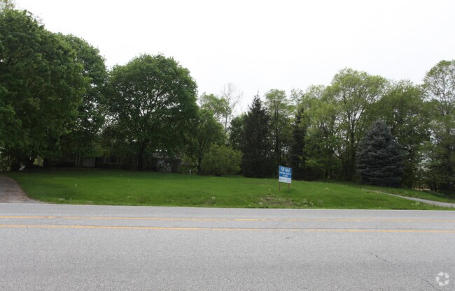
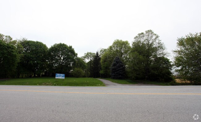
Property Record
19837 National Pike, Hagerstown, MD 21740
NEARBY LISTINGS FOR SALE OR LEASE
Property Detail
19837 National Pike
16-011630
6.99 ACRES 19837 NATIONAL PIKE
Commercialofficeresidentialmixeduse
Washington
A
Maryland
24043C0310D
6.99 AC
2024
Washington County
2025
Washington, DC
011302
Hagerstown-Martinsburg, MD-WV
2,870 SF
DEMOGRAPHICS near 19837 National Pike
1 Mile
3 Mile
5 Mile
2024 Total Population
444
18,115
68,761
2029 Population
449
18,402
69,791
Pop Growth 2024-2029
+ 1.13%
+ 1.58%
+ 1.50%
Average Age
45
42
40
2024 Total Households
168
7,299
27,635
HH Growth 2024-2029
+ 1.19%
+ 1.60%
+ 1.52%
Median Household Inc
$161,628
$74,415
$54,947
Avg Household Size
2.60
2.40
2.40
2024 Avg HH Vehicles
3.00
2.00
2.00
Median Home Value
$361,111
$265,536
$218,361
Median Year Built
1990
1987
1970
Nearby Places
Map Layers
Map Styles
 Street
 Aerial
- Restaurants
- Banks
- Shops
- Fitness
- Groceries
PUBLIC TRANSPORTATION
AIRPORT
Hagerstown Regional/Richard A Henson Field
DRIVE
WALK
Distance
Hagerstown Regional/Richard A Henson Field
17 min
9.1 mi
Nearby Properties
Address
Land Use
TOTAL SIZE
Lot Size
Zoning
Address
Land Use
TOTAL SIZE
Lot Size
Zoning
502,262 SF
36.64 AC
ORI
Address
Land Use
TOTAL SIZE
Lot Size
Zoning
1,236,085 SF
134.31 AC
IMU
Address
Land Use
TOTAL SIZE
Lot Size
Zoning
200,815 SF
9.14 AC
ORI
Address
Land Use
TOTAL SIZE
Lot Size
Zoning
76.18 AC
U
Address
Land Use
TOTAL SIZE
Lot Size
Zoning
290,600 SF
51.35 AC
IMU
Address
Land Use
TOTAL SIZE
Lot Size
Zoning
7,427 SF
79.25 AC
RS
Address
Land Use
TOTAL SIZE
Lot Size
Zoning
67,434 SF
4.30 AC
RS
Address
Land Use
TOTAL SIZE
Lot Size
Zoning
80,816 SF
19.68 AC
ORI
Address
Land Use
TOTAL SIZE
Lot Size
Zoning
138,132 SF
22.90 AC
HI
Address
Land Use
TOTAL SIZE
Lot Size
Zoning
29,405 SF
29.47 AC
RH
Address
Land Use
TOTAL SIZE
Lot Size
Zoning
4,180 SF
244.75 AC
RT
Address
Land Use
TOTAL SIZE
Lot Size
Zoning
9.86 AC
CR
Address
Land Use
TOTAL SIZE
Lot Size
Zoning
8.01 AC
RS-PU
Address
Land Use
TOTAL SIZE
Lot Size
Zoning
45,305 SF
5.17 AC
RS-PU
Address
Land Use
TOTAL SIZE
Lot Size
Zoning
10,659 SF
142.91 AC
IR
Address
Land Use
TOTAL SIZE
Lot Size
Zoning
18,228 SF
7.75 AC
RS-PU
Address
Land Use
TOTAL SIZE
Lot Size
Zoning
30,660 SF
7.53 AC
RSPUD
Address
Land Use
TOTAL SIZE
Lot Size
Zoning
58,280 SF
20.16 AC
RS
Address
Land Use
TOTAL SIZE
Lot Size
Zoning
18,300 SF
8.76 AC
RS-PU
Address
Land Use
TOTAL SIZE
Lot Size
Zoning
107,520 SF
6.88 AC
RH
Address
Land Use
TOTAL SIZE
Lot Size
Zoning
28,387 SF
11.54 AC
RU
Address
Land Use
TOTAL SIZE
Lot Size
Zoning
9.69 AC
RS-PU
Address
Land Use
TOTAL SIZE
Lot Size
Zoning
28,395 SF
6.20 AC
RH
Address
Land Use
TOTAL SIZE
Lot Size
Zoning
106,460 SF
11.63 AC
IR
Address
Land Use
TOTAL SIZE
Lot Size
Zoning
55,897 SF
4.30 AC
CG
Address
Land Use
TOTAL SIZE
Lot Size
Zoning
8,925 SF
10.30 AC
HI
Address
Land Use
TOTAL SIZE
Lot Size
Zoning
28,842 SF
6.05 AC
RH
Address
Land Use
TOTAL SIZE
Lot Size
Zoning
40,000 SF
9.22 AC
HI
Address
Land Use
TOTAL SIZE
Lot Size
Zoning
16,530 SF
18.89 AC
ORI
Address
Land Use
TOTAL SIZE
Lot Size
Zoning
45,000 SF
3.70 AC
BG
The World's #1 Commercial Real Estate Marketplace
Connect with us
© 2025 CoStar Group
The information above has been obtained from sources believed reliable. While we do not doubt its accuracy we have not verified it and make no guarantee, warranty or representation about it. It is your responsibility to independently confirm its accuracy and completeness. Any projections, opinions, assumptions, or estimates used are for example only and do not represent the current or future performance of the property. The value of this transaction to you depends on tax and other factors which should be evaluated by your tax, financial, and legal advisors. You and your advisors should conduct a careful, independent investigation of the property to determine to your satisfaction the suitability of the property for your needs.