Property Record
220 Pga Blvd, Bear, DE 19701
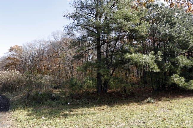
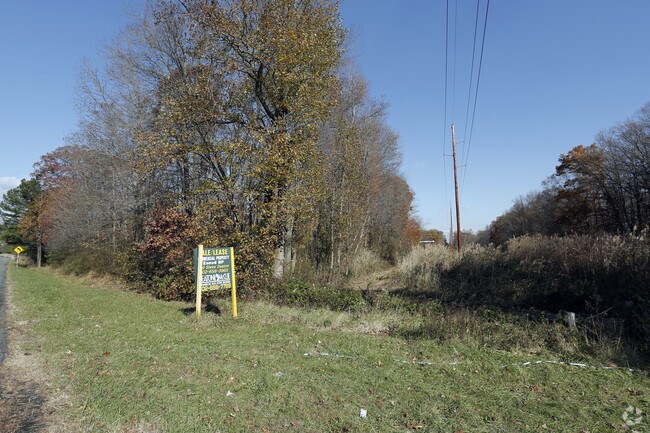
This Property Is For Sale
Property Detail
220 Pga Blvd
11-023.00-116
NEW CASTLE
Commercialnec
Delaware
BP
1
B and X Area of moderate flood hazard, usually the area between the limits of the 100-year and 500-year floods.
2.27 AC
2025
South New Castle County
2025
Philadelphia
014809
Philadelphia-Camden-Wilmington, PA-NJ-DE-MD
NEARBY LISTINGS FOR SALE OR LEASE
DEMOGRAPHICS near 220 Pga Blvd
1 mile
3 mile
5 mile
2025 Total Population
9,829
57,915
138,066
2030 Population
10,045
59,388
141,437
Pop Growth 2025-2030
+ 2.20%
+ 2.54%
+ 2.44%
Average Age
39
40
40
2025 Total Households
3,876
21,401
51,211
HH Growth 2025-2030
+ 2.37%
+ 2.71%
+ 2.60%
Median Household Inc
$82,548
$94,436
$92,149
Avg Household Size
2.50
2.60
2.60
2025 Avg HH Vehicles
2.00
2.00
2.00
Median Home Value
$292,491
$359,453
$344,428
Median Year Built
1990
1993
1990
Nearby Places
Map Layers
Map Styles
 Street
 Aerial
Layers
 Traffic
 Biking
Places
Listings with unknown addresses are not visible on the map
- Restaurants
- Banks
- Shops
- Fitness
- Groceries
PUBLIC TRANSPORTATION
COMMUTER RAIL
Newark (R2 - Southeastern Pennsylvania Transportation Authority Regional Rail (SEPTA Regional Rail))
Drive
Walk
Distance
Newark (R2 - Southeastern Pennsylvania Transportation Authority Regional Rail (SEPTA Regional Rail))
8 min
5.7 mi
Churchmans Crossing (R2 - Southeastern Pennsylvania Transportation Authority Regional Rail (SEPTA Regional Rail))
Drive
Walk
Distance
Churchmans Crossing (R2 - Southeastern Pennsylvania Transportation Authority Regional Rail (SEPTA Regional Rail))
13 min
8.5 mi
Freight Ports
Port of Wilmington, RI
Drive
Walk
Distance
Port of Wilmington, RI
23 min
15.9 mi
Nearby Properties
Address
Land Use
TOTAL SIZE
Lot Size
Zoning
Address
Land Use
TOTAL SIZE
Lot Size
Zoning
Address
Land Use
TOTAL SIZE
Lot Size
Zoning
Address
Land Use
TOTAL SIZE
Lot Size
Zoning
4,676 SF
42.81 AC
NCAP
Address
Land Use
TOTAL SIZE
Lot Size
Zoning
226,878 SF
73.68 AC
CR
Address
Land Use
TOTAL SIZE
Lot Size
Zoning
259,722 SF
20.72 AC
NCAP
Address
Land Use
TOTAL SIZE
Lot Size
Zoning
161,018 SF
97.88 AC
OR
Address
Land Use
TOTAL SIZE
Lot Size
Zoning
59.70 AC
BP
Address
Land Use
TOTAL SIZE
Lot Size
Zoning
343,216 SF
27.10 AC
ST
Address
Land Use
TOTAL SIZE
Lot Size
Zoning
385,350 SF
43.51 AC
OR
Address
Land Use
TOTAL SIZE
Lot Size
Zoning
Address
Land Use
TOTAL SIZE
Lot Size
Zoning
266,818 SF
64.16 AC
BP
Address
Land Use
TOTAL SIZE
Lot Size
Zoning
234,941 SF
19.54 AC
NCPUD
Address
Land Use
TOTAL SIZE
Lot Size
Zoning
Address
Land Use
TOTAL SIZE
Lot Size
Zoning
293,376 SF
149.74 AC
I
Address
Land Use
TOTAL SIZE
Lot Size
Zoning
281.01 AC
BP
Address
Land Use
TOTAL SIZE
Lot Size
Zoning
930 SF
52.69 AC
S
Address
Land Use
TOTAL SIZE
Lot Size
Zoning
62,498 SF
132.23 AC
I
Address
Land Use
TOTAL SIZE
Lot Size
Zoning
15,168 SF
7.85 AC
NCAP
Address
Land Use
TOTAL SIZE
Lot Size
Zoning
392,955 SF
16.87 AC
NCAP
Address
Land Use
TOTAL SIZE
Lot Size
Zoning
2,040 SF
15.38 AC
NCAP
Address
Land Use
TOTAL SIZE
Lot Size
Zoning
Address
Land Use
TOTAL SIZE
Lot Size
Zoning
18,101 SF
8.91 AC
NCAP
Address
Land Use
TOTAL SIZE
Lot Size
Zoning
91,473 SF
59.44 AC
S
Address
Land Use
TOTAL SIZE
Lot Size
Zoning
11,362 SF
36.39 AC
I
Address
Land Use
TOTAL SIZE
Lot Size
Zoning
94,417 SF
28.89 AC
CR
Address
Land Use
TOTAL SIZE
Lot Size
Zoning
62,054 SF
37.38 AC
S
Address
Land Use
TOTAL SIZE
Lot Size
Zoning
47.77 AC
OR
Address
Land Use
TOTAL SIZE
Lot Size
Zoning
153,556 SF
30.12 AC
OR
Address
Land Use
TOTAL SIZE
Lot Size
Zoning
132,816 SF
7.11 AC
NCPUD
Address
Land Use
TOTAL SIZE
Lot Size
Zoning
145.78 AC
BP
The World's #1 Commercial Real Estate Marketplace
Connect with us
© 2026 CoStar Group
The information above has been obtained from sources believed reliable. While we do not doubt its accuracy we have not verified it and make no guarantee, warranty or representation about it. It is your responsibility to independently confirm its accuracy and completeness. Any projections, opinions, assumptions, or estimates used are for example only and do not represent the current or future performance of the property. The value of this transaction to you depends on tax and other factors which should be evaluated by your tax, financial, and legal advisors. You and your advisors should conduct a careful, independent investigation of the property to determine to your satisfaction the suitability of the property for your needs.