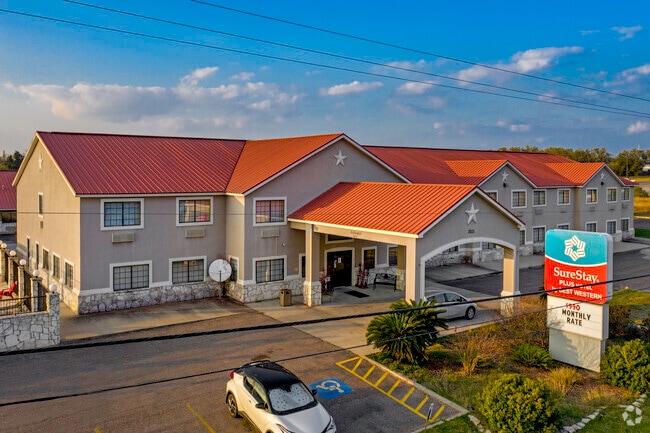
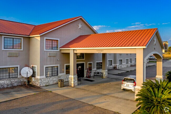
Property Record
1985 S Highway 59 St E, Beeville, TX 78102

Property Detail
1985 S Highway 59 St E
101564
A BURKE ABST 5 TR 61-2 11.81 AC
Commercialnec
BEE
AE The base floodplain where base flood elevations are provided. AE Zones are now used on new format FIRMs instead of A1-A30 Zones.
Texas
2025
11.81 AC
2025
Texas South Area
950204
Other Market Areas
46,846 SF
Beeville, TX
NEARBY LISTINGS FOR SALE OR LEASE
-
-
View all Beeville listings for sale on LoopNet.com
DEMOGRAPHICS near 1985 S Highway 59 St E
1 mile
3 mile
5 mile
2025 Total Population
2,533
15,390
26,054
2030 Population
2,466
15,152
25,787
Pop Growth 2025-2030
(2.65%)
(1.55%)
(1.02%)
Average Age
37
37
39
2025 Total Households
919
5,711
6,702
HH Growth 2025-2030
(2.83%)
(1.45%)
(1.34%)
Median Household Inc
$64,228
$55,720
$57,158
Avg Household Size
2.60
2.60
2.60
2025 Avg HH Vehicles
2.00
2.00
2.00
Median Home Value
$123,106
$106,437
$113,086
Median Year Built
1978
1974
1975
Nearby Places
Map Layers
Map Styles
 Street
 Aerial
Layers
 Traffic
 Biking
Places
Listings with unknown addresses are not visible on the map
- Restaurants
- Banks
- Shops
- Fitness
- Groceries
Nearby Properties
Address
Land Use
TOTAL SIZE
Lot Size
Zoning
Address
Land Use
TOTAL SIZE
Lot Size
Zoning
140.77 AC
Address
Land Use
TOTAL SIZE
Lot Size
Zoning
2,642 SF
159.22 AC
Address
Land Use
TOTAL SIZE
Lot Size
Zoning
270,574 SF
43.40 AC
Address
Land Use
TOTAL SIZE
Lot Size
Zoning
264,088 SF
80.99 AC
Address
Land Use
TOTAL SIZE
Lot Size
Zoning
110,635 SF
27.15 AC
Address
Land Use
TOTAL SIZE
Lot Size
Zoning
106,600 SF
15.24 AC
Address
Land Use
TOTAL SIZE
Lot Size
Zoning
169,286 SF
22.02 AC
Address
Land Use
TOTAL SIZE
Lot Size
Zoning
441,580 SF
22.14 AC
Address
Land Use
TOTAL SIZE
Lot Size
Zoning
22,806 SF
8.65 AC
Address
Land Use
TOTAL SIZE
Lot Size
Zoning
52,170 SF
22.05 AC
Address
Land Use
TOTAL SIZE
Lot Size
Zoning
74,831 SF
5.93 AC
Address
Land Use
TOTAL SIZE
Lot Size
Zoning
78,282 SF
1.96 AC
Address
Land Use
TOTAL SIZE
Lot Size
Zoning
53,164 SF
4.03 AC
Address
Land Use
TOTAL SIZE
Lot Size
Zoning
198,036 SF
4.80 AC
Address
Land Use
TOTAL SIZE
Lot Size
Zoning
208,977 SF
4.94 AC
Address
Land Use
TOTAL SIZE
Lot Size
Zoning
33,835 SF
16.07 AC
Address
Land Use
TOTAL SIZE
Lot Size
Zoning
55,565 SF
6.18 AC
Address
Land Use
TOTAL SIZE
Lot Size
Zoning
72,998 SF
4.31 AC
Address
Land Use
TOTAL SIZE
Lot Size
Zoning
82,500 SF
6.18 AC
Address
Land Use
TOTAL SIZE
Lot Size
Zoning
64,132 SF
5 AC
Address
Land Use
TOTAL SIZE
Lot Size
Zoning
167,080 SF
4.86 AC
Address
Land Use
TOTAL SIZE
Lot Size
Zoning
46,425 SF
2.46 AC
Address
Land Use
TOTAL SIZE
Lot Size
Zoning
17,622 SF
1 AC
Address
Land Use
TOTAL SIZE
Lot Size
Zoning
40,034 SF
3.41 AC
Address
Land Use
TOTAL SIZE
Lot Size
Zoning
10,294 SF
3 AC
Address
Land Use
TOTAL SIZE
Lot Size
Zoning
64,033 SF
1.81 AC
Address
Land Use
TOTAL SIZE
Lot Size
Zoning
52,418 SF
1.63 AC
Address
Land Use
TOTAL SIZE
Lot Size
Zoning
11,649 SF
6.13 AC
The World's #1 Commercial Real Estate Marketplace
Connect with us
© 2026 CoStar Group
The information above has been obtained from sources believed reliable. While we do not doubt its accuracy we have not verified it and make no guarantee, warranty or representation about it. It is your responsibility to independently confirm its accuracy and completeness. Any projections, opinions, assumptions, or estimates used are for example only and do not represent the current or future performance of the property. The value of this transaction to you depends on tax and other factors which should be evaluated by your tax, financial, and legal advisors. You and your advisors should conduct a careful, independent investigation of the property to determine to your satisfaction the suitability of the property for your needs.