Property Record
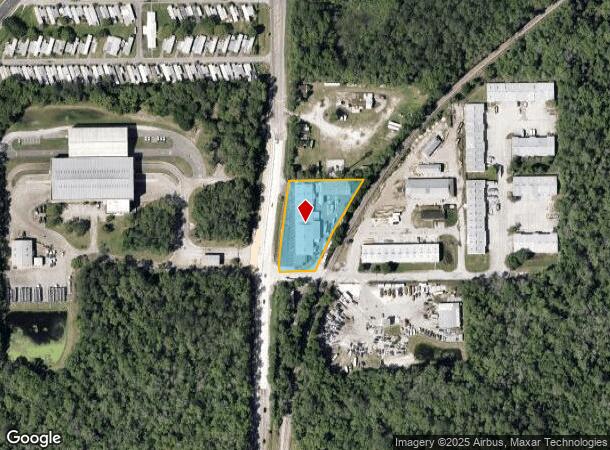
1985 State Road 419, Longwood, FL 32750

NEARBY LISTINGS FOR SALE OR LEASE
Property Detail
1985 State Road 419
Orlando-Kissimmee-Sanford, FL
Shumans Add To Eureka Hammock
27-20-30-501-0000-0020
LOT 2 W OF RR (LESS N 330 FT & W 30 FT FOR RD) & WLY 50 FT OF VACD RR ADJ ON E SHUMANS ADD TO EUREKA HAMMOCK PB 2 PG 53
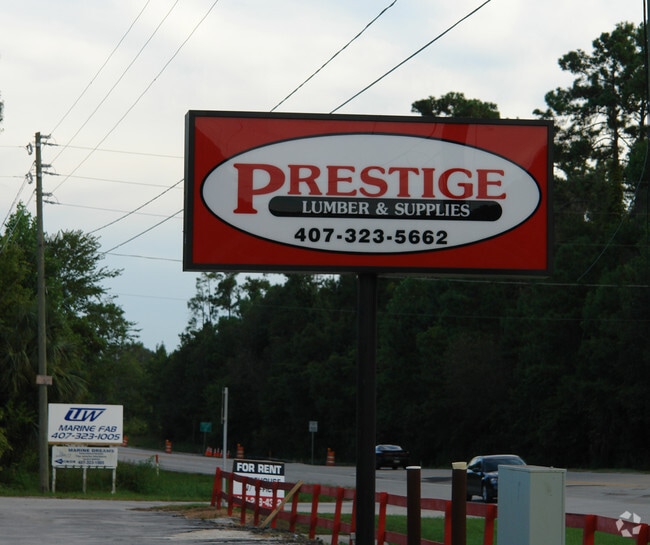
Lumberyard
Seminole
X
Florida
12117C0160F
2
2024
1.33 AC
2024
Seminole County
020905
Orlando
14,400 SF
DEMOGRAPHICS near 1985 State Road 419
1 Mile
3 Mile
5 Mile
2024 Total Population
2,816
61,683
174,934
2029 Population
2,901
63,927
182,245
Pop Growth 2024-2029
+ 3.02%
+ 3.64%
+ 4.18%
Average Age
42
41
41
2024 Total Households
1,060
23,625
67,609
HH Growth 2024-2029
+ 3.11%
+ 3.75%
+ 4.28%
Median Household Inc
$69,654
$65,783
$69,523
Avg Household Size
2.60
2.50
2.50
2024 Avg HH Vehicles
2.00
2.00
2.00
Median Home Value
$333,408
$269,901
$293,949
Median Year Built
1985
1985
1987
Nearby Places
Map Layers
Map Styles
 Street
 Aerial
- Restaurants
- Banks
- Shops
- Fitness
- Groceries
PUBLIC TRANSPORTATION
COMMUTER RAIL
DRIVE
WALK
Distance
7 min
3.6 mi
DRIVE
WALK
Distance
8 min
3.8 mi
AIRPORT
Orlando Sanford International
DRIVE
WALK
Distance
Orlando Sanford International
13 min
6.9 mi
Orlando International
DRIVE
WALK
Distance
Orlando International
39 min
22.5 mi
Daytona Beach International
DRIVE
WALK
Distance
Daytona Beach International
55 min
40.1 mi
Nearby Properties
Address
Land Use
TOTAL SIZE
Lot Size
Zoning
Address
Land Use
TOTAL SIZE
Lot Size
Zoning
2,548 SF
34.45 AC
PUD
Address
Land Use
TOTAL SIZE
Lot Size
Zoning
629,182 SF
1.81 AC
R1A
Address
Land Use
TOTAL SIZE
Lot Size
Zoning
350,767 SF
11.12 AC
PUD
Address
Land Use
TOTAL SIZE
Lot Size
Zoning
3,668 SF
3.12 AC
C1
Address
Land Use
TOTAL SIZE
Lot Size
Zoning
505 SF
1.94 AC
Address
Land Use
TOTAL SIZE
Lot Size
Zoning
97,888 SF
3.72 AC
IND
Address
Land Use
TOTAL SIZE
Lot Size
Zoning
210,934 SF
10.96 AC
GC2
Address
Land Use
TOTAL SIZE
Lot Size
Zoning
1,077 SF
3.17 AC
Address
Land Use
TOTAL SIZE
Lot Size
Zoning
10,757 SF
70.59 AC
C2
Address
Land Use
TOTAL SIZE
Lot Size
Zoning
3,920 SF
10.57 AC
PUD
Address
Land Use
TOTAL SIZE
Lot Size
Zoning
1,518 SF
12.08 AC
PUD
Address
Land Use
TOTAL SIZE
Lot Size
Zoning
1,696 SF
0.16 AC
A1
Address
Land Use
TOTAL SIZE
Lot Size
Zoning
138,513 SF
14.95 AC
GC2
Address
Land Use
TOTAL SIZE
Lot Size
Zoning
204,151 SF
12 AC
MR2
Address
Land Use
TOTAL SIZE
Lot Size
Zoning
101.53 AC
PUD
Address
Land Use
TOTAL SIZE
Lot Size
Zoning
29,863 SF
6.95 AC
Address
Land Use
TOTAL SIZE
Lot Size
Zoning
195,936 SF
58.50 AC
PUD
Address
Land Use
TOTAL SIZE
Lot Size
Zoning
209,331 SF
18.73 AC
GC2
Address
Land Use
TOTAL SIZE
Lot Size
Zoning
158,656 SF
17.80 AC
GC2
Address
Land Use
TOTAL SIZE
Lot Size
Zoning
121,720 SF
7.20 AC
GC2
Address
Land Use
TOTAL SIZE
Lot Size
Zoning
286,491 SF
13.96 AC
R1A
Address
Land Use
TOTAL SIZE
Lot Size
Zoning
480 SF
20.56 AC
GC2
Address
Land Use
TOTAL SIZE
Lot Size
Zoning
220 SF
7.72 AC
GC
Address
Land Use
TOTAL SIZE
Lot Size
Zoning
57,712 SF
10.98 AC
Address
Land Use
TOTAL SIZE
Lot Size
Zoning
1,124 SF
11.01 AC
MR2
Address
Land Use
TOTAL SIZE
Lot Size
Zoning
40,040 SF
2.72 AC
Address
Land Use
TOTAL SIZE
Lot Size
Zoning
100,968 SF
5.13 AC
PUD
Address
Land Use
TOTAL SIZE
Lot Size
Zoning
15,322 SF
7.61 AC
Address
Land Use
TOTAL SIZE
Lot Size
Zoning
91,706 SF
4.38 AC
GC
Address
Land Use
TOTAL SIZE
Lot Size
Zoning
112,526 SF
8.23 AC
GC
The World's #1 Commercial Real Estate Marketplace
Connect with us
© 2025 CoStar Group
The information above has been obtained from sources believed reliable. While we do not doubt its accuracy we have not verified it and make no guarantee, warranty or representation about it. It is your responsibility to independently confirm its accuracy and completeness. Any projections, opinions, assumptions, or estimates used are for example only and do not represent the current or future performance of the property. The value of this transaction to you depends on tax and other factors which should be evaluated by your tax, financial, and legal advisors. You and your advisors should conduct a careful, independent investigation of the property to determine to your satisfaction the suitability of the property for your needs.