Property Record
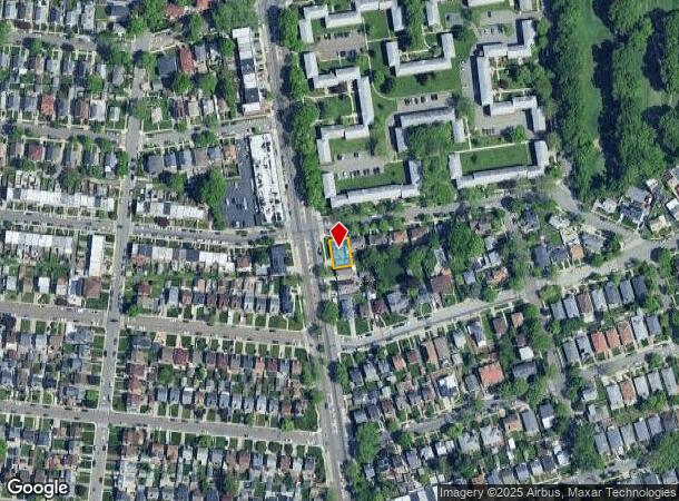
19904 22Nd Ave, Whitestone, NY 11357


Current Lease Availabilities
NEARBY LISTINGS FOR SALE OR LEASE
Property Detail
19904 22Nd Ave
05790-0010
Queens
Commercialofficeresidentialmixeduse
New York
X
10
3604970118F
0.10 AC
2024
Northeast Queens
2025
Long Island (New York)
099701
New York-Jersey City-White Plains, NY-NJ
2,020 SF
DEMOGRAPHICS near 19904 22Nd Ave
1 Mile
3 Mile
5 Mile
2024 Total Population
46,000
352,070
1,087,149
2029 Population
43,036
330,778
1,018,178
Pop Growth 2024-2029
(6.44%)
(6.05%)
(6.34%)
Average Age
47
45
42
2024 Total Households
17,646
124,695
378,288
HH Growth 2024-2029
(7.11%)
(6.49%)
(6.52%)
Median Household Inc
$90,845
$69,386
$72,505
Avg Household Size
2.50
2.70
2.70
2024 Avg HH Vehicles
1.00
1.00
1.00
Median Home Value
$751,842
$759,768
$698,706
Median Year Built
1956
1956
1955
Nearby Places
Map Layers
Map Styles
 Street
 Aerial
- Restaurants
- Banks
- Shops
- Fitness
- Groceries
PUBLIC TRANSPORTATION
COMMUTER RAIL
Auburndale Station (Port Washington Branch - Long Island Rail Road)
DRIVE
WALK
Distance
Auburndale Station (Port Washington Branch - Long Island Rail Road)
3 min
1.1 mi
Broadway Station (Port Washington Branch - Long Island Rail Road)
DRIVE
WALK
Distance
Broadway Station (Port Washington Branch - Long Island Rail Road)
4 min
2.0 mi
AIRPORT
LaGuardia
DRIVE
WALK
Distance
LaGuardia
14 min
6.9 mi
John F Kennedy International
DRIVE
WALK
Distance
John F Kennedy International
21 min
11.8 mi
Westchester County
DRIVE
WALK
Distance
Westchester County
41 min
27.1 mi
Freight Ports
NY - Red Hook Container Terminal
DRIVE
WALK
Distance
NY - Red Hook Container Terminal
28 min
16.7 mi
Nearby Properties
Address
Land Use
TOTAL SIZE
Lot Size
Zoning
Address
Land Use
TOTAL SIZE
Lot Size
Zoning
2,697,663 SF
3.46 AC
C5-3
Address
Land Use
TOTAL SIZE
Lot Size
Zoning
1,666,696 SF
1.87 AC
C52.5
Address
Land Use
TOTAL SIZE
Lot Size
Zoning
2,078,606 SF
58.93 AC
R4
Address
Land Use
TOTAL SIZE
Lot Size
Zoning
878,386 SF
20.55 AC
R4
Address
Land Use
TOTAL SIZE
Lot Size
Zoning
703,265 SF
83.45 AC
R4
Address
Land Use
TOTAL SIZE
Lot Size
Zoning
421,996 SF
136.05 AC
R3-1
Address
Land Use
TOTAL SIZE
Lot Size
Zoning
4,050 SF
113.40 AC
PARK
Address
Land Use
TOTAL SIZE
Lot Size
Zoning
947 SF
101.82 AC
PARK
Address
Land Use
TOTAL SIZE
Lot Size
Zoning
4,800 SF
80.10 AC
PARK
Address
Land Use
TOTAL SIZE
Lot Size
Zoning
332,266 SF
12.57 AC
M2-1
Address
Land Use
TOTAL SIZE
Lot Size
Zoning
1,186,778 SF
31.45 AC
R4
Address
Land Use
TOTAL SIZE
Lot Size
Zoning
577,654 SF
5.38 AC
R6
Address
Land Use
TOTAL SIZE
Lot Size
Zoning
511,684 SF
13.09 AC
R4
Address
Land Use
TOTAL SIZE
Lot Size
Zoning
377,896 SF
11.36 AC
R3-2
Address
Land Use
TOTAL SIZE
Lot Size
Zoning
250,577 SF
23.17 AC
M2-1
Address
Land Use
TOTAL SIZE
Lot Size
Zoning
198,298 SF
13.93 AC
C4-1
Address
Land Use
TOTAL SIZE
Lot Size
Zoning
186,843 SF
5.37 AC
R2A
Address
Land Use
TOTAL SIZE
Lot Size
Zoning
281,416 SF
2.57 AC
C4-2
Address
Land Use
TOTAL SIZE
Lot Size
Zoning
382,302 SF
6.23 AC
R2A
Address
Land Use
TOTAL SIZE
Lot Size
Zoning
614,916 SF
28.10 AC
R4
Address
Land Use
TOTAL SIZE
Lot Size
Zoning
2,828 SF
78.05 AC
PARK
Address
Land Use
TOTAL SIZE
Lot Size
Zoning
454,631 SF
24.61 AC
M1-1
Address
Land Use
TOTAL SIZE
Lot Size
Zoning
443,492 SF
27.75 AC
M1-1
Address
Land Use
TOTAL SIZE
Lot Size
Zoning
15.83 AC
M2-1
Address
Land Use
TOTAL SIZE
Lot Size
Zoning
202,063 SF
2.79 AC
C4-2
Address
Land Use
TOTAL SIZE
Lot Size
Zoning
109,805 SF
1.96 AC
C4-2
Address
Land Use
TOTAL SIZE
Lot Size
Zoning
319,231 SF
3.76 AC
R4
Address
Land Use
TOTAL SIZE
Lot Size
Zoning
303,039 SF
C4-2
Address
Land Use
TOTAL SIZE
Lot Size
Zoning
95.36 AC
PARK
Address
Land Use
TOTAL SIZE
Lot Size
Zoning
29,608 SF
33.60 AC
PARK
The World's #1 Commercial Real Estate Marketplace
Connect with us
© 2025 CoStar Group
The information above has been obtained from sources believed reliable. While we do not doubt its accuracy we have not verified it and make no guarantee, warranty or representation about it. It is your responsibility to independently confirm its accuracy and completeness. Any projections, opinions, assumptions, or estimates used are for example only and do not represent the current or future performance of the property. The value of this transaction to you depends on tax and other factors which should be evaluated by your tax, financial, and legal advisors. You and your advisors should conduct a careful, independent investigation of the property to determine to your satisfaction the suitability of the property for your needs.