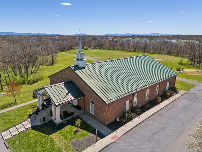
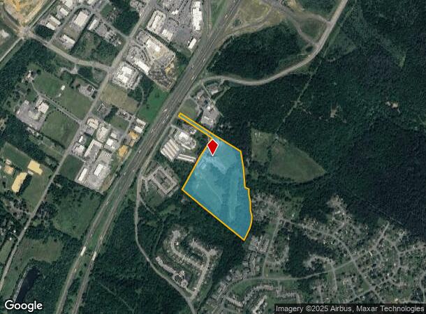
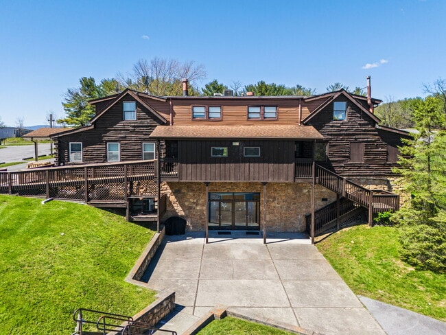
Property Record
199 Agape Way, Stephens City, VA 22655
NEARBY LISTINGS FOR SALE OR LEASE
-
-
View all Stephens City listings for sale on LoopNet.com
Property Detail
199 Agape Way
75A-87C
4
Religious
29.51 ACRES
A
Frederick
51069C0330E
Virginia
0
29.51 AC
2025
Frederick County
050900
Washington, DC
7,000 SF
Winchester, VA-WV
DEMOGRAPHICS near 199 Agape Way
1 Mile
3 Mile
5 Mile
2024 Total Population
3,410
28,282
52,774
2029 Population
3,741
30,842
56,512
Pop Growth 2024-2029
+ 9.71%
+ 9.05%
+ 7.08%
Average Age
39
39
40
2024 Total Households
1,415
10,531
20,058
HH Growth 2024-2029
+ 9.75%
+ 8.98%
+ 6.86%
Median Household Inc
$67,738
$87,576
$79,651
Avg Household Size
2.40
2.60
2.50
2024 Avg HH Vehicles
2.00
2.00
2.00
Median Home Value
$248,422
$306,601
$335,143
Median Year Built
1988
1991
1989
Nearby Places
- Restaurants
- Banks
- Shops
- Fitness
- Groceries
SALE & LEASE HISTORY
LISTING DATE
SALE/LEASE

Apr 02, 2024
For Sale
Nearby Properties
Address
Land Use
TOTAL SIZE
Lot Size
Zoning
Address
Land Use
TOTAL SIZE
Lot Size
Zoning
156,379 SF
55.53 AC
RA
Address
Land Use
TOTAL SIZE
Lot Size
Zoning
234,642 SF
40 AC
RA
Address
Land Use
TOTAL SIZE
Lot Size
Zoning
1,440 SF
6.73 AC
RA
Address
Land Use
TOTAL SIZE
Lot Size
Zoning
30,054 SF
62.32 AC
M2
Address
Land Use
TOTAL SIZE
Lot Size
Zoning
411,597 SF
32.20 AC
M1
Address
Land Use
TOTAL SIZE
Lot Size
Zoning
156,000 SF
56.91 AC
RA
Address
Land Use
TOTAL SIZE
Lot Size
Zoning
15.24 AC
RP
Address
Land Use
TOTAL SIZE
Lot Size
Zoning
254,560 SF
42.88 AC
M1
Address
Land Use
TOTAL SIZE
Lot Size
Zoning
351,500 SF
28.38 AC
M1
Address
Land Use
TOTAL SIZE
Lot Size
Zoning
422,658 SF
64.27 AC
M1
Address
Land Use
TOTAL SIZE
Lot Size
Zoning
2,310 SF
17.28 AC
RP
Address
Land Use
TOTAL SIZE
Lot Size
Zoning
106,296 SF
23.22 AC
M1
Address
Land Use
TOTAL SIZE
Lot Size
Zoning
252,000 SF
24.87 AC
M1
Address
Land Use
TOTAL SIZE
Lot Size
Zoning
239,570 SF
17 AC
M1
Address
Land Use
TOTAL SIZE
Lot Size
Zoning
440,999 SF
55.46 AC
M1
Address
Land Use
TOTAL SIZE
Lot Size
Zoning
87,000 SF
16.30 AC
EIP
Address
Land Use
TOTAL SIZE
Lot Size
Zoning
71,569 SF
37.35 AC
RA
Address
Land Use
TOTAL SIZE
Lot Size
Zoning
71,607 SF
14.97 AC
RA
Address
Land Use
TOTAL SIZE
Lot Size
Zoning
204,600 SF
14.38 AC
M1
Address
Land Use
TOTAL SIZE
Lot Size
Zoning
65,668 SF
16.03 AC
B2
Address
Land Use
TOTAL SIZE
Lot Size
Zoning
107,923 SF
23.65 AC
RP
Address
Land Use
TOTAL SIZE
Lot Size
Zoning
75,257 SF
18.29 AC
RP
Address
Land Use
TOTAL SIZE
Lot Size
Zoning
300,515 SF
20.73 AC
M1
Address
Land Use
TOTAL SIZE
Lot Size
Zoning
105,340 SF
18.45 AC
M1
Address
Land Use
TOTAL SIZE
Lot Size
Zoning
126,580 SF
9.27 AC
B3
Address
Land Use
TOTAL SIZE
Lot Size
Zoning
39,884 SF
57.27 AC
RA
Address
Land Use
TOTAL SIZE
Lot Size
Zoning
40,022 SF
13.34 AC
RA
Address
Land Use
TOTAL SIZE
Lot Size
Zoning
20,000 SF
6.96 AC
RP
Address
Land Use
TOTAL SIZE
Lot Size
Zoning
93,052 SF
5.93 AC
B2
Address
Land Use
TOTAL SIZE
Lot Size
Zoning
54,425 SF
5.93 AC
B2
The World's #1 Commercial Real Estate Marketplace
Connect with us
© 2025 CoStar Group
The information above has been obtained from sources believed reliable. While we do not doubt its accuracy we have not verified it and make no guarantee, warranty or representation about it. It is your responsibility to independently confirm its accuracy and completeness. Any projections, opinions, assumptions, or estimates used are for example only and do not represent the current or future performance of the property. The value of this transaction to you depends on tax and other factors which should be evaluated by your tax, financial, and legal advisors. You and your advisors should conduct a careful, independent investigation of the property to determine to your satisfaction the suitability of the property for your needs.