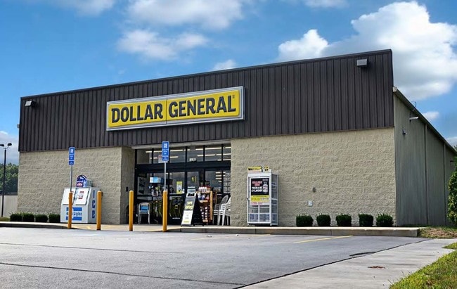
Property Record
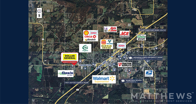
199 Highway 64 W, Beebe, AR 72012

Property Detail
199 Highway 64 W
004-05000-208-A
PT E 1/2 NW BEING 16.26 X 155.57 X 34.25 X 287.42 X 200 X 243
Storebuilding
White
B and X Area of moderate flood hazard, usually the area between the limits of the 100-year and 500-year floods.
Arkansas
2025
1.23 AC
2025
Arkansas North Area
071201
Other Market Areas
9,020 SF
Searcy, AR
NEARBY LISTINGS FOR SALE OR LEASE
DEMOGRAPHICS near 199 Highway 64 W
1 mile
3 mile
5 mile
2025 Total Population
1,607
8,928
20,332
2030 Population
1,667
9,233
21,030
Pop Growth 2025-2030
+ 3.73%
+ 3.42%
+ 3.43%
Average Age
40
37
37
2025 Total Households
627
3,277
7,551
HH Growth 2025-2030
+ 3.83%
+ 3.60%
+ 3.54%
Median Household Inc
$100,456
$80,631
$78,076
Avg Household Size
2.50
2.50
2.60
2025 Avg HH Vehicles
2.00
2.00
2.00
Median Home Value
$227,108
$182,648
$176,634
Median Year Built
2005
1998
1999
Nearby Places
Map Layers
Map Styles
 Street
 Aerial
Layers
 Traffic
 Biking
Places
Listings with unknown addresses are not visible on the map
- Restaurants
- Banks
- Shops
- Fitness
- Groceries
PUBLIC TRANSPORTATION
AIRPORT
Bill and Hillary Clinton Ntl/Adams Field
Drive
Walk
Distance
Bill and Hillary Clinton Ntl/Adams Field
40 min
35.0 mi
SALE & LEASE HISTORY
LISTING DATE
SALE/LEASE

Mar 08, 2019
For Sale
Jan 06, 2025
For Sale
Nearby Properties
Address
Land Use
TOTAL SIZE
Lot Size
Zoning
Address
Land Use
TOTAL SIZE
Lot Size
Zoning
165,516 SF
19.69 AC
Address
Land Use
TOTAL SIZE
Lot Size
Zoning
27,143 SF
7.63 AC
Address
Land Use
TOTAL SIZE
Lot Size
Zoning
9,630 SF
1.09 AC
Address
Land Use
TOTAL SIZE
Lot Size
Zoning
41,860 SF
32.11 AC
Address
Land Use
TOTAL SIZE
Lot Size
Zoning
86,284 SF
7 AC
Address
Land Use
TOTAL SIZE
Lot Size
Zoning
8,720 SF
1.41 AC
Address
Land Use
TOTAL SIZE
Lot Size
Zoning
21,526 SF
2.58 AC
Address
Land Use
TOTAL SIZE
Lot Size
Zoning
40,344 SF
3.01 AC
Address
Land Use
TOTAL SIZE
Lot Size
Zoning
30,864 SF
3 AC
Address
Land Use
TOTAL SIZE
Lot Size
Zoning
25,080 SF
2.30 AC
Address
Land Use
TOTAL SIZE
Lot Size
Zoning
28,774 SF
2.98 AC
Address
Land Use
TOTAL SIZE
Lot Size
Zoning
25,190 SF
4.88 AC
Address
Land Use
TOTAL SIZE
Lot Size
Zoning
5,762 SF
0.73 AC
Address
Land Use
TOTAL SIZE
Lot Size
Zoning
8,696 SF
1.64 AC
Address
Land Use
TOTAL SIZE
Lot Size
Zoning
28,750 SF
10 AC
Address
Land Use
TOTAL SIZE
Lot Size
Zoning
17,640 SF
2.57 AC
Address
Land Use
TOTAL SIZE
Lot Size
Zoning
4,837 SF
1.81 AC
Address
Land Use
TOTAL SIZE
Lot Size
Zoning
22,040 SF
2.56 AC
Address
Land Use
TOTAL SIZE
Lot Size
Zoning
5,888 SF
0.69 AC
Address
Land Use
TOTAL SIZE
Lot Size
Zoning
5,126 SF
2.93 AC
Address
Land Use
TOTAL SIZE
Lot Size
Zoning
13,992 SF
10.05 AC
Address
Land Use
TOTAL SIZE
Lot Size
Zoning
7,441 SF
2.03 AC
Address
Land Use
TOTAL SIZE
Lot Size
Zoning
18,316 SF
1.83 AC
Address
Land Use
TOTAL SIZE
Lot Size
Zoning
18,950 SF
1.15 AC
Address
Land Use
TOTAL SIZE
Lot Size
Zoning
10,176 SF
1.87 AC
Address
Land Use
TOTAL SIZE
Lot Size
Zoning
7,500 SF
1.70 AC
Address
Land Use
TOTAL SIZE
Lot Size
Zoning
3,493 SF
1.41 AC
Address
Land Use
TOTAL SIZE
Lot Size
Zoning
24,448 SF
1.69 AC
Address
Land Use
TOTAL SIZE
Lot Size
Zoning
20,400 SF
1.24 AC
Address
Land Use
TOTAL SIZE
Lot Size
Zoning
5,586 SF
0.77 AC
The World's #1 Commercial Real Estate Marketplace
Connect with us
© 2026 CoStar Group
The information above has been obtained from sources believed reliable. While we do not doubt its accuracy we have not verified it and make no guarantee, warranty or representation about it. It is your responsibility to independently confirm its accuracy and completeness. Any projections, opinions, assumptions, or estimates used are for example only and do not represent the current or future performance of the property. The value of this transaction to you depends on tax and other factors which should be evaluated by your tax, financial, and legal advisors. You and your advisors should conduct a careful, independent investigation of the property to determine to your satisfaction the suitability of the property for your needs.