Property Record
199 Jagger Mill Rd, Sanford, ME 04073


Property Detail
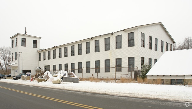
199 Jagger Mill Rd
Manufacturinglight
York
RD
Maine
AE The base floodplain where base flood elevations are provided. AE Zones are now used on new format FIRMs instead of A1-A30 Zones.
0.90 AC
2025
York County
2025
Portland/South Portland
030300
Portland-South Portland, ME
1,561 SF
SANF-000069-R000015
NEARBY LISTINGS FOR SALE OR LEASE
DEMOGRAPHICS near 199 Jagger Mill Rd
1 mile
3 mile
5 mile
2025 Total Population
1,052
11,081
24,544
2030 Population
1,079
11,294
25,033
Pop Growth 2025-2030
+ 2.57%
+ 1.92%
+ 1.99%
Average Age
46
43
43
2025 Total Households
492
4,564
10,102
HH Growth 2025-2030
+ 2.44%
+ 1.86%
+ 1.91%
Median Household Inc
$69,666
$69,804
$74,101
Avg Household Size
2.10
2.30
2.30
2025 Avg HH Vehicles
2.00
2.00
2.00
Median Home Value
$294,365
$282,401
$306,337
Median Year Built
1985
1976
1975
Nearby Places
Map Layers
Map Styles
 Street
 Aerial
Layers
 Traffic
 Biking
Places
Listings with unknown addresses are not visible on the map
- Restaurants
- Banks
- Shops
- Fitness
- Groceries
PUBLIC TRANSPORTATION
COMMUTER RAIL
Drive
Walk
Distance
17 min
9.1 mi
AIRPORT
Portsmouth International at Pease
Drive
Walk
Distance
Portsmouth International at Pease
47 min
31.7 mi
Portland International Jetport
Drive
Walk
Distance
Portland International Jetport
43 min
32.2 mi
Freight Ports
Portland, ME
Drive
Walk
Distance
Portland, ME
44 min
34.8 mi
Nearby Properties
Address
Land Use
TOTAL SIZE
Lot Size
Zoning
Address
Land Use
TOTAL SIZE
Lot Size
Zoning
220,000 SF
137 AC
GR
Address
Land Use
TOTAL SIZE
Lot Size
Zoning
35.08 AC
Address
Land Use
TOTAL SIZE
Lot Size
Zoning
450 AC
RMU
Address
Land Use
TOTAL SIZE
Lot Size
Zoning
198,252 SF
21.38 AC
IB
Address
Land Use
TOTAL SIZE
Lot Size
Zoning
283,350 SF
17.14 AC
AD
Address
Land Use
TOTAL SIZE
Lot Size
Zoning
30.33 AC
SB
Address
Land Use
TOTAL SIZE
Lot Size
Zoning
101 AC
IB
Address
Land Use
TOTAL SIZE
Lot Size
Zoning
134,480 SF
15.35 AC
IB
Address
Land Use
TOTAL SIZE
Lot Size
Zoning
1,271.85 AC
DZ
Address
Land Use
TOTAL SIZE
Lot Size
Zoning
24,959 SF
19.77 AC
IB
Address
Land Use
TOTAL SIZE
Lot Size
Zoning
9 AC
GR
Address
Land Use
TOTAL SIZE
Lot Size
Zoning
83,505 SF
17 AC
RD
Address
Land Use
TOTAL SIZE
Lot Size
Zoning
6.81 AC
Address
Land Use
TOTAL SIZE
Lot Size
Zoning
6.71 AC
SB
Address
Land Use
TOTAL SIZE
Lot Size
Zoning
4.08 AC
IB
Address
Land Use
TOTAL SIZE
Lot Size
Zoning
61,457 SF
0.87 AC
IR
Address
Land Use
TOTAL SIZE
Lot Size
Zoning
Address
Land Use
TOTAL SIZE
Lot Size
Zoning
2.59 AC
Address
Land Use
TOTAL SIZE
Lot Size
Zoning
16,708 SF
3 AC
DB
Address
Land Use
TOTAL SIZE
Lot Size
Zoning
107.11 AC
AD
Address
Land Use
TOTAL SIZE
Lot Size
Zoning
14,044 SF
2.62 AC
CC
Address
Land Use
TOTAL SIZE
Lot Size
Zoning
25.50 AC
AD
Address
Land Use
TOTAL SIZE
Lot Size
Zoning
4.09 AC
IB
Address
Land Use
TOTAL SIZE
Lot Size
Zoning
2.65 AC
CC
Address
Land Use
TOTAL SIZE
Lot Size
Zoning
19,019 SF
19.41 AC
SFR
Address
Land Use
TOTAL SIZE
Lot Size
Zoning
5,996 SF
17.10 AC
RMU
Address
Land Use
TOTAL SIZE
Lot Size
Zoning
92,944 SF
19.38 AC
SB
Address
Land Use
TOTAL SIZE
Lot Size
Zoning
1,080 SF
3.50 AC
GR
Address
Land Use
TOTAL SIZE
Lot Size
Zoning
4.72 AC
SFR
Address
Land Use
TOTAL SIZE
Lot Size
Zoning
26,748 SF
1.20 AC
The World's #1 Commercial Real Estate Marketplace
Connect with us
© 2026 CoStar Group
The information above has been obtained from sources believed reliable. While we do not doubt its accuracy we have not verified it and make no guarantee, warranty or representation about it. It is your responsibility to independently confirm its accuracy and completeness. Any projections, opinions, assumptions, or estimates used are for example only and do not represent the current or future performance of the property. The value of this transaction to you depends on tax and other factors which should be evaluated by your tax, financial, and legal advisors. You and your advisors should conduct a careful, independent investigation of the property to determine to your satisfaction the suitability of the property for your needs.