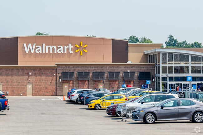
Property Record
1990 Brandt Point Dr, Webster, NY 14580
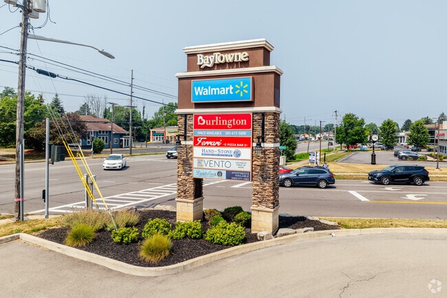
NEARBY LISTINGS FOR SALE OR LEASE
Property Detail
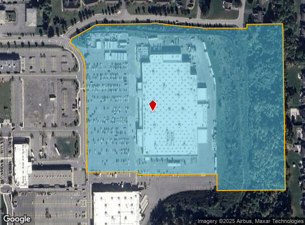
1990 Brandt Point Dr
264200 093.02-1-25.11
Monroe
Communitycenter
New York
X
25.110
36055C0228G
22.75 AC
2025
Northeast
2024
Rochester
011507
Rochester, NY
198,229 SF
DEMOGRAPHICS near 1990 Brandt Point Dr
1 Mile
3 Mile
5 Mile
2024 Total Population
6,962
47,324
157,432
2029 Population
6,890
46,689
155,096
Pop Growth 2024-2029
(1.03%)
(1.34%)
(1.48%)
Average Age
43
44
42
2024 Total Households
3,077
20,519
68,168
HH Growth 2024-2029
(1.01%)
(1.40%)
(1.53%)
Median Household Inc
$84,702
$86,055
$68,665
Avg Household Size
2.20
2.20
2.20
2024 Avg HH Vehicles
2.00
2.00
2.00
Median Home Value
$236,301
$212,893
$182,569
Median Year Built
1991
1978
1960
Nearby Places
Map Layers
Map Styles
 Street
 Aerial
- Restaurants
- Banks
- Shops
- Fitness
- Groceries
PUBLIC TRANSPORTATION
COMMUTER RAIL
Rochester (Empire Service - VIA Rail, Lake Shore Limited - VIA Rail, Maple Leaf - VIA Rail, Toronto - New York - VIA Rail)
DRIVE
WALK
Distance
Rochester (Empire Service - VIA Rail, Lake Shore Limited - VIA Rail, Maple Leaf - VIA Rail, Toronto - New York - VIA Rail)
13 min
7.1 mi
AIRPORT
Frederick Douglass/Greater Rochester International
DRIVE
WALK
Distance
Frederick Douglass/Greater Rochester International
22 min
12.3 mi
Freight Ports
Albany, NY Port
DRIVE
WALK
Distance
Albany, NY Port
270 min
228.6 mi
Nearby Properties
Address
Land Use
TOTAL SIZE
Lot Size
Zoning
Address
Land Use
TOTAL SIZE
Lot Size
Zoning
39.21 AC
Address
Land Use
TOTAL SIZE
Lot Size
Zoning
32,868 SF
46.85 AC
Address
Land Use
TOTAL SIZE
Lot Size
Zoning
278,538 SF
53.90 AC
09200
Address
Land Use
TOTAL SIZE
Lot Size
Zoning
283,456 SF
40.76 AC
R-1-20
Address
Land Use
TOTAL SIZE
Lot Size
Zoning
168,660 SF
42.78 AC
Address
Land Use
TOTAL SIZE
Lot Size
Zoning
35,546 SF
34.12 AC
GB
Address
Land Use
TOTAL SIZE
Lot Size
Zoning
52,716 SF
10.72 AC
LLD
Address
Land Use
TOTAL SIZE
Lot Size
Zoning
48,000 SF
19.51 AC
03 - MULTI
Address
Land Use
TOTAL SIZE
Lot Size
Zoning
80,405 SF
15.14 AC
Address
Land Use
TOTAL SIZE
Lot Size
Zoning
134,894 SF
16 AC
01 - NOT Z
Address
Land Use
TOTAL SIZE
Lot Size
Zoning
2,617 SF
27.13 AC
Address
Land Use
TOTAL SIZE
Lot Size
Zoning
73,724 SF
11.79 AC
02 - SINGL
Address
Land Use
TOTAL SIZE
Lot Size
Zoning
3,121 SF
16.17 AC
MR
Address
Land Use
TOTAL SIZE
Lot Size
Zoning
7,424 SF
41.69 AC
Address
Land Use
TOTAL SIZE
Lot Size
Zoning
205,258 SF
40 AC
Address
Land Use
TOTAL SIZE
Lot Size
Zoning
11,862 SF
35.80 AC
26340
Address
Land Use
TOTAL SIZE
Lot Size
Zoning
930 SF
13.45 AC
03 - MULTI
Address
Land Use
TOTAL SIZE
Lot Size
Zoning
97,055 SF
15.73 AC
Address
Land Use
TOTAL SIZE
Lot Size
Zoning
31,378 SF
16.90 AC
03 - MULTI
Address
Land Use
TOTAL SIZE
Lot Size
Zoning
52,716 SF
7.57 AC
LLD
Address
Land Use
TOTAL SIZE
Lot Size
Zoning
118,000 SF
16.38 AC
GB
Address
Land Use
TOTAL SIZE
Lot Size
Zoning
67,158 SF
25.29 AC
R-1-20
Address
Land Use
TOTAL SIZE
Lot Size
Zoning
380,600 SF
44.14 AC
06 - INDUS
Address
Land Use
TOTAL SIZE
Lot Size
Zoning
18,832 SF
31.20 AC
09170
Address
Land Use
TOTAL SIZE
Lot Size
Zoning
8,464 SF
9.60 AC
03 - MULTI
Address
Land Use
TOTAL SIZE
Lot Size
Zoning
93,520 SF
37.91 AC
Address
Land Use
TOTAL SIZE
Lot Size
Zoning
8,526 SF
26.46 AC
Address
Land Use
TOTAL SIZE
Lot Size
Zoning
Address
Land Use
TOTAL SIZE
Lot Size
Zoning
5,693 SF
17.28 AC
The World's #1 Commercial Real Estate Marketplace
Connect with us
© 2026 CoStar Group
The information above has been obtained from sources believed reliable. While we do not doubt its accuracy we have not verified it and make no guarantee, warranty or representation about it. It is your responsibility to independently confirm its accuracy and completeness. Any projections, opinions, assumptions, or estimates used are for example only and do not represent the current or future performance of the property. The value of this transaction to you depends on tax and other factors which should be evaluated by your tax, financial, and legal advisors. You and your advisors should conduct a careful, independent investigation of the property to determine to your satisfaction the suitability of the property for your needs.