Property Record
1990 Mccrays Mill Rd, Sumter, SC 29150


Property Detail
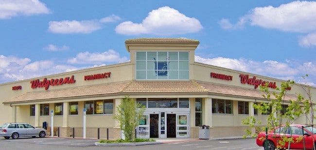
1990 Mccrays Mill Rd
206-12-03-015
TRACTS A PB 2004-523 1.76 AC PB88-27 Z31-66
Storebuilding
Sumter
B-1
South Carolina
B and X Area of moderate flood hazard, usually the area between the limits of the 100-year and 500-year floods.
1.76 AC
2023
Orangeburg/Sumter
2025
Other Market Areas
001704
Sumter, SC
14,523 SF
NEARBY LISTINGS FOR SALE OR LEASE
DEMOGRAPHICS near 1990 Mccrays Mill Rd
1 mile
3 mile
5 mile
2024 Total Population
4,224
35,494
60,292
2029 Population
4,161
35,133
59,818
Pop Growth 2024-2029
(1.49%)
(1.02%)
(0.79%)
Average Age
41
41
40
2024 Total Households
1,743
14,601
24,433
HH Growth 2024-2029
(1.32%)
(0.88%)
(0.69%)
Median Household Inc
$59,712
$55,944
$56,510
Avg Household Size
2.40
2.30
2.40
2024 Avg HH Vehicles
2.00
2.00
2.00
Median Home Value
$206,531
$204,019
$202,812
Median Year Built
1984
1981
1983
Nearby Places
Map Layers
Map Styles
 Street
 Aerial
Transit
 Traffic
 Biking
Places
Listings with unknown addresses are not visible on the map
- Restaurants
- Banks
- Shops
- Fitness
- Groceries
SALE & LEASE HISTORY
LISTING DATE
SALE/LEASE

Sep 24, 2016
For Sale
Sep 23, 2016
For Sale
May 10, 2022
For Sale
Jun 22, 2020
For Sale
Aug 09, 2022
For Sale
Nearby Properties
Address
Land Use
TOTAL SIZE
Lot Size
Zoning
Address
Land Use
TOTAL SIZE
Lot Size
Zoning
65,367 SF
11.59 AC
COMM
Address
Land Use
TOTAL SIZE
Lot Size
Zoning
1 SF
126.83 AC
Address
Land Use
TOTAL SIZE
Lot Size
Zoning
172,485 SF
29.12 AC
COMM
Address
Land Use
TOTAL SIZE
Lot Size
Zoning
1 SF
572.52 AC
GC
Address
Land Use
TOTAL SIZE
Lot Size
Zoning
91,066 SF
17.76 AC
Address
Land Use
TOTAL SIZE
Lot Size
Zoning
54,133 SF
8.72 AC
Address
Land Use
TOTAL SIZE
Lot Size
Zoning
121,695 SF
14.82 AC
COMM
Address
Land Use
TOTAL SIZE
Lot Size
Zoning
27,515 SF
8.57 AC
R
Address
Land Use
TOTAL SIZE
Lot Size
Zoning
85,300 SF
8.25 AC
Address
Land Use
TOTAL SIZE
Lot Size
Zoning
39,234 SF
9.40 AC
G-C
Address
Land Use
TOTAL SIZE
Lot Size
Zoning
82,571 SF
18 AC
Address
Land Use
TOTAL SIZE
Lot Size
Zoning
29,902 SF
40.86 AC
Address
Land Use
TOTAL SIZE
Lot Size
Zoning
129,767 SF
28 AC
Address
Land Use
TOTAL SIZE
Lot Size
Zoning
75,615 SF
15 AC
R
Address
Land Use
TOTAL SIZE
Lot Size
Zoning
46,959 SF
4.43 AC
G-C
Address
Land Use
TOTAL SIZE
Lot Size
Zoning
49,894 SF
5.01 AC
Address
Land Use
TOTAL SIZE
Lot Size
Zoning
56,294 SF
31.71 AC
R-6
Address
Land Use
TOTAL SIZE
Lot Size
Zoning
15,666 SF
2.80 AC
COMM
Address
Land Use
TOTAL SIZE
Lot Size
Zoning
78,026 SF
18.31 AC
Address
Land Use
TOTAL SIZE
Lot Size
Zoning
1 SF
19.98 AC
Address
Land Use
TOTAL SIZE
Lot Size
Zoning
9,896 SF
1.66 AC
COMM
Address
Land Use
TOTAL SIZE
Lot Size
Zoning
25,333 SF
3.72 AC
COMM
Address
Land Use
TOTAL SIZE
Lot Size
Zoning
1 SF
2.17 AC
CBD
Address
Land Use
TOTAL SIZE
Lot Size
Zoning
1 SF
32.43 AC
Address
Land Use
TOTAL SIZE
Lot Size
Zoning
29,920 SF
5 AC
R
Address
Land Use
TOTAL SIZE
Lot Size
Zoning
46,432 SF
7.59 AC
GC
Address
Land Use
TOTAL SIZE
Lot Size
Zoning
28,919 SF
14.40 AC
R-15
Address
Land Use
TOTAL SIZE
Lot Size
Zoning
17,754 SF
2.87 AC
G-C
Address
Land Use
TOTAL SIZE
Lot Size
Zoning
12,096 SF
4.57 AC
GC
Address
Land Use
TOTAL SIZE
Lot Size
Zoning
10,786 SF
1.82 AC
PO
The World's #1 Commercial Real Estate Marketplace
Connect with us
© 2026 CoStar Group
The information above has been obtained from sources believed reliable. While we do not doubt its accuracy we have not verified it and make no guarantee, warranty or representation about it. It is your responsibility to independently confirm its accuracy and completeness. Any projections, opinions, assumptions, or estimates used are for example only and do not represent the current or future performance of the property. The value of this transaction to you depends on tax and other factors which should be evaluated by your tax, financial, and legal advisors. You and your advisors should conduct a careful, independent investigation of the property to determine to your satisfaction the suitability of the property for your needs.