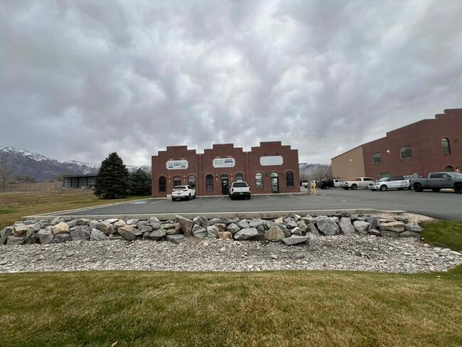
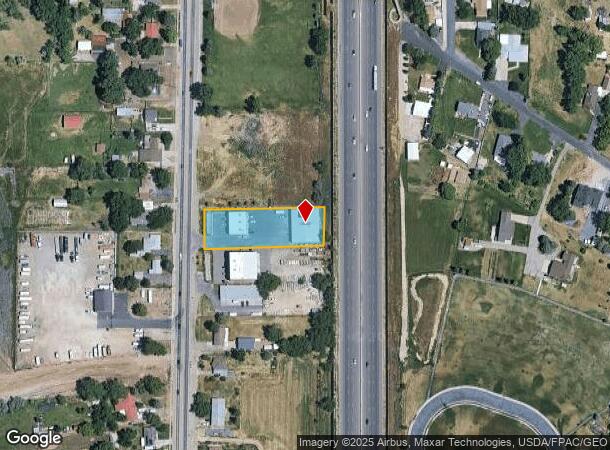
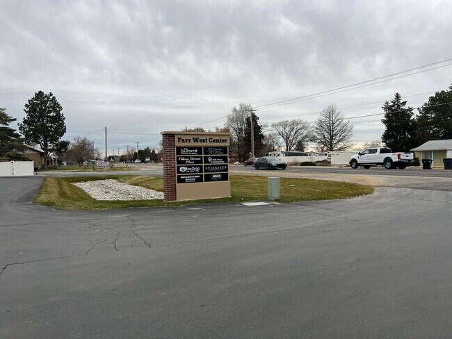
Property Record
1990 N 2000 W, Ogden, UT 84404

NEARBY LISTINGS FOR SALE OR LEASE
Property Detail
1990 N 2000 W
Ogden, UT
U S Survey
19-040-0054
PART OF THE SOUTHEAST QUARTER OF SECTION 35, TOWNSHIP 7 NORTH RANGE 2 WEST, SALT LAKE MERIDIAN, U.S. SURVEY: BEGINNING AT
Publicstorage
Weber
X
Utah
49057C0200F
4
2025
0.93 AC
2025
Davis North
210406
Salt Lake City
16,000 SF
DEMOGRAPHICS near 1990 N 2000 W
1 Mile
3 Mile
5 Mile
2024 Total Population
2,820
37,090
99,243
2029 Population
3,028
40,140
107,024
Pop Growth 2024-2029
+ 7.38%
+ 8.22%
+ 7.84%
Average Age
36
35
36
2024 Total Households
821
11,545
32,056
HH Growth 2024-2029
+ 7.55%
+ 8.37%
+ 8.03%
Median Household Inc
$126,336
$94,448
$78,794
Avg Household Size
3.50
3.20
3.00
2024 Avg HH Vehicles
3.00
2.00
2.00
Median Home Value
$477,990
$440,473
$382,166
Median Year Built
2003
2003
1994
Nearby Places
Map Layers
Map Styles
 Street
 Aerial
- Restaurants
- Banks
- Shops
- Fitness
- Groceries
PUBLIC TRANSPORTATION
COMMUTER RAIL
Ogden (FrontRunner North - Utah Transit Authority (UTA))
DRIVE
WALK
Distance
Ogden (FrontRunner North - Utah Transit Authority (UTA))
12 min
7.1 mi
Roy (FrontRunner North - Utah Transit Authority (UTA))
DRIVE
WALK
Distance
Roy (FrontRunner North - Utah Transit Authority (UTA))
14 min
8.0 mi
Freight Ports
Port of Stockton
DRIVE
WALK
Distance
Port of Stockton
753 min
734.2 mi
SALE & LEASE HISTORY
LISTING DATE
SALE/LEASE

Sep 25, 2016
For Lease
Jan 30, 2018
For Lease
Dec 10, 2020
For Lease
Nearby Properties
Address
Land Use
TOTAL SIZE
Lot Size
Zoning
Address
Land Use
TOTAL SIZE
Lot Size
Zoning
1,154,674 SF
133.48 AC
Address
Land Use
TOTAL SIZE
Lot Size
Zoning
1,001,933 SF
40.73 AC
Address
Land Use
TOTAL SIZE
Lot Size
Zoning
111,832 SF
24.92 AC
Address
Land Use
TOTAL SIZE
Lot Size
Zoning
104,868 SF
22.96 AC
Address
Land Use
TOTAL SIZE
Lot Size
Zoning
292,940 SF
17.83 AC
Address
Land Use
TOTAL SIZE
Lot Size
Zoning
108,917 SF
13.90 AC
Address
Land Use
TOTAL SIZE
Lot Size
Zoning
183,172 SF
47.62 AC
Address
Land Use
TOTAL SIZE
Lot Size
Zoning
292,900 SF
14.54 AC
Address
Land Use
TOTAL SIZE
Lot Size
Zoning
264,373 SF
13.52 AC
Address
Land Use
TOTAL SIZE
Lot Size
Zoning
596 SF
8.08 AC
Address
Land Use
TOTAL SIZE
Lot Size
Zoning
1,840 SF
127.86 AC
Address
Land Use
TOTAL SIZE
Lot Size
Zoning
247,962 SF
19.14 AC
Address
Land Use
TOTAL SIZE
Lot Size
Zoning
7,632 SF
6.87 AC
Address
Land Use
TOTAL SIZE
Lot Size
Zoning
228,832 SF
4.61 AC
Address
Land Use
TOTAL SIZE
Lot Size
Zoning
298,546 SF
12.66 AC
Address
Land Use
TOTAL SIZE
Lot Size
Zoning
296,653 SF
11.45 AC
Address
Land Use
TOTAL SIZE
Lot Size
Zoning
26,418 SF
9.81 AC
Address
Land Use
TOTAL SIZE
Lot Size
Zoning
45,534 SF
7.07 AC
Address
Land Use
TOTAL SIZE
Lot Size
Zoning
178,655 SF
11.61 AC
Address
Land Use
TOTAL SIZE
Lot Size
Zoning
21,756 SF
2.32 AC
Address
Land Use
TOTAL SIZE
Lot Size
Zoning
102,522 SF
13.14 AC
Address
Land Use
TOTAL SIZE
Lot Size
Zoning
130,740 SF
21.64 AC
Address
Land Use
TOTAL SIZE
Lot Size
Zoning
219,240 SF
10.23 AC
Address
Land Use
TOTAL SIZE
Lot Size
Zoning
164,694 SF
10 AC
Address
Land Use
TOTAL SIZE
Lot Size
Zoning
43,946 SF
5.83 AC
The World's #1 Commercial Real Estate Marketplace
Connect with us
© 2026 CoStar Group
The information above has been obtained from sources believed reliable. While we do not doubt its accuracy we have not verified it and make no guarantee, warranty or representation about it. It is your responsibility to independently confirm its accuracy and completeness. Any projections, opinions, assumptions, or estimates used are for example only and do not represent the current or future performance of the property. The value of this transaction to you depends on tax and other factors which should be evaluated by your tax, financial, and legal advisors. You and your advisors should conduct a careful, independent investigation of the property to determine to your satisfaction the suitability of the property for your needs.