Property Record
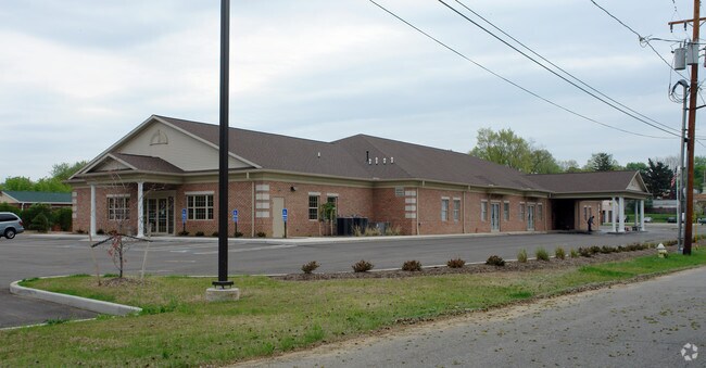
1990 S Main St, Akron, OH 44301


Property Detail
1990 S Main St
Akron, OH
TR 10 LOT 16 W OF S MAIN ST N OF W DRESDEN AVE
68-61391
Summit
Funeralhome
Ohio
B and X Area of moderate flood hazard, usually the area between the limits of the 100-year and 500-year floods.
16
2023
2.13 AC
2025
Akron
505900
Cleveland
12,518 SF
NEARBY LISTINGS FOR SALE OR LEASE
DEMOGRAPHICS near 1990 S Main St
1 mile
3 mile
5 mile
2025 Total Population
7,972
77,660
182,367
2030 Population
7,919
78,184
183,399
Pop Growth 2025-2030
(0.66%)
+ 0.67%
+ 0.57%
Average Age
41
39
40
2025 Total Households
3,544
33,249
78,646
HH Growth 2025-2030
(0.76%)
+ 0.61%
+ 0.53%
Median Household Inc
$52,613
$44,949
$47,257
Avg Household Size
2.20
2.20
2.20
2025 Avg HH Vehicles
2.00
2.00
2.00
Median Home Value
$128,904
$110,641
$130,371
Median Year Built
1949
1952
1953
Nearby Places
Map Layers
Map Styles
 Street
 Aerial
Transit
 Traffic
 Biking
Places
Listings with unknown addresses are not visible on the map
- Restaurants
- Banks
- Shops
- Fitness
- Groceries
PUBLIC TRANSPORTATION
COMMUTER RAIL
Akron Northside (National Park Scenic Railway - Cuyahoga Valley Scenic Railroad)
Drive
Walk
Distance
Akron Northside (National Park Scenic Railway - Cuyahoga Valley Scenic Railroad)
11 min
4.4 mi
Big Bend (National Park Scenic Railway - Cuyahoga Valley Scenic Railroad)
Drive
Walk
Distance
Big Bend (National Park Scenic Railway - Cuyahoga Valley Scenic Railroad)
17 min
7.5 mi
AIRPORT
Akron-Canton Regional
Drive
Walk
Distance
Akron-Canton Regional
15 min
11.5 mi
Freight Ports
Port of Toledo
Drive
Walk
Distance
Port of Toledo
163 min
138.2 mi
Nearby Properties
Address
Land Use
TOTAL SIZE
Lot Size
Zoning
Address
Land Use
TOTAL SIZE
Lot Size
Zoning
225,751 SF
0.16 AC
Address
Land Use
TOTAL SIZE
Lot Size
Zoning
203,458 SF
10.41 AC
Address
Land Use
TOTAL SIZE
Lot Size
Zoning
9.19 AC
Address
Land Use
TOTAL SIZE
Lot Size
Zoning
Address
Land Use
TOTAL SIZE
Lot Size
Zoning
257,958 SF
4.64 AC
Address
Land Use
TOTAL SIZE
Lot Size
Zoning
91,678 SF
5.24 AC
Address
Land Use
TOTAL SIZE
Lot Size
Zoning
423,125 SF
5.57 AC
Address
Land Use
TOTAL SIZE
Lot Size
Zoning
57,369 SF
93.97 AC
Address
Land Use
TOTAL SIZE
Lot Size
Zoning
3.16 AC
Address
Land Use
TOTAL SIZE
Lot Size
Zoning
227,634 SF
21.46 AC
Address
Land Use
TOTAL SIZE
Lot Size
Zoning
248,793 SF
0.27 AC
Address
Land Use
TOTAL SIZE
Lot Size
Zoning
2.20 AC
Address
Land Use
TOTAL SIZE
Lot Size
Zoning
184,791 SF
3.25 AC
Address
Land Use
TOTAL SIZE
Lot Size
Zoning
154,926 SF
12.38 AC
Address
Land Use
TOTAL SIZE
Lot Size
Zoning
127,297 SF
6.03 AC
Address
Land Use
TOTAL SIZE
Lot Size
Zoning
89,642 SF
0.69 AC
Address
Land Use
TOTAL SIZE
Lot Size
Zoning
196,767 SF
37.16 AC
Address
Land Use
TOTAL SIZE
Lot Size
Zoning
Address
Land Use
TOTAL SIZE
Lot Size
Zoning
99,003 SF
20.10 AC
Address
Land Use
TOTAL SIZE
Lot Size
Zoning
270,860 SF
131.89 AC
Address
Land Use
TOTAL SIZE
Lot Size
Zoning
121,006 SF
6.09 AC
Address
Land Use
TOTAL SIZE
Lot Size
Zoning
22,977 SF
263.47 AC
Address
Land Use
TOTAL SIZE
Lot Size
Zoning
57,180 SF
6.67 AC
Address
Land Use
TOTAL SIZE
Lot Size
Zoning
49,278 SF
1.25 AC
Address
Land Use
TOTAL SIZE
Lot Size
Zoning
Address
Land Use
TOTAL SIZE
Lot Size
Zoning
148.10 AC
Address
Land Use
TOTAL SIZE
Lot Size
Zoning
51,520 SF
2.70 AC
Address
Land Use
TOTAL SIZE
Lot Size
Zoning
52,640 SF
0.42 AC
Address
Land Use
TOTAL SIZE
Lot Size
Zoning
126,708 SF
3.26 AC
Address
Land Use
TOTAL SIZE
Lot Size
Zoning
203,059 SF
55.62 AC
The World's #1 Commercial Real Estate Marketplace
Connect with us
© 2026 CoStar Group
The information above has been obtained from sources believed reliable. While we do not doubt its accuracy we have not verified it and make no guarantee, warranty or representation about it. It is your responsibility to independently confirm its accuracy and completeness. Any projections, opinions, assumptions, or estimates used are for example only and do not represent the current or future performance of the property. The value of this transaction to you depends on tax and other factors which should be evaluated by your tax, financial, and legal advisors. You and your advisors should conduct a careful, independent investigation of the property to determine to your satisfaction the suitability of the property for your needs.