Property Record
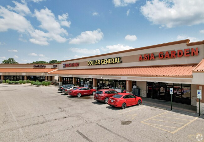
1990 Vandalia St, Collinsville, IL 62234


NEARBY LISTINGS FOR SALE OR LEASE
Property Detail
1990 Vandalia St
St. Louis
The Orchards Shopping Center Subd
St. Louis, MO-IL
THE ORCHARDS SHOPPING CENTER SUBDIVISION NORTH PART OUTLOT A 48.60 X 579.38 IRREGULAR
132212212203024
Madison
Storebuilding
Illinois
2024
a
2024
0.65 AC
403300
Metro East Illinois
45,334 SF
DEMOGRAPHICS near 1990 Vandalia St
1 Mile
3 Mile
5 Mile
2024 Total Population
6,399
30,983
57,501
2029 Population
6,293
30,551
56,718
Pop Growth 2024-2029
(1.66%)
(1.39%)
(1.36%)
Average Age
43
42
41
2024 Total Households
2,848
13,316
23,725
HH Growth 2024-2029
(1.65%)
(1.43%)
(1.38%)
Median Household Inc
$62,143
$69,480
$74,435
Avg Household Size
2.20
2.30
2.40
2024 Avg HH Vehicles
2.00
2.00
2.00
Median Home Value
$157,373
$163,039
$176,357
Median Year Built
1976
1975
1979
Nearby Places
Map Layers
Map Styles
 Street
 Aerial
- Restaurants
- Banks
- Shops
- Fitness
- Groceries
PUBLIC TRANSPORTATION
AIRPORT
Scott AFB/Midamerica St Louis
DRIVE
WALK
Distance
Scott AFB/Midamerica St Louis
34 min
20.1 mi
St Louis Lambert International
DRIVE
WALK
Distance
St Louis Lambert International
40 min
28.3 mi
SALE & LEASE HISTORY
LISTING DATE
SALE/LEASE

Sep 25, 2016
For Lease
Nov 21, 2017
For Lease
Jul 28, 2017
For Lease
Jan 25, 2021
For Lease
Feb 23, 2022
For Lease
Feb 08, 2022
For Sale
Aug 07, 2017
For Lease
Nearby Properties
Address
Land Use
TOTAL SIZE
Lot Size
Zoning
Address
Land Use
TOTAL SIZE
Lot Size
Zoning
148,997 SF
10 AC
Address
Land Use
TOTAL SIZE
Lot Size
Zoning
131,296 SF
14.60 AC
Address
Land Use
TOTAL SIZE
Lot Size
Zoning
5,280 SF
3.69 AC
Address
Land Use
TOTAL SIZE
Lot Size
Zoning
54,699 SF
2.20 AC
Address
Land Use
TOTAL SIZE
Lot Size
Zoning
12,900 SF
5.76 AC
Address
Land Use
TOTAL SIZE
Lot Size
Zoning
57,825 SF
2.68 AC
Address
Land Use
TOTAL SIZE
Lot Size
Zoning
35,046 SF
6.82 AC
Address
Land Use
TOTAL SIZE
Lot Size
Zoning
3,868 SF
0.22 AC
Address
Land Use
TOTAL SIZE
Lot Size
Zoning
40,168 SF
1.08 AC
Address
Land Use
TOTAL SIZE
Lot Size
Zoning
40,430 SF
Address
Land Use
TOTAL SIZE
Lot Size
Zoning
84,816 SF
0.89 AC
Address
Land Use
TOTAL SIZE
Lot Size
Zoning
Address
Land Use
TOTAL SIZE
Lot Size
Zoning
756 SF
8.77 AC
Address
Land Use
TOTAL SIZE
Lot Size
Zoning
26,408 SF
2.94 AC
Address
Land Use
TOTAL SIZE
Lot Size
Zoning
35,940 SF
1.50 AC
Address
Land Use
TOTAL SIZE
Lot Size
Zoning
50,400 SF
6.67 AC
Address
Land Use
TOTAL SIZE
Lot Size
Zoning
5,475 SF
2.91 AC
Address
Land Use
TOTAL SIZE
Lot Size
Zoning
5,280 SF
2.72 AC
Address
Land Use
TOTAL SIZE
Lot Size
Zoning
64,411 SF
1.80 AC
Address
Land Use
TOTAL SIZE
Lot Size
Zoning
40,176 SF
7.44 AC
Address
Land Use
TOTAL SIZE
Lot Size
Zoning
39,750 SF
3.90 AC
Address
Land Use
TOTAL SIZE
Lot Size
Zoning
31,024 SF
11.62 AC
Address
Land Use
TOTAL SIZE
Lot Size
Zoning
31,041 SF
1.62 AC
Address
Land Use
TOTAL SIZE
Lot Size
Zoning
9,904 SF
5.50 AC
Address
Land Use
TOTAL SIZE
Lot Size
Zoning
35,900 SF
3.28 AC
Address
Land Use
TOTAL SIZE
Lot Size
Zoning
40,994 SF
4 AC
Address
Land Use
TOTAL SIZE
Lot Size
Zoning
30,670 SF
2.36 AC
Address
Land Use
TOTAL SIZE
Lot Size
Zoning
19,619 SF
1.43 AC
Address
Land Use
TOTAL SIZE
Lot Size
Zoning
7,929 SF
25.01 AC
The World's #1 Commercial Real Estate Marketplace
Connect with us
© 2026 CoStar Group
The information above has been obtained from sources believed reliable. While we do not doubt its accuracy we have not verified it and make no guarantee, warranty or representation about it. It is your responsibility to independently confirm its accuracy and completeness. Any projections, opinions, assumptions, or estimates used are for example only and do not represent the current or future performance of the property. The value of this transaction to you depends on tax and other factors which should be evaluated by your tax, financial, and legal advisors. You and your advisors should conduct a careful, independent investigation of the property to determine to your satisfaction the suitability of the property for your needs.