Property Record
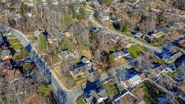
1990 Wolfangel Rd, Cincinnati, OH 45255

Property Detail
1990 Wolfangel Rd
Cincinnati, OH-KY-IN
WOLFANGEL RD 50 X 170 LOT 136 FOREST PK SUB
500-0201-0144
HAMILTON
Residentialacreage
Ohio
B and X Area of moderate flood hazard, usually the area between the limits of the 100-year and 500-year floods.
136
2025
0.21 AC
2025
Forestville
025102
Cincinnati/Dayton
NEARBY LISTINGS FOR SALE OR LEASE
-
-
View all Cincinnati listings for sale on LoopNet.com
DEMOGRAPHICS near 1990 Wolfangel Rd
1 mile
3 mile
5 mile
2025 Total Population
9,970
59,255
101,325
2030 Population
10,068
59,439
102,327
Pop Growth 2025-2030
+ 0.98%
+ 0.31%
+ 0.99%
Average Age
42
41
41
2025 Total Households
4,037
23,761
41,643
HH Growth 2025-2030
+ 1.07%
+ 0.46%
+ 1.21%
Median Household Inc
$94,518
$95,156
$85,746
Avg Household Size
2.40
2.40
2.40
2025 Avg HH Vehicles
2.00
2.00
2.00
Median Home Value
$307,725
$311,471
$299,999
Median Year Built
1980
1975
1976
Nearby Places
Map Layers
Map Styles
 Street
 Aerial
Transit
 Traffic
 Biking
Places
Listings with unknown addresses are not visible on the map
- Restaurants
- Banks
- Shops
- Fitness
- Groceries
PUBLIC TRANSPORTATION
AIRPORT
Cincinnati/Northern Kentucky International
Drive
Walk
Distance
Cincinnati/Northern Kentucky International
38 min
22.9 mi
Freight Ports
Port of Toledo
Drive
Walk
Distance
Port of Toledo
254 min
214.8 mi
SALE & LEASE HISTORY
LISTING DATE
SALE/LEASE

Dec 01, 2023
For Sale
Nearby Properties
Address
Land Use
TOTAL SIZE
Lot Size
Zoning
Address
Land Use
TOTAL SIZE
Lot Size
Zoning
26.42 AC
Address
Land Use
TOTAL SIZE
Lot Size
Zoning
12.46 AC
Address
Land Use
TOTAL SIZE
Lot Size
Zoning
3.87 AC
Address
Land Use
TOTAL SIZE
Lot Size
Zoning
25.31 AC
Address
Land Use
TOTAL SIZE
Lot Size
Zoning
25.27 AC
Address
Land Use
TOTAL SIZE
Lot Size
Zoning
11.96 AC
Address
Land Use
TOTAL SIZE
Lot Size
Zoning
5.09 AC
Address
Land Use
TOTAL SIZE
Lot Size
Zoning
36.96 AC
Address
Land Use
TOTAL SIZE
Lot Size
Zoning
12,505 SF
37.33 AC
SF6
Address
Land Use
TOTAL SIZE
Lot Size
Zoning
20.38 AC
Address
Land Use
TOTAL SIZE
Lot Size
Zoning
16.77 AC
Address
Land Use
TOTAL SIZE
Lot Size
Zoning
1,680 SF
13.55 AC
Address
Land Use
TOTAL SIZE
Lot Size
Zoning
72,272 SF
20.31 AC
Address
Land Use
TOTAL SIZE
Lot Size
Zoning
8.99 AC
Address
Land Use
TOTAL SIZE
Lot Size
Zoning
1,134,029 SF
229.73 AC
Address
Land Use
TOTAL SIZE
Lot Size
Zoning
8.98 AC
SF6
Address
Land Use
TOTAL SIZE
Lot Size
Zoning
21.90 AC
SF6
Address
Land Use
TOTAL SIZE
Lot Size
Zoning
7.49 AC
Address
Land Use
TOTAL SIZE
Lot Size
Zoning
14.12 AC
Address
Land Use
TOTAL SIZE
Lot Size
Zoning
12,000 SF
22.66 AC
Address
Land Use
TOTAL SIZE
Lot Size
Zoning
28.27 AC
Address
Land Use
TOTAL SIZE
Lot Size
Zoning
25.59 AC
Address
Land Use
TOTAL SIZE
Lot Size
Zoning
6.55 AC
Address
Land Use
TOTAL SIZE
Lot Size
Zoning
55,848 SF
12.51 AC
Address
Land Use
TOTAL SIZE
Lot Size
Zoning
9,088 SF
42.09 AC
Address
Land Use
TOTAL SIZE
Lot Size
Zoning
50,212 SF
10.61 AC
Address
Land Use
TOTAL SIZE
Lot Size
Zoning
14.17 AC
Address
Land Use
TOTAL SIZE
Lot Size
Zoning
Address
Land Use
TOTAL SIZE
Lot Size
Zoning
3,803 SF
21.34 AC
Address
Land Use
TOTAL SIZE
Lot Size
Zoning
The World's #1 Commercial Real Estate Marketplace
Connect with us
© 2026 CoStar Group
The information above has been obtained from sources believed reliable. While we do not doubt its accuracy we have not verified it and make no guarantee, warranty or representation about it. It is your responsibility to independently confirm its accuracy and completeness. Any projections, opinions, assumptions, or estimates used are for example only and do not represent the current or future performance of the property. The value of this transaction to you depends on tax and other factors which should be evaluated by your tax, financial, and legal advisors. You and your advisors should conduct a careful, independent investigation of the property to determine to your satisfaction the suitability of the property for your needs.