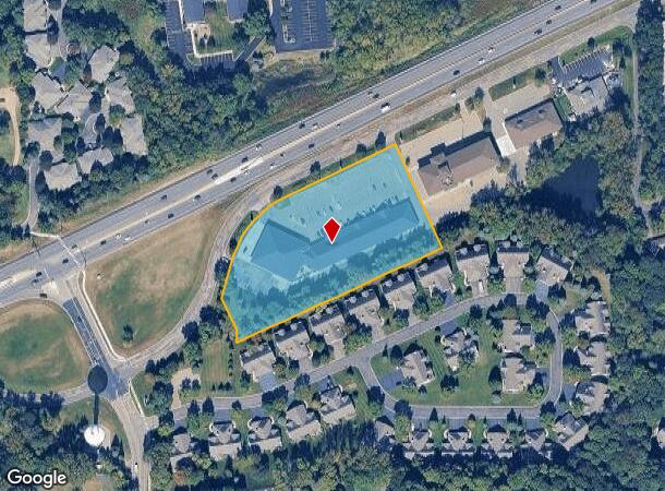
Property Record
19905 Highway 7, Excelsior, MN 55331


NEARBY LISTINGS FOR SALE OR LEASE
Property Detail
19905 Highway 7
Minneapolis-St. Paul-Bloomington, MN-WI
Waterford 6Th Addn
25-117-23-43-0064
LOT 001 BLOCK 001 T WATERFORD 6TH ADDN N 625X291X577X123
Commercialnec
Hennepin
X
Minnesota
27019C0116D
1
2024
3.41 AC
2024
Ridgedale
027504
Minneapolis/St Paul
DEMOGRAPHICS near 19905 Highway 7
1 Mile
3 Mile
5 Mile
2024 Total Population
4,843
43,165
101,401
2029 Population
4,753
43,152
101,840
Pop Growth 2024-2029
(1.86%)
(0.03%)
+ 0.43%
Average Age
43
43
43
2024 Total Households
1,851
16,371
39,676
HH Growth 2024-2029
(2.00%)
(0.15%)
+ 0.34%
Median Household Inc
$136,538
$132,505
$124,103
Avg Household Size
2.50
2.60
2.50
2024 Avg HH Vehicles
2.00
2.00
2.00
Median Home Value
$573,964
$472,595
$479,130
Median Year Built
1980
1980
1983
Nearby Places
Map Layers
Map Styles
 Street
 Aerial
- Restaurants
- Banks
- Shops
- Fitness
- Groceries
PUBLIC TRANSPORTATION
AIRPORT
Minneapolis-St Paul International/Wold-Chamberlain
DRIVE
WALK
Distance
Minneapolis-St Paul International/Wold-Chamberlain
30 min
20.4 mi
Freight Ports
Port Milwaukee
DRIVE
WALK
Distance
Port Milwaukee
398 min
354.1 mi
SALE & LEASE HISTORY
LISTING DATE
SALE/LEASE

Oct 29, 2019
For Lease
May 27, 2020
For Lease
Dec 15, 2016
For Lease
Nearby Properties
Address
Land Use
TOTAL SIZE
Lot Size
Zoning
Address
Land Use
TOTAL SIZE
Lot Size
Zoning
4.32 AC
Address
Land Use
TOTAL SIZE
Lot Size
Zoning
122,807 SF
30.62 AC
Address
Land Use
TOTAL SIZE
Lot Size
Zoning
3,073 SF
155.36 AC
Address
Land Use
TOTAL SIZE
Lot Size
Zoning
3.82 AC
Address
Land Use
TOTAL SIZE
Lot Size
Zoning
7,209 SF
2.53 AC
B1
Address
Land Use
TOTAL SIZE
Lot Size
Zoning
1.85 AC
Address
Land Use
TOTAL SIZE
Lot Size
Zoning
29,091 SF
34.94 AC
PUD
Address
Land Use
TOTAL SIZE
Lot Size
Zoning
7.82 AC
R4
Address
Land Use
TOTAL SIZE
Lot Size
Zoning
17.67 AC
R4
Address
Land Use
TOTAL SIZE
Lot Size
Zoning
9.29 AC
R4
Address
Land Use
TOTAL SIZE
Lot Size
Zoning
88,948 SF
10.14 AC
B2
Address
Land Use
TOTAL SIZE
Lot Size
Zoning
14.04 AC
R4
Address
Land Use
TOTAL SIZE
Lot Size
Zoning
38,825 SF
5.38 AC
B3
Address
Land Use
TOTAL SIZE
Lot Size
Zoning
1,000 SF
14 AC
Address
Land Use
TOTAL SIZE
Lot Size
Zoning
Address
Land Use
TOTAL SIZE
Lot Size
Zoning
Address
Land Use
TOTAL SIZE
Lot Size
Zoning
1.67 AC
Address
Land Use
TOTAL SIZE
Lot Size
Zoning
69,144 SF
13.98 AC
Address
Land Use
TOTAL SIZE
Lot Size
Zoning
123,472 SF
9.07 AC
B2
Address
Land Use
TOTAL SIZE
Lot Size
Zoning
6.52 AC
Address
Land Use
TOTAL SIZE
Lot Size
Zoning
3.20 AC
Address
Land Use
TOTAL SIZE
Lot Size
Zoning
5.68 AC
Address
Land Use
TOTAL SIZE
Lot Size
Zoning
28,134 SF
2.70 AC
PUD
Address
Land Use
TOTAL SIZE
Lot Size
Zoning
62,862 SF
7.91 AC
B2
Address
Land Use
TOTAL SIZE
Lot Size
Zoning
21,208 SF
3.59 AC
B1
Address
Land Use
TOTAL SIZE
Lot Size
Zoning
5.84 AC
R4
Address
Land Use
TOTAL SIZE
Lot Size
Zoning
16,986 SF
1.77 AC
PUD
Address
Land Use
TOTAL SIZE
Lot Size
Zoning
2.10 AC
Address
Land Use
TOTAL SIZE
Lot Size
Zoning
Address
Land Use
TOTAL SIZE
Lot Size
Zoning
2.60 AC
The World's #1 Commercial Real Estate Marketplace
Connect with us
© 2025 CoStar Group
The information above has been obtained from sources believed reliable. While we do not doubt its accuracy we have not verified it and make no guarantee, warranty or representation about it. It is your responsibility to independently confirm its accuracy and completeness. Any projections, opinions, assumptions, or estimates used are for example only and do not represent the current or future performance of the property. The value of this transaction to you depends on tax and other factors which should be evaluated by your tax, financial, and legal advisors. You and your advisors should conduct a careful, independent investigation of the property to determine to your satisfaction the suitability of the property for your needs.