Property Record
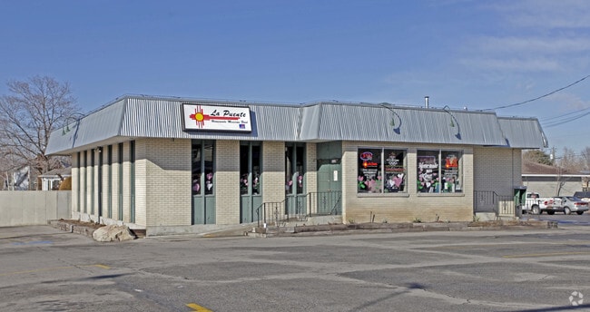
1995 E 3300 S, Millcreek, UT 84106

NEARBY LISTINGS FOR SALE OR LEASE
Property Detail
1995 E 3300 S
16-28-430-033-0000
COM ON N LINE OF 33RD SOUTH ST S 0^04 W 1490.5 FT & N 89^18 W 119 FT FR E 1/4 COR SEC 28 T 1S R 1E SL MER N 89^18 W 60 FT N 0^04 E 165.2 FT M OR L N 89^56 E 60 FT S 0^04 W 169.1 FT TO BEG 0.22 AC
Storebuilding
Salt Lake
X
Utah
49035C0304H
0.19 AC
2024
Central Valley East
2025
Salt Lake City
110300
Salt Lake City-Murray, UT
DEMOGRAPHICS near 1995 E 3300 S
1 Mile
3 Mile
5 Mile
2024 Total Population
16,876
144,267
277,738
2029 Population
16,944
145,541
280,643
Pop Growth 2024-2029
+ 0.40%
+ 0.88%
+ 1.05%
Average Age
38
39
38
2024 Total Households
6,245
57,985
114,729
HH Growth 2024-2029
+ 0.27%
+ 0.89%
+ 1.14%
Median Household Inc
$102,381
$82,510
$71,342
Avg Household Size
2.60
2.40
2.30
2024 Avg HH Vehicles
2.00
2.00
2.00
Median Home Value
$645,914
$583,792
$560,953
Median Year Built
1959
1965
1970
Nearby Places
Map Layers
Map Styles
 Street
 Aerial
- Restaurants
- Banks
- Shops
- Fitness
- Groceries
PUBLIC TRANSPORTATION
AIRPORT
Salt Lake City International
DRIVE
WALK
Distance
Salt Lake City International
19 min
14.1 mi
Freight Ports
Port of Stockton
DRIVE
WALK
Distance
Port of Stockton
720 min
704.5 mi
Nearby Properties
Address
Land Use
TOTAL SIZE
Lot Size
Zoning
Address
Land Use
TOTAL SIZE
Lot Size
Zoning
298,628 SF
27.30 AC
I
Address
Land Use
TOTAL SIZE
Lot Size
Zoning
207,140 SF
23.06 AC
P
Address
Land Use
TOTAL SIZE
Lot Size
Zoning
257,003 SF
25.87 AC
1108
Address
Land Use
TOTAL SIZE
Lot Size
Zoning
691,463 SF
17.80 AC
RM
Address
Land Use
TOTAL SIZE
Lot Size
Zoning
183,600 SF
10.70 AC
RMF-35
Address
Land Use
TOTAL SIZE
Lot Size
Zoning
128,997 SF
3.04 AC
ESN
Address
Land Use
TOTAL SIZE
Lot Size
Zoning
297,476 SF
1.62 AC
CSHBD2
Address
Land Use
TOTAL SIZE
Lot Size
Zoning
302,944 SF
5.47 AC
Address
Land Use
TOTAL SIZE
Lot Size
Zoning
369,717 SF
2.50 AC
RO
Address
Land Use
TOTAL SIZE
Lot Size
Zoning
412,006 SF
1.70 AC
C3
Address
Land Use
TOTAL SIZE
Lot Size
Zoning
369,377 SF
1.65 AC
Address
Land Use
TOTAL SIZE
Lot Size
Zoning
426,600 SF
1.61 AC
CSHBD1
Address
Land Use
TOTAL SIZE
Lot Size
Zoning
903,167 SF
1.90 AC
CSHBD1
Address
Land Use
TOTAL SIZE
Lot Size
Zoning
125,518 SF
11.03 AC
RMZC
Address
Land Use
TOTAL SIZE
Lot Size
Zoning
33,164 SF
6.88 AC
RM
Address
Land Use
TOTAL SIZE
Lot Size
Zoning
107,416 SF
5.46 AC
CSHBD2
Address
Land Use
TOTAL SIZE
Lot Size
Zoning
303,240 SF
29.21 AC
1205
Address
Land Use
TOTAL SIZE
Lot Size
Zoning
299,673 SF
2.16 AC
C3
Address
Land Use
TOTAL SIZE
Lot Size
Zoning
83,204 SF
12.87 AC
RM
Address
Land Use
TOTAL SIZE
Lot Size
Zoning
266,380 SF
2.09 AC
CSHBD1
Address
Land Use
TOTAL SIZE
Lot Size
Zoning
99,702 SF
12.73 AC
R-M
Address
Land Use
TOTAL SIZE
Lot Size
Zoning
84,246 SF
6.51 AC
RM
Address
Land Use
TOTAL SIZE
Lot Size
Zoning
295,307 SF
2.46 AC
C-B
Address
Land Use
TOTAL SIZE
Lot Size
Zoning
386,512 SF
9.66 AC
C-SHDB
Address
Land Use
TOTAL SIZE
Lot Size
Zoning
621,969 SF
10.17 AC
CS
Address
Land Use
TOTAL SIZE
Lot Size
Zoning
256,179 SF
0.87 AC
CSHBD2
Address
Land Use
TOTAL SIZE
Lot Size
Zoning
147,742 SF
1.52 AC
CSH BD
Address
Land Use
TOTAL SIZE
Lot Size
Zoning
63,922 SF
7.96 AC
RM
Address
Land Use
TOTAL SIZE
Lot Size
Zoning
63,922 SF
3 AC
RM
Address
Land Use
TOTAL SIZE
Lot Size
Zoning
433,385 SF
3.64 AC
R/M-U
The World's #1 Commercial Real Estate Marketplace
Connect with us
© 2026 CoStar Group
The information above has been obtained from sources believed reliable. While we do not doubt its accuracy we have not verified it and make no guarantee, warranty or representation about it. It is your responsibility to independently confirm its accuracy and completeness. Any projections, opinions, assumptions, or estimates used are for example only and do not represent the current or future performance of the property. The value of this transaction to you depends on tax and other factors which should be evaluated by your tax, financial, and legal advisors. You and your advisors should conduct a careful, independent investigation of the property to determine to your satisfaction the suitability of the property for your needs.