Property Record
1995 E Chaneyville Rd, Owings, MD 20736
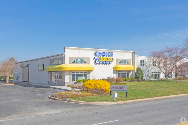

Property Detail
1995 E Chaneyville Rd
03-009459
1 AC E/S RT 4 CHANEYVILLE
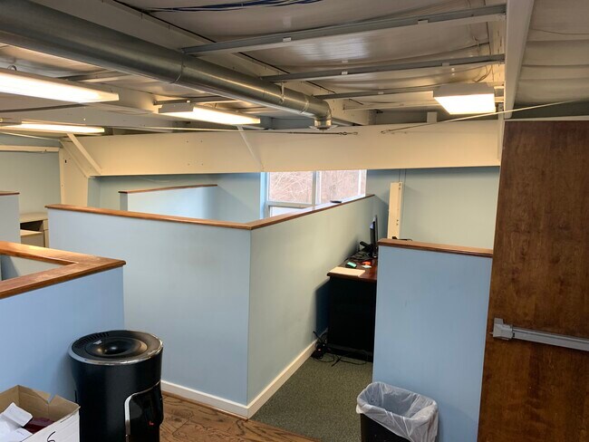
Warehouse
Calvert
RC
Maryland
B and X Area of moderate flood hazard, usually the area between the limits of the 100-year and 500-year floods.
1 AC
2025
Calvert County
2025
Washington, DC
860200
California-Lexington Park, MD
12,320 SF
NEARBY LISTINGS FOR SALE OR LEASE
-
-
View all Owings listings for sale on LoopNet.com
DEMOGRAPHICS near 1995 E Chaneyville Rd
1 mile
3 mile
5 mile
2025 Total Population
1,554
10,152
25,427
2030 Population
1,550
10,120
25,471
Pop Growth 2025-2030
(0.26%)
(0.32%)
+ 0.17%
Average Age
41
42
41
2025 Total Households
497
3,343
8,634
HH Growth 2025-2030
(0.20%)
(0.39%)
+ 0.13%
Median Household Inc
$174,528
$169,760
$157,058
Avg Household Size
3.10
3.00
2.90
2025 Avg HH Vehicles
3.00
3.00
3.00
Median Home Value
$701,897
$666,473
$606,515
Median Year Built
1995
1990
1987
Nearby Places
Map Layers
Map Styles
 Street
 Aerial
Layers
 Traffic
 Biking
Places
Listings with unknown addresses are not visible on the map
- Restaurants
- Banks
- Shops
- Fitness
- Groceries
PUBLIC TRANSPORTATION
AIRPORT
Ronald Reagan Washington Ntl
Drive
Walk
Distance
Ronald Reagan Washington Ntl
53 min
33.3 mi
Baltimore/Washington International Thurgood Marshall
Drive
Walk
Distance
Baltimore/Washington International Thurgood Marshall
64 min
43.0 mi
Freight Ports
Port of Baltimore
Drive
Walk
Distance
Port of Baltimore
70 min
48.3 mi
SALE & LEASE HISTORY
LISTING DATE
SALE/LEASE

Mar 17, 2020
For Lease
Mar 17, 2020
For Sale
Jul 25, 2019
For Sale
Feb 07, 2021
For Sale
Nearby Properties
Address
Land Use
TOTAL SIZE
Lot Size
Zoning
Address
Land Use
TOTAL SIZE
Lot Size
Zoning
18,400 SF
111 AC
RUR
Address
Land Use
TOTAL SIZE
Lot Size
Zoning
3,680 SF
15.01 AC
TC
Address
Land Use
TOTAL SIZE
Lot Size
Zoning
47,434 SF
15.47 AC
TC
Address
Land Use
TOTAL SIZE
Lot Size
Zoning
23,840 SF
58.70 AC
RUR
Address
Land Use
TOTAL SIZE
Lot Size
Zoning
42,078 SF
6.82 AC
TC
Address
Land Use
TOTAL SIZE
Lot Size
Zoning
76,560 SF
13.81 AC
TC
Address
Land Use
TOTAL SIZE
Lot Size
Zoning
12,294 SF
7.88 AC
R-1
Address
Land Use
TOTAL SIZE
Lot Size
Zoning
48,816 SF
4.87 AC
TC
Address
Land Use
TOTAL SIZE
Lot Size
Zoning
44,650 SF
9.36 AC
RUR
Address
Land Use
TOTAL SIZE
Lot Size
Zoning
55,120 SF
15 AC
RUR
Address
Land Use
TOTAL SIZE
Lot Size
Zoning
18,720 SF
9.01 AC
I-1
Address
Land Use
TOTAL SIZE
Lot Size
Zoning
32,360 SF
4.34 AC
TC
Address
Land Use
TOTAL SIZE
Lot Size
Zoning
38,380 SF
8.85 AC
I-1
Address
Land Use
TOTAL SIZE
Lot Size
Zoning
14,046 SF
3.01 AC
TC
Address
Land Use
TOTAL SIZE
Lot Size
Zoning
25,612 SF
3 AC
TC
Address
Land Use
TOTAL SIZE
Lot Size
Zoning
14.86 AC
Address
Land Use
TOTAL SIZE
Lot Size
Zoning
4,252 SF
4.30 AC
TC
Address
Land Use
TOTAL SIZE
Lot Size
Zoning
20,005 SF
4.78 AC
TC
Address
Land Use
TOTAL SIZE
Lot Size
Zoning
22,082 SF
2.96 AC
RC
Address
Land Use
TOTAL SIZE
Lot Size
Zoning
5,468 SF
1.69 AC
TC
Address
Land Use
TOTAL SIZE
Lot Size
Zoning
7,265 SF
2.46 AC
TC
Address
Land Use
TOTAL SIZE
Lot Size
Zoning
13,212 SF
1.69 AC
TC
Address
Land Use
TOTAL SIZE
Lot Size
Zoning
272.95 AC
RUR
Address
Land Use
TOTAL SIZE
Lot Size
Zoning
3,050 SF
1.78 AC
RC
Address
Land Use
TOTAL SIZE
Lot Size
Zoning
13,500 SF
2.75 AC
Address
Land Use
TOTAL SIZE
Lot Size
Zoning
9,072 SF
4.01 AC
TC
Address
Land Use
TOTAL SIZE
Lot Size
Zoning
3,800 SF
81.42 AC
RUR
Address
Land Use
TOTAL SIZE
Lot Size
Zoning
10,698 SF
1.36 AC
RC
Address
Land Use
TOTAL SIZE
Lot Size
Zoning
4,800 SF
1.47 AC
TC
Address
Land Use
TOTAL SIZE
Lot Size
Zoning
26,784 SF
2.60 AC
I-1
The World's #1 Commercial Real Estate Marketplace
Connect with us
© 2026 CoStar Group
The information above has been obtained from sources believed reliable. While we do not doubt its accuracy we have not verified it and make no guarantee, warranty or representation about it. It is your responsibility to independently confirm its accuracy and completeness. Any projections, opinions, assumptions, or estimates used are for example only and do not represent the current or future performance of the property. The value of this transaction to you depends on tax and other factors which should be evaluated by your tax, financial, and legal advisors. You and your advisors should conduct a careful, independent investigation of the property to determine to your satisfaction the suitability of the property for your needs.