Property Record
1995 Route 16, Ossipee, NH 03864


Property Detail
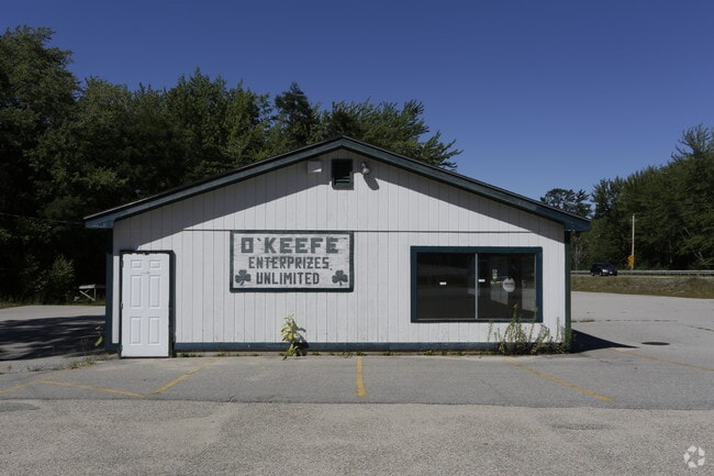
1995 Route 16
Commercialbuilding
CARROLL
RSC
New Hampshire
AE The base floodplain where base flood elevations are provided. AE Zones are now used on new format FIRMs instead of A1-A30 Zones.
24000
2024
0.75 AC
2024
Concord/New Hampshire North Area
955902
Other Market Areas
2,448 SF
OSSI-000027-000000-024000
NEARBY LISTINGS FOR SALE OR LEASE
DEMOGRAPHICS near 1995 Route 16
1 mile
3 mile
5 mile
2025 Total Population
209
2,341
6,518
2030 Population
218
2,494
6,808
Pop Growth 2025-2030
+ 4.31%
+ 6.54%
+ 4.45%
Average Age
46
50
50
2025 Total Households
92
1,121
3,086
HH Growth 2025-2030
+ 5.43%
+ 6.87%
+ 4.86%
Median Household Inc
$65,454
$76,905
$74,071
Avg Household Size
2.10
2.00
2.00
2025 Avg HH Vehicles
2.00
2.00
2.00
Median Home Value
$303,125
$372,244
$388,161
Median Year Built
1982
1984
1984
Nearby Places
Map Layers
Map Styles
 Street
 Aerial
Layers
 Traffic
 Biking
Places
Listings with unknown addresses are not visible on the map
- Restaurants
- Banks
- Shops
- Fitness
- Groceries
SALE & LEASE HISTORY
LISTING DATE
SALE/LEASE

Sep 24, 2016
For Sale
Nearby Properties
Address
Land Use
TOTAL SIZE
Lot Size
Zoning
Address
Land Use
TOTAL SIZE
Lot Size
Zoning
390.81 AC
RUR OS
Address
Land Use
TOTAL SIZE
Lot Size
Zoning
4,197 SF
30.10 AC
OSSIPE
Address
Land Use
TOTAL SIZE
Lot Size
Zoning
1,001 SF
25.80 AC
OSSIPE
Address
Land Use
TOTAL SIZE
Lot Size
Zoning
2,022 SF
51.77 AC
COMMER
Address
Land Use
TOTAL SIZE
Lot Size
Zoning
3,812 SF
10.74 AC
OSSIPE
Address
Land Use
TOTAL SIZE
Lot Size
Zoning
13,017 SF
116.50 AC
GENERA
Address
Land Use
TOTAL SIZE
Lot Size
Zoning
1,111 SF
OSSIPE
Address
Land Use
TOTAL SIZE
Lot Size
Zoning
6,129 SF
29.50 AC
RUR
Address
Land Use
TOTAL SIZE
Lot Size
Zoning
100.08 AC
COM
Address
Land Use
TOTAL SIZE
Lot Size
Zoning
22,103 SF
5.59 AC
COM
Address
Land Use
TOTAL SIZE
Lot Size
Zoning
19,271 SF
8 AC
RSC
Address
Land Use
TOTAL SIZE
Lot Size
Zoning
3,280 SF
12.70 AC
OSSIPE
Address
Land Use
TOTAL SIZE
Lot Size
Zoning
8.80 AC
C/I GR
Address
Land Use
TOTAL SIZE
Lot Size
Zoning
15,257 SF
3.50 AC
RSC
Address
Land Use
TOTAL SIZE
Lot Size
Zoning
6.73 AC
VIL DC
Address
Land Use
TOTAL SIZE
Lot Size
Zoning
26.70 AC
RUR OS
Address
Land Use
TOTAL SIZE
Lot Size
Zoning
11,220 SF
2.40 AC
COM
Address
Land Use
TOTAL SIZE
Lot Size
Zoning
4,577 SF
0.47 AC
OSSIPE
Address
Land Use
TOTAL SIZE
Lot Size
Zoning
3,152 SF
0.50 AC
OSSIPE
Address
Land Use
TOTAL SIZE
Lot Size
Zoning
4,340 SF
0.97 AC
OSSIPE
Address
Land Use
TOTAL SIZE
Lot Size
Zoning
38 AC
TAMWOR
Address
Land Use
TOTAL SIZE
Lot Size
Zoning
2,301 SF
3.06 AC
OSSIPE
Address
Land Use
TOTAL SIZE
Lot Size
Zoning
0.70 AC
RUR OS
Address
Land Use
TOTAL SIZE
Lot Size
Zoning
2,251 SF
0.56 AC
OSSIPE
Address
Land Use
TOTAL SIZE
Lot Size
Zoning
5.60 AC
RSC
Address
Land Use
TOTAL SIZE
Lot Size
Zoning
3,000 SF
5.34 AC
TAMWOR
Address
Land Use
TOTAL SIZE
Lot Size
Zoning
1,826 SF
0.53 AC
OSSIPE
Address
Land Use
TOTAL SIZE
Lot Size
Zoning
1.50 AC
RSC
Address
Land Use
TOTAL SIZE
Lot Size
Zoning
5,089 SF
9.91 AC
TAMWOR
Address
Land Use
TOTAL SIZE
Lot Size
Zoning
6,000 SF
4 AC
TAMWOR
The World's #1 Commercial Real Estate Marketplace
Connect with us
© 2026 CoStar Group
The information above has been obtained from sources believed reliable. While we do not doubt its accuracy we have not verified it and make no guarantee, warranty or representation about it. It is your responsibility to independently confirm its accuracy and completeness. Any projections, opinions, assumptions, or estimates used are for example only and do not represent the current or future performance of the property. The value of this transaction to you depends on tax and other factors which should be evaluated by your tax, financial, and legal advisors. You and your advisors should conduct a careful, independent investigation of the property to determine to your satisfaction the suitability of the property for your needs.