Property Record
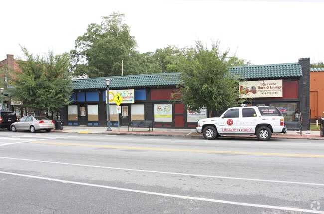
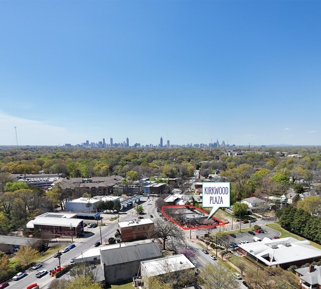
1998 Hosea L Williams Dr Ne, Atlanta, GA 30317


This Property Is For Sale
NEARBY LISTINGS FOR SALE OR LEASE
Property Detail
1998 Hosea L Williams Dr Ne
15-206-01-118
7 X 29 X 129 X 94 X ... .34 AC
Storebuilding
DeKalb
X
Georgia
13089C0064K
11
2025
0.20 AC
2025
Decatur/East Atl
020700
Atlanta
8,055 SF
Atlanta-Sandy Springs-Roswell, GA
DEMOGRAPHICS near 1998 Hosea L Williams Dr Ne
1 Mile
3 Mile
5 Mile
2024 Total Population
15,583
130,146
368,228
2029 Population
15,716
131,605
376,064
Pop Growth 2024-2029
+ 0.85%
+ 1.12%
+ 2.13%
Average Age
37
38
37
2024 Total Households
6,826
60,758
165,361
HH Growth 2024-2029
+ 0.84%
+ 1.37%
+ 2.43%
Median Household Inc
$95,993
$105,848
$82,651
Avg Household Size
2.30
2.10
2.00
2024 Avg HH Vehicles
1.00
2.00
1.00
Median Home Value
$516,624
$506,355
$441,227
Median Year Built
1968
1968
1982
Nearby Places
- Restaurants
- Banks
- Shops
- Fitness
- Groceries
PUBLIC TRANSPORTATION
COMMUTER RAIL
DRIVE
WALK
Distance
15 min
7.6 mi
AIRPORT
Hartsfield - Jackson Atlanta International
DRIVE
WALK
Distance
Hartsfield - Jackson Atlanta International
22 min
13.1 mi
Nearby Properties
Address
Land Use
TOTAL SIZE
Lot Size
Zoning
Address
Land Use
TOTAL SIZE
Lot Size
Zoning
2,283,599 SF
12.93 AC
I1
Address
Land Use
TOTAL SIZE
Lot Size
Zoning
467,847 SF
1.62 AC
I2
Address
Land Use
TOTAL SIZE
Lot Size
Zoning
2,612 SF
137.60 AC
X
Address
Land Use
TOTAL SIZE
Lot Size
Zoning
1,121,700 SF
2.21 AC
I2
Address
Land Use
TOTAL SIZE
Lot Size
Zoning
0.91 AC
I1
Address
Land Use
TOTAL SIZE
Lot Size
Zoning
736,752 SF
3.86 AC
C1
Address
Land Use
TOTAL SIZE
Lot Size
Zoning
543,748 SF
3.86 AC
I2
Address
Land Use
TOTAL SIZE
Lot Size
Zoning
432,056 SF
17.87 AC
C1
Address
Land Use
TOTAL SIZE
Lot Size
Zoning
400,311 SF
4.45 AC
I2
Address
Land Use
TOTAL SIZE
Lot Size
Zoning
123,732 SF
0.51 AC
RM75
Address
Land Use
TOTAL SIZE
Lot Size
Zoning
327,098 SF
4.92 AC
X
Address
Land Use
TOTAL SIZE
Lot Size
Zoning
398,215 SF
3.19 AC
C1
Address
Land Use
TOTAL SIZE
Lot Size
Zoning
99,770 SF
2.14 AC
Address
Land Use
TOTAL SIZE
Lot Size
Zoning
959,348 SF
7.28 AC
PDMU
Address
Land Use
TOTAL SIZE
Lot Size
Zoning
548,615 SF
4.52 AC
I1
Address
Land Use
TOTAL SIZE
Lot Size
Zoning
543,551 SF
5.26 AC
R4
Address
Land Use
TOTAL SIZE
Lot Size
Zoning
290,130 SF
6.13 AC
R100
Address
Land Use
TOTAL SIZE
Lot Size
Zoning
397,758 SF
1.91 AC
I1
Address
Land Use
TOTAL SIZE
Lot Size
Zoning
495,740 SF
2.65 AC
C1
Address
Land Use
TOTAL SIZE
Lot Size
Zoning
566,872 SF
3.31 AC
I1
Address
Land Use
TOTAL SIZE
Lot Size
Zoning
67,882 SF
4.77 AC
X
Address
Land Use
TOTAL SIZE
Lot Size
Zoning
491,862 SF
2.44 AC
R4
Address
Land Use
TOTAL SIZE
Lot Size
Zoning
624,087 SF
4.45 AC
I2
Address
Land Use
TOTAL SIZE
Lot Size
Zoning
9,828 SF
2.46 AC
C1
Address
Land Use
TOTAL SIZE
Lot Size
Zoning
390,107 SF
4.98 AC
C1
Address
Land Use
TOTAL SIZE
Lot Size
Zoning
438,163 SF
4.45 AC
R5
Address
Land Use
TOTAL SIZE
Lot Size
Zoning
363,464 SF
2.92 AC
I2
Address
Land Use
TOTAL SIZE
Lot Size
Zoning
348,894 SF
0.58 AC
I1
Address
Land Use
TOTAL SIZE
Lot Size
Zoning
400,347 SF
3.30 AC
I2
Address
Land Use
TOTAL SIZE
Lot Size
Zoning
334,127 SF
0.01 AC
X
The World's #1 Commercial Real Estate Marketplace
Connect with us
© 2025 CoStar Group
The information above has been obtained from sources believed reliable. While we do not doubt its accuracy we have not verified it and make no guarantee, warranty or representation about it. It is your responsibility to independently confirm its accuracy and completeness. Any projections, opinions, assumptions, or estimates used are for example only and do not represent the current or future performance of the property. The value of this transaction to you depends on tax and other factors which should be evaluated by your tax, financial, and legal advisors. You and your advisors should conduct a careful, independent investigation of the property to determine to your satisfaction the suitability of the property for your needs.