Property Record
19973 College View Dr, Redding, CA 96003


Property Detail
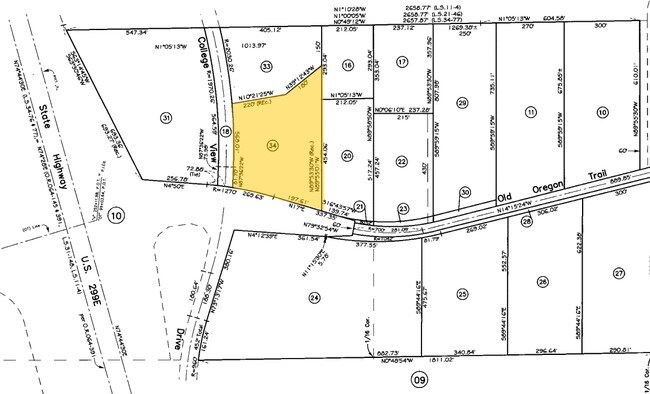
19973 College View Dr
076-110-034-000
PORTION OF PARCEL 1 ; MAP 194-77
Servicestationmarket
Shasta
C-H
California
AE The base floodplain where base flood elevations are provided. AE Zones are now used on new format FIRMs instead of A1-A30 Zones.
3.64 AC
2024
Redding/Chico
2025
Other Market Areas
010804
Redding, CA
5,157 SF
NEARBY LISTINGS FOR SALE OR LEASE
DEMOGRAPHICS near 19973 College View Dr
1 mile
3 mile
5 mile
2025 Total Population
628
24,218
78,762
2030 Population
616
24,207
78,773
Pop Growth 2025-2030
(1.91%)
(0.05%)
+ 0.01%
Average Age
42
41
41
2025 Total Households
233
9,745
31,923
HH Growth 2025-2030
(2.15%)
(0.08%)
+ 0.04%
Median Household Inc
$88,793
$81,996
$73,517
Avg Household Size
2.60
2.40
2.40
2025 Avg HH Vehicles
2.00
2.00
2.00
Median Home Value
$525,000
$424,984
$358,182
Median Year Built
1994
1990
1983
Nearby Places
Map Layers
Map Styles
 Street
 Aerial
Layers
 Traffic
 Biking
Places
Listings with unknown addresses are not visible on the map
- Restaurants
- Banks
- Shops
- Fitness
- Groceries
PUBLIC TRANSPORTATION
COMMUTER RAIL
Drive
Walk
Distance
9 min
6.5 mi
AIRPORT
Redding Regional
Drive
Walk
Distance
Redding Regional
13 min
8.1 mi
Nearby Properties
Address
Land Use
TOTAL SIZE
Lot Size
Zoning
Address
Land Use
TOTAL SIZE
Lot Size
Zoning
1,016 SF
14.35 AC
Address
Land Use
TOTAL SIZE
Lot Size
Zoning
140.36 AC
Address
Land Use
TOTAL SIZE
Lot Size
Zoning
39.85 AC
Address
Land Use
TOTAL SIZE
Lot Size
Zoning
8.22 AC
Address
Land Use
TOTAL SIZE
Lot Size
Zoning
223,579 SF
19.65 AC
Address
Land Use
TOTAL SIZE
Lot Size
Zoning
19,572 SF
5.94 AC
Address
Land Use
TOTAL SIZE
Lot Size
Zoning
5.44 AC
Address
Land Use
TOTAL SIZE
Lot Size
Zoning
31,526 SF
55.92 AC
Address
Land Use
TOTAL SIZE
Lot Size
Zoning
10.27 AC
Address
Land Use
TOTAL SIZE
Lot Size
Zoning
1,500 SF
69.70 AC
Address
Land Use
TOTAL SIZE
Lot Size
Zoning
95,645 SF
9.55 AC
Address
Land Use
TOTAL SIZE
Lot Size
Zoning
2.42 AC
Address
Land Use
TOTAL SIZE
Lot Size
Zoning
101,683 SF
8.48 AC
Address
Land Use
TOTAL SIZE
Lot Size
Zoning
54,811 SF
2.22 AC
Address
Land Use
TOTAL SIZE
Lot Size
Zoning
46,705 SF
2 AC
Address
Land Use
TOTAL SIZE
Lot Size
Zoning
8,200 SF
55.72 AC
Address
Land Use
TOTAL SIZE
Lot Size
Zoning
125,402 SF
20.61 AC
Address
Land Use
TOTAL SIZE
Lot Size
Zoning
66,420 SF
4.80 AC
Address
Land Use
TOTAL SIZE
Lot Size
Zoning
20.85 AC
Address
Land Use
TOTAL SIZE
Lot Size
Zoning
4.12 AC
Address
Land Use
TOTAL SIZE
Lot Size
Zoning
6,072 SF
4.38 AC
Address
Land Use
TOTAL SIZE
Lot Size
Zoning
14.81 AC
Address
Land Use
TOTAL SIZE
Lot Size
Zoning
5.53 AC
Address
Land Use
TOTAL SIZE
Lot Size
Zoning
46,235 SF
8.08 AC
Address
Land Use
TOTAL SIZE
Lot Size
Zoning
3,150 SF
13.75 AC
Address
Land Use
TOTAL SIZE
Lot Size
Zoning
Address
Land Use
TOTAL SIZE
Lot Size
Zoning
38,868 SF
2.54 AC
Address
Land Use
TOTAL SIZE
Lot Size
Zoning
86,352 SF
6.58 AC
Address
Land Use
TOTAL SIZE
Lot Size
Zoning
12.11 AC
Address
Land Use
TOTAL SIZE
Lot Size
Zoning
29,656 SF
3.18 AC
The World's #1 Commercial Real Estate Marketplace
Connect with us
© 2026 CoStar Group
The information above has been obtained from sources believed reliable. While we do not doubt its accuracy we have not verified it and make no guarantee, warranty or representation about it. It is your responsibility to independently confirm its accuracy and completeness. Any projections, opinions, assumptions, or estimates used are for example only and do not represent the current or future performance of the property. The value of this transaction to you depends on tax and other factors which should be evaluated by your tax, financial, and legal advisors. You and your advisors should conduct a careful, independent investigation of the property to determine to your satisfaction the suitability of the property for your needs.